 |
|
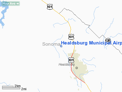
Healdsburg Municipal Airport |
|
|
Location
& QuickFacts
|
FAA
Information Effective: |
2006-06-08 |
|
Airport
Identifier: |
O31 |
|
Longitude/Latitude: |
122-53-57.9830W/38-39-12.6750N
-122.899440/38.653521 (Estimated) |
|
Elevation: |
278 ft / 84.73 m (Surveyed) |
|
Land: |
50 acres |
|
From
nearest city: |
3 nautical miles NW of Healdsburg, CA |
|
Location: |
Sonoma County, CA |
|
Magnetic Variation: |
16E (1985) |
Owner
& Manager
|
Ownership: |
Publicly owned |
|
Owner: |
City Of Healdsburg |
|
Address: |
401 Grove St
Healdsburg, CA 95448 |
|
Phone
number: |
707-431-3319 |
|
Manager: |
Barbara Jason-white |
|
Address: |
401 Grove St
Healdsburg, CA 95448 |
|
Phone
number: |
707-431-3319
PHONE AT MGRS CITY HALL OFFICE. |
Airport
Operations and Facilities
|
Airport
Use: |
Open to public |
|
Wind
indicator: |
Yes |
|
Segmented
Circle: |
Yes |
|
Control
Tower: |
No |
|
Attendance
Schedule: |
ALL/ALL/0800-1700 |
|
Lighting
Schedule: |
RDO-CTL
ACTVT MIRL RY 13/31 - CTAF. |
|
Landing
fee charge: |
No |
|
Sectional
chart: |
San Francisco |
|
Region: |
AWP - Western-Pacific |
|
Traffic
Pattern Alt: |
1000 ft |
|
Boundary
ARTCC: |
ZOA - Oakland |
|
Tie-in
FSS: |
OAK - Oakland |
|
FSS
on Airport: |
No |
|
FSS
Phone: |
510-273-6111 |
|
FSS
Toll Free: |
1-800-WX-BRIEF |
|
NOTAMs
Facility: |
OAK (NOTAM-d service avaliable) |
|
Federal Agreements: |
N |
Airport
Communications
|
CTAF: |
122.800 |
|
Unicom: |
122.800 |
Airport
Services
|
Fuel
available: |
100 80 |
|
Airframe
Repair: |
MAJOR |
|
Power
Plant Repair: |
MAJOR |
|
Bottled
Oxygen: |
NONE |
|
Bulk
Oxygen: |
NONE |
|
Runway Information
Runway 13/31
|
Dimension: |
2707 x 60 ft / 825.1 x 18.3 m |
|
Surface: |
ASPH, Good Condition |
|
Weight
Limit: |
Single wheel: 12500 lbs.
ESTIMATED BY OWNER. |
|
Edge
Lights: |
Medium |
|
|
Runway 13 |
Runway 31 |
|
Elevation: |
285.00 ft |
272.00 ft |
|
Traffic
Pattern: |
Right |
Left |
|
Markings: |
Basic, Good Condition |
Basic, Good Condition |
|
Runway
End Identifier: |
No |
No |
|
Centerline
Lights: |
No |
No |
|
Touchdown
Lights: |
No |
No |
|
Obstruction: |
15 ft road, 340.0 ft from runway, 140 ft left
of centerline, 9:1 slope to clear |
53 ft hill, 2000.0 ft from runway, 400 ft left
of centerline, 33:1 slope to clear |
|
Radio Navigation
Aids
|
ID |
Type |
Name |
Ch |
Freq |
Var |
Dist |
|
LOP |
NDB |
Lampson |
|
217.00 |
16E |
20.5 nm |
|
STS |
VOR/DME |
Santa Rosa |
077X |
113.00 |
16E |
9.7 nm |
|
ENI |
VORTAC |
Mendocino |
070X |
112.30 |
16E |
29.7 nm |
|
PYE |
VORTAC |
Point Reyes |
084X |
113.70 |
17E |
34.5 nm |
|
SGD |
VORTAC |
Scaggs Island |
058X |
112.10 |
17E |
37.8 nm |
|
ILA |
VORTAC |
Williams |
091X |
114.40 |
18E |
47.9 nm |
Remarks
- NOISE
ABATEMENT; TPA 1300' MSL; TOUCH & GO LTD TO 4/ACFT/DAY.
- RWY
31 DOWNDRAFTS APCH END.
- ESTABD
PRIOR TO 15 MAY 1959.
Based Aircraft
|
Aircraft
based on field: |
63 |
|
Single
Engine Airplanes: |
61 |
|
Multi
Engine Airplanes: |
2 |
Operational Statistics
|
Aircraft
Operations: |
87/Day |
|
General
Aviation Local: |
79.6% |
|
General
Aviation Itinerant: |
20.4% |
Healdsburg Municipal Airport
Address:
Sonoma County, CA
Tel:
707-431-3319
Images
and information placed above are from
http://www.airport-data.com/airport/O31/
We
thank them for the data!
| General
Info |
| Country |
United
States |
| State |
CALIFORNIA
|
| FAA ID |
O31
|
| Latitude |
38-39-12.675N
|
| Longitude |
122-53-57.983W
|
| Elevation |
278 feet
|
| Near City |
HEALDSBURG
|
We don't guarantee the information is fresh and accurate. The data may
be wrong or outdated.
For more up-to-date information please refer to other sources.
|
|


