 |
|
|
|
|
|
Location
& QuickFacts
|
FAA
Information Effective: |
2006-06-08 |
|
Airport
Identifier: |
CN23 |
|
Longitude/Latitude: |
116-40-31.1100W/34-57-41.9430N
-116.675308/34.961651 (Estimated) |
|
Elevation: |
1825 ft / 556.26 m (Estimated) |
|
Land: |
0 acres |
|
From
nearest city: |
8 nautical miles E of Yermo, CA |
|
Location: |
San Bernardino County, CA |
|
Magnetic Variation: |
14E (1985) |
Owner
& Manager
|
Ownership: |
Privately owned |
|
Owner: |
Duane D Davis |
|
Address: |
240 N Dale Ave
Fullerton, CA 92633 |
|
Manager: |
Duane D Davis |
|
Address: |
240 N Dale Ave
Fullerton, CA 92633 |
|
Phone number: |
714-521-6100 |
Airport
Operations and Facilities
|
Airport Use: |
Private |
|
Wind indicator: |
Yes |
|
Segmented Circle: |
No |
|
Control Tower: |
No |
|
Attendance Schedule: |
ALL/SUNDAY/1000-1800 |
|
Landing fee charge: |
No |
|
Sectional chart: |
Los Angeles |
|
Region: |
AWP - Western-Pacific |
|
Traffic Pattern Alt: |
1000 ft |
|
Boundary ARTCC: |
ZLA - Los Angeles |
|
Tie-in FSS: |
RAL - Riverside |
|
FSS on Airport: |
No |
|
FSS Phone: |
951-351-3020 |
|
FSS Toll Free: |
1-800-WX-BRIEF |
Airport
Services
|
Airframe
Repair: |
NONE |
|
Power
Plant Repair: |
NONE |
|
Bottled
Oxygen: |
NONE |
|
Bulk
Oxygen: |
NONE |
|
Runway Information
Runway 07/25
|
Dimension: |
2640 x 100 ft / 804.7 x 30.5 m |
|
Surface: |
DIRT, |
|
|
Runway 07 |
Runway 25 |
|
Traffic
Pattern: |
Left |
Left |
|
Markings: |
None, |
None, |
|
Runway
End Identifier: |
No |
No |
|
Centerline
Lights: |
No |
No |
|
Touchdown
Lights: |
No |
No |
|
Radio Navigation
Aids
|
ID |
Type |
Name |
Ch |
Freq |
Var |
Dist |
|
NXP |
TACAN |
Coyote |
063X |
|
14E |
47.5 nm |
|
VCV |
VOR/DME |
Victorville |
031X |
109.40 |
14E |
41.6 nm |
|
DAG |
VORTAC |
Daggett |
079X |
113.20 |
15E |
4.8 nm |
|
HEC |
VORTAC |
Hector |
074X |
112.70 |
15E |
14.4 nm |
Based Aircraft
|
Aircraft
based on field: |
1 |
|
Single
Engine Airplanes: |
1 |
Operational Statistics
|
Aircraft
Operations: |
13/Week |
|
General
Aviation Local: |
88.6% |
|
General
Aviation Itinerant: |
11.4% |
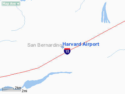
Harvard Airport
Address:
San Bernardino County, CA
Tel:
714-521-6100
Images
and information placed above are from
http://www.airport-data.com/airport/CN23/
We
thank them for the data!
| General
Info |
| Country |
United
States |
| State |
CALIFORNIA
|
| FAA ID |
CN23
|
| Latitude |
34-57-41.943N
|
| Longitude |
116-40-31.110W
|
| Elevation |
1825 feet
|
| Near City |
YERMO
|
We don't guarantee the information is fresh and accurate. The data may
be wrong or outdated.
For more up-to-date information please refer to other sources.
|
|


