 |
|
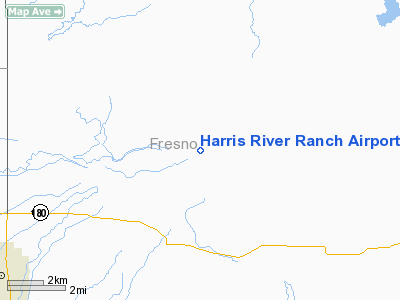
Harris River Ranch Airport |
Location
& QuickFacts
|
FAA
Information Effective: |
2006-06-08 |
|
Airport
Identifier: |
9CA7 |
|
Longitude/Latitude: |
119-26-09.4570W/36-46-01.8190N
-119.435960/36.767172 (Estimated) |
|
Elevation: |
450 ft / 137.16 m (Estimated) |
|
Land: |
0 acres |
|
From
nearest city: |
7 nautical miles NE of Sanger, CA |
|
Location: |
Fresno County, CA |
|
Magnetic Variation: |
15E (1990) |
Owner
& Manager
|
Ownership: |
Privately owned |
|
Owner: |
Harris Farms Inc |
|
Address: |
Rt 1 Box 420
Coalinga, CA 93210 |
|
Phone number: |
209-884-2477 |
|
Manager: |
John A Langenhein |
|
Address: |
Rt 1 Box 420
Coalinga, CA 93210 |
|
Phone number: |
209-787-3613 |
Airport
Operations and Facilities
|
Airport
Use: |
Private
PERSONAL USE. |
|
Wind
indicator: |
Yes |
|
Segmented
Circle: |
No |
|
Control
Tower: |
No |
|
Attendance
Schedule: |
UNATNDD |
|
Sectional
chart: |
San Francisco |
|
Region: |
AWP - Western-Pacific |
|
Boundary
ARTCC: |
ZOA - Oakland |
|
Tie-in
FSS: |
RIU - Rancho Murieta |
|
FSS
on Airport: |
No |
|
FSS
Phone: |
916-354-0161 |
|
FSS
Toll Free: |
1-800-WX-BRIEF |
|
Runway Information
Runway 07/25
|
Dimension: |
3018 x 28 ft / 919.9 x 8.5 m |
|
Surface: |
ASPH, |
|
|
Runway 07 |
Runway 25 |
|
Traffic
Pattern: |
Left |
Left |
|
Obstruction: |
60 ft trees, 200.0 ft from runway |
|
|
Radio Navigation
Aids
|
ID |
Type |
Name |
Ch |
Freq |
Var |
Dist |
|
CUK |
NDB |
Academy |
|
266.00 |
14E |
9.9 nm |
|
FCH |
NDB |
Chandler |
|
344.00 |
15E |
19.3 nm |
|
COR |
NDB |
Salyer Farms |
|
205.00 |
16E |
42.4 nm |
|
NLC |
TACAN |
Lemoore |
080X |
|
16E |
36.1 nm |
|
VIS |
VOR/DME |
Visalia |
031X |
109.40 |
16E |
24.1 nm |
|
CZQ |
VORTAC |
Clovis |
076X |
112.90 |
15E |
19.6 nm |
|
FRA |
VORTAC |
Friant |
103X |
115.60 |
17E |
21.7 nm |
Remarks
- PROVIDED
PRIVATE USE VFR ONLY.
Based Aircraft
|
Aircraft
based on field: |
1 |
|
Single
Engine Airplanes: |
1 |
Harris River Ranch Airport
Address:
Fresno County, CA
Tel:
209-884-2477, 209-787-3613
Images
and information placed above are from
http://www.airport-data.com/airport/9CA7/
We
thank them for the data!
| General
Info |
| Country |
United
States |
| State |
CALIFORNIA
|
| FAA ID |
9CA7
|
| Latitude |
36-46-01.819N
|
| Longitude |
119-26-09.457W
|
| Elevation |
450 feet
|
| Near City |
SANGER
|
We don't guarantee the information is fresh and accurate. The data may
be wrong or outdated.
For more up-to-date information please refer to other sources.
|
|


