 |
|
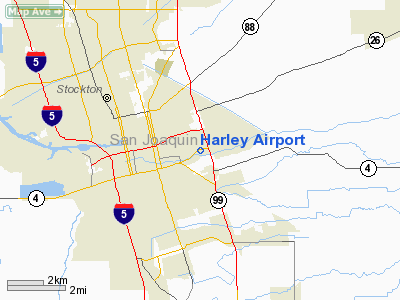
Location
& QuickFacts
|
FAA
Information Effective: |
2006-06-08 |
|
Airport
Identifier: |
6CL8 |
|
Longitude/Latitude: |
121-14-36.0000W/37-57-03.0000N
-121.243333/37.950833 (Estimated) |
|
Elevation: |
20 ft / 6.10 m (Estimated) |
|
Land: |
60 acres |
|
From
nearest city: |
4 nautical miles SE of Stockton, CA |
|
Location: |
San Joaquin County, CA |
|
Magnetic Variation: |
16E (1995) |
Owner
& Manager
|
Ownership: |
Privately owned |
|
Owner: |
Murray Family Trust Of 1989 |
|
Address: |
2560 Hall Avenue
Stockton, CA 95205-7790 |
|
Phone number: |
209-462-1577 |
|
Manager: |
Dave Murray |
|
Address: |
2560 Hall Avenue
Stockton, CA 95205-7790 |
|
Phone number: |
209-462-1577 |
Airport
Operations and Facilities
|
Airport
Use: |
Private |
|
Wind
indicator: |
Yes |
|
Segmented
Circle: |
No |
|
Control
Tower: |
No |
|
Attendance
Schedule: |
UNATNDD |
|
Sectional
chart: |
San Francisco |
|
Region: |
AWP - Western-Pacific |
|
Boundary
ARTCC: |
ZOA - Oakland |
|
Tie-in
FSS: |
RIU - Rancho Murieta |
|
FSS
Phone: |
916-354-0161 |
|
FSS
Toll Free: |
1-800-WX-BRIEF |
|
Runway Information
Runway 09/27
|
Dimension: |
1700 x 30 ft / 518.2 x 9.1 m |
|
Surface: |
GRVL, |
|
|
Runway 09 |
Runway 27 |
|
Traffic
Pattern: |
Left |
Left |
|
Displaced
threshold: |
300.00 ft |
300.00 ft |
|
Obstruction: |
80 ft trees, 200.0 ft from runway |
50 ft trees, 300.0 ft from runway |
|
Radio Navigation
Aids
|
ID |
Type |
Name |
Ch |
Freq |
Var |
Dist |
|
TCY |
NDB |
Tracy |
|
203.00 |
15E |
18.2 nm |
|
LV |
NDB |
Reiga |
|
374.00 |
16E |
26.1 nm |
|
SUU |
TACAN |
Travis |
113X |
|
17E |
37.6 nm |
|
NUQ |
TACAN |
Moffett |
123X |
|
17E |
49.7 nm |
|
TZZ |
VOR |
Travis |
|
116.40 |
17E |
35.8 nm |
|
MOD |
VOR/DME |
Modesto |
093X |
114.60 |
17E |
23.7 nm |
|
CCR |
VOR/DME |
Concord |
117X |
117.00 |
17E |
38.4 nm |
|
MCC |
VOR/DME |
Mc Clellan |
029X |
109.20 |
17E |
43.7 nm |
|
SJC |
VOR/DME |
San Jose |
088X |
114.10 |
16E |
48.1 nm |
|
ECA |
VORTAC |
Manteca |
107X |
116.00 |
17E |
7.8 nm |
|
LIN |
VORTAC |
Linden |
095X |
114.80 |
17E |
13.6 nm |
|
SAC |
VORTAC |
Sacramento |
099X |
115.20 |
17E |
33.0 nm |
|
OAK |
VORTAC |
Oakland |
115X |
116.80 |
17E |
48.5 nm |
|
SAC |
VOT |
Sacramento Executive |
|
111.40 |
|
35.9 nm |
|
SMF |
VOT |
Sacramento Metropolitan |
|
111.40 |
|
47.4 nm |
Remarks
- RY
09/27 SOFT AFTER RAIN.
- PROVIDED
VFR, PRIVATE USE AND MAINTAIN COMMUNICATIONS WITH STOCKTON MUNI ARPT
ATCT.
Based Aircraft
|
Aircraft
based on field: |
1 |
|
Single
Engine Airplanes: |
1 |
Harley Airport
Address:
San Joaquin County, CA
Tel:
209-462-1577
Images
and information placed above are from
http://www.airport-data.com/airport/6CL8/
We
thank them for the data!
| General
Info |
| Country |
United
States |
| State |
CALIFORNIA
|
| FAA ID |
6CL8
|
| Latitude |
37-57-03.000N
|
| Longitude |
121-14-36.000W
|
| Elevation |
20 feet
|
| Near City |
STOCKTON
|
We don't guarantee the information is fresh and accurate. The data may
be wrong or outdated.
For more up-to-date information please refer to other sources.
|
|


