 |
|
|
|
|
|
Location
& QuickFacts
|
FAA
Information Effective: |
2006-06-08 |
|
Airport
Identifier: |
11CL |
|
Longitude/Latitude: |
117-39-12.2070W/34-37-47.9640N
-117.653391/34.629990 (Estimated) |
|
Elevation: |
2885 ft / 879.35 m (Estimated) |
|
Land: |
370 acres |
|
From
nearest city: |
12 nautical miles NW of Adelanto, CA |
|
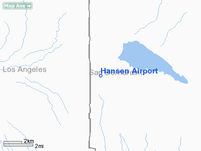
Location: |
San Bernardino County, CA |
|
Magnetic Variation: |
14E (1985) |
Owner
& Manager
|
Ownership: |
Privately owned |
|
Owner: |
Ernest E Hansen |
|
Address: |
20875 Old El Mirage Rd
Adelanto, CA 92301-9705 |
|
Phone
number: |
619-388-4383 |
|
Manager: |
Ernest E. Hansen |
|
Address: |
20875 Old El Mirage Rd
Adelanto, CA 92301-9705 |
|
Phone number: |
619-388-4383 |
Airport
Operations and Facilities
|
Airport
Use: |
Private |
|
Wind
indicator: |
Yes |
|
Segmented
Circle: |
Yes |
|
Control
Tower: |
No |
|
Attendance
Schedule: |
ALL/ALL/ALL |
|
Landing
fee charge: |
No |
|
Sectional
chart: |
Los Angeles |
|
Region: |
AWP - Western-Pacific |
|
Boundary
ARTCC: |
ZLA - Los Angeles |
|
Tie-in FSS: |
RAL - Riverside |
|
FSS on Airport: |
No |
|
FSS Phone: |
951-351-3020 |
|
FSS Toll Free: |
1-800-WX-BRIEF |
Airport
Communications
Airport
Services
|
Fuel
available: |
100LL |
|
Airframe
Repair: |
NONE |
|
Power
Plant Repair: |
NONE |
|
Bottled
Oxygen: |
NONE |
|
Bulk
Oxygen: |
NONE |
|
Runway Information
Runway 07/25
|
Dimension: |
5875 x 80 ft / 1790.7 x 24.4 m |
|
Surface: |
DIRT, |
|
|
Runway 07 |
Runway 25 |
|
Traffic
Pattern: |
Left |
Left |
|
Runway
End Identifier: |
No |
No |
|
Centerline
Lights: |
No |
No |
|
Touchdown
Lights: |
No |
No |
|
Obstruction: |
40 ft pline, 800.0 ft from runway, 50:1 slope
to clear |
, 23:1 slope to clear |
|
Radio Navigation
Aids
|
ID |
Type |
Name |
Ch |
Freq |
Var |
Dist |
|
GWF |
NDB |
Gen William J Fox |
|
282.00 |
15E |
28.6 nm |
|
SB |
NDB |
Petis |
|
397.00 |
14E |
37.3 nm |
|
EMT |
NDB |
El Monte |
|
359.00 |
15E |
37.6 nm |
|
PAI |
NDB |
Pacoima |
|
370.00 |
15E |
43.8 nm |
|
RIV |
TACAN |
March |
077X |
|
14E |
47.4 nm |
|
RAL |
VOR |
Riverside |
|
112.40 |
15E |
42.0 nm |
|
VCV |
VOR/DME |
Victorville |
031X |
109.40 |
14E |
13.2 nm |
|
VNY |
VOR/DME |
Van Nuys |
078X |
113.10 |
15E |
48.2 nm |
|
PMD |
VORTAC |
Palmdale |
092X |
114.50 |
15E |
20.3 nm |
|
EDW |
VORTAC |
Edwards |
111X |
116.40 |
15E |
21.5 nm |
|
POM |
VORTAC |
Pomona |
041X |
110.40 |
15E |
33.8 nm |
|
PDZ |
VORTAC |
Paradise |
059X |
112.20 |
15E |
43.2 nm |
|
LHS |
VORTAC |
Lake Hughes |
021X |
108.40 |
15E |
45.8 nm |
Remarks
- 72.6'
MARKED TWR 300' N OF RWY.
Based Aircraft
|
Aircraft
based on field: |
3 |
|
Single
Engine Airplanes: |
2 |
|
Ultralights: |
1 |
Operational Statistics
|
Aircraft
Operations: |
12/Week |
|
General
Aviation Local: |
83.3% |
|
General
Aviation Itinerant: |
16.7% |
Hansen Airport
Address:
San Bernardino County, CA
Tel:
619-388-4383
Images
and information placed above are from
http://www.airport-data.com/airport/11CL/
We
thank them for the data!
| General
Info |
| Country |
United
States |
| State |
CALIFORNIA
|
| FAA ID |
11CL
|
| Latitude |
34-37-47.964N
|
| Longitude |
117-39-12.207W
|
| Elevation |
2885 feet
|
| Near City |
ADELANTO
|
We don't guarantee the information is fresh and accurate. The data may
be wrong or outdated.
For more up-to-date information please refer to other sources.
|
|


