 |
|
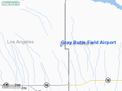
Location
& QuickFacts
|
FAA
Information Effective: |
2006-06-08 |
|
Airport
Identifier: |
04CA |
|
Longitude/Latitude: |
117-40-30.0000W/34-33-50.0000N
-117.675000/34.563889 (Estimated) |
|
Elevation: |
3020 ft / 920.50 m () |
|
Land: |
640 acres |
|
From
nearest city: |
25 nautical miles E of Palmdale, CA |
|
Location: |
Los Angeles County, CA |
|
Magnetic Variation: |
14E (2000) |
Owner
& Manager
|
Ownership: |
Privately owned |
|
Owner: |
General Atomics Aero Systems Inc. |
|
Address: |
16761 Via Del Campo Court
San Diego, CA 92127 |
|
Phone number: |
661-233-6000 |
|
Manager: |
Gary Bender |
|
Address: |
25500 East Avenue
Palmdale, CA 93550 |
|
Phone number: |
661-233-6000 |
Airport
Operations and Facilities
|
Airport
Use: |
Private |
|
Segmented
Circle: |
No |
|
Control
Tower: |
No |
|
Attendance
Schedule: |
UNATNDD |
|
Region: |
AWP - Western-Pacific |
|
Boundary
ARTCC: |
ZLA - Los Angeles |
|
Responsible
ARTCC: |
ZLA - Los Angeles |
|
Tie-in
FSS: |
RAL - Riverside |
|
FSS
Phone: |
951-351-3020 |
|
FSS
Toll Free: |
1-800-WX-BRIEF |
|
Runway Information
Runway 08/26
|
Dimension: |
5000 x 150 ft / 1524.0 x 45.7 m |
|
Surface: |
ASPH, |
|
|
Runway 08 |
Runway 26 |
|
Traffic
Pattern: |
Left |
Left |
|
Radio Navigation
Aids
|
ID |
Type |
Name |
Ch |
Freq |
Var |
Dist |
|
GWF |
NDB |
Gen William J Fox |
|
282.00 |
15E |
28.8 nm |
|
EMT |
NDB |
El Monte |
|
359.00 |
15E |
33.6 nm |
|
SB |
NDB |
Petis |
|
397.00 |
14E |
34.1 nm |
|
PAI |
NDB |
Pacoima |
|
370.00 |
15E |
40.9 nm |
|
CPM |
NDB |
Compton |
|
378.00 |
15E |
49.5 nm |
|
RIV |
TACAN |
March |
077X |
|
14E |
44.2 nm |
|
RAL |
VOR |
Riverside |
|
112.40 |
15E |
38.4 nm |
|
VCV |
VOR/DME |
Victorville |
031X |
109.40 |
14E |
14.2 nm |
|
VNY |
VOR/DME |
Van Nuys |
078X |
113.10 |
15E |
45.4 nm |
|
PMD |
VORTAC |
Palmdale |
092X |
114.50 |
15E |
19.7 nm |
|
EDW |
VORTAC |
Edwards |
111X |
116.40 |
15E |
25.3 nm |
|
POM |
VORTAC |
Pomona |
041X |
110.40 |
15E |
29.7 nm |
|
PDZ |
VORTAC |
Paradise |
059X |
112.20 |
15E |
39.5 nm |
|
LHS |
VORTAC |
Lake Hughes |
021X |
108.40 |
15E |
45.2 nm |
Remarks
- PROVIDED
PRIVATE USE; VFR OPNS; OBSTRUCTION FREE APCH AND DEP SURFACES; AND INSTALL
LIGHTING IF OPNS ARE CONDUCTED BETWEEN SUNSET AND SUNRISE.
Gray Butte Field Airport
Address:
Los Angeles County, CA
Tel:
661-233-6000
Images
and information placed above are from
http://www.airport-data.com/airport/04CA/
We
thank them for the data!
| General
Info |
| Country |
United
States |
| State |
CALIFORNIA
|
| FAA ID |
04CA
|
| Latitude |
34-33-50.000N
|
| Longitude |
117-40-30.000W
|
| Elevation |
3020 feet
|
| Near City |
PALMDALE
|
We don't guarantee the information is fresh and accurate. The data may
be wrong or outdated.
For more up-to-date information please refer to other sources.
|
|


