 |
|
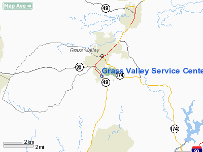
Grass Valley Service Center Heliport |
|
|
Location
& QuickFacts
|
FAA
Information Effective: |
2006-06-08 |
|
Airport
Identifier: |
48CL |
|
Longitude/Latitude: |
121-03-33.8150W/39-11-59.6190N
-121.059393/39.199894 (Estimated) |
|
Elevation: |
2430 ft / 740.66 m (Estimated) |
|
Land: |
0 acres |
|
From
nearest city: |
2 nautical miles S of Grass Valley, CA |
|
Location: |
Nevada County, CA |
|
Magnetic Variation: |
16E (1985) |
Owner
& Manager
|
Ownership: |
Privately owned |
|
Owner: |
Pacific Gas & Electric Co |
|
Address: |
343 Sacramento St
Auburn, CA 95603 |
|
Phone number: |
530-889-3195 |
|
Manager: |
Division Hydro Superintendent |
|
Address: |
343 Sacramento St
Auburn, CA 95603 |
|
Phone number: |
530-889-3195
EXTENSION 2482 |
Airport
Operations and Facilities
|
Airport
Use: |
Private |
|
Wind
indicator: |
Yes |
|
Segmented
Circle: |
No |
|
Control
Tower: |
No |
|
Attendance
Schedule: |
ALL/MON-FRI/0700-2400 |
|
Landing
fee charge: |
No |
|
Sectional
chart: |
San Francisco |
|
Region: |
AWP - Western-Pacific |
|
Boundary
ARTCC: |
ZOA - Oakland |
|
Tie-in
FSS: |
RIU - Rancho Murieta |
|
FSS
on Airport: |
No |
|
FSS
Phone: |
916-354-0161 |
|
FSS
Toll Free: |
1-800-WX-BRIEF |
|
Runway Information
Helipad H1
|
Dimension: |
66 x 66 ft / 20.1 x 20.1 m |
|
Surface: |
ASPH, |
|
|
Runway H1 |
Runway |
|
Traffic
Pattern: |
Left |
Left |
|
Radio Navigation
Aids
|
ID |
Type |
Name |
Ch |
Freq |
Var |
Dist |
|
MY |
NDB |
Halow |
|
222.00 |
16E |
25.7 nm |
|
OVE |
NDB |
Oroville |
|
212.00 |
16E |
31.6 nm |
|
BAB |
TACAN |
Beale |
023X |
|
16E |
18.2 nm |
|
MYV |
VOR/DME |
Marysville |
045X |
110.80 |
16E |
24.7 nm |
|
HNW |
VOR/DME |
Hangtown |
102X |
115.50 |
17E |
32.0 nm |
|
MCC |
VOR/DME |
Mc Clellan |
029X |
109.20 |
17E |
35.8 nm |
|
SWR |
VOR/DME |
Squaw Valley |
079X |
113.20 |
16E |
36.8 nm |
|
ILA |
VORTAC |
Williams |
091X |
114.40 |
18E |
45.8 nm |
|
SMF |
VOT |
Sacramento Metropolitan |
|
111.40 |
|
39.4 nm |
|
SAC |
VOT |
Sacramento Executive |
|
111.40 |
|
46.1 nm |
Grass Valley Service Center Heliport
Address:
Nevada County, CA
Tel:
530-889-3195
Images
and information placed above are from
http://www.airport-data.com/airport/48CL/
We
thank them for the data!
| General
Info |
| Country |
United
States |
| State |
CALIFORNIA
|
| FAA ID |
48CL
|
| Latitude |
39-11-59.619N
|
| Longitude |
121-03-33.815W
|
| Elevation |
2430 feet
|
| Near City |
GRASS
VALLEY |
We don't guarantee the information is fresh and accurate. The data may
be wrong or outdated.
For more up-to-date information please refer to other sources.
|
|


