 |
|
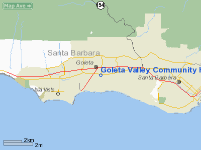
Goleta Valley Community Hospital Heliport |
|
|
Location
& QuickFacts
|
FAA
Information Effective: |
2006-06-08 |
|
Airport
Identifier: |
CA96 |
|
Longitude/Latitude: |
119-48-34.4980W/34-26-00.9870N
-119.809583/34.433608 (Estimated) |
|
Elevation: |
45 ft / 13.72 m (Estimated) |
|
Land: |
0 acres |
|
From
nearest city: |
1 nautical miles SE of Santa Barbara, CA |
|
Location: |
Santa Barbara County, CA |
|
Magnetic Variation: |
14E (1985) |
Owner
& Manager
|
Ownership: |
Privately owned |
|
Owner: |
Goleta Valley Commty Hosp |
|
Address: |
351 S. Patterson Ave.
Santa Barbara, CA 93111 |
|
Phone
number: |
805-967-3411 |
|
Manager: |
Goleta Valley Commty Hospital |
|
Address: |
351 S. Patterson Ave
Santa Barbara, CA 93111 |
|
Phone number: |
805-967-3411
EXT. 298 |
Airport
Operations and Facilities
|
Airport
Use: |
Private
MEDICAL. |
|
Wind
indicator: |
Yes |
|
Segmented
Circle: |
Yes |
|
Control
Tower: |
No |
|
Attendance
Schedule: |
ALL/ALL/ALL |
|
Lighting
Schedule: |
PHONE REQ
FOR PERIMETER LGTS CALL 805-967-3411. |
|
Landing fee charge: |
No |
|
Sectional chart: |
Los Angeles |
|
Region: |
AWP - Western-Pacific |
|
Boundary ARTCC: |
ZLA - Los Angeles |
|
Tie-in FSS: |
HHR - Hawthorne |
|
FSS on Airport: |
No |
|
FSS Phone: |
310-970-0102 |
|
FSS Toll Free: |
1-800-WX-BRIEF |
Airport
Communications
|
Runway Information
Helipad H1
|
Dimension: |
42 x 42 ft / 12.8 x 12.8 m |
|
Surface: |
CONC, |
|
|
Runway H1 |
Runway |
|
Traffic
Pattern: |
Left |
Left |
|
Radio Navigation
Aids
|
ID |
Type |
Name |
Ch |
Freq |
Var |
Dist |
|
NTD |
TACAN |
Point Mugu |
043X |
|
15E |
38.9 nm |
|
VBG |
TACAN |
Vandenberg |
059Y |
|
15E |
42.3 nm |
|
GLJ |
VOR |
Guadalupe |
|
111.00 |
16E |
47.0 nm |
|
CMA |
VOR/DME |
Camarillo |
105X |
115.80 |
15E |
37.9 nm |
|
VTU |
VOR/DME |
Ventura |
019X |
108.20 |
15E |
42.3 nm |
|
RZS |
VORTAC |
San Marcus |
096X |
114.90 |
14E |
4.9 nm |
|
GVO |
VORTAC |
Gaviota |
085X |
113.80 |
16E |
15.1 nm |
|
FLW |
VORTAC |
Fellows |
122X |
117.50 |
16E |
39.7 nm |
|
FIM |
VORTAC |
Fillmore |
072X |
112.50 |
15E |
46.3 nm |
Remarks
- CONTACT
TOWER PRIOR TO LANDING.
- HOSP
REQUIRES 15 MIN PRIOR ETA USING CALL LETTERS (WHI-7) AND FREQ 123.05.
- (E3A)
ADDNL PHONE NR TO HHR FSS 1-WX-BRIEF.
- PRIVATE
USE.
Goleta Valley Community Hospital Heliport
Address:
Santa Barbara County, CA
Tel:
805-967-3411
Images
and information placed above are from
http://www.airport-data.com/airport/CA96/
We
thank them for the data!
| General
Info |
| Country |
United
States |
| State |
CALIFORNIA
|
| FAA ID |
CA96
|
| Latitude |
34-26-00.987N
|
| Longitude |
119-48-34.498W
|
| Elevation |
45 feet
|
| Near City |
SANTA
BARBARA |
We don't guarantee the information is fresh and accurate. The data may
be wrong or outdated.
For more up-to-date information please refer to other sources.
|
|


