 |
|
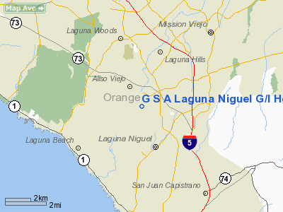
G S A Laguna Niguel G/l Helistop Heliport |
Location
& QuickFacts
|
FAA
Information Effective: |
2006-06-08 |
|
Airport
Identifier: |
1CA3 |
|
Longitude/Latitude: |
117-42-56.1880W/33-33-42.0890N
-117.715608/33.561691 (Estimated) |
|
Elevation: |
188 ft / 57.30 m (Estimated) |
|
Land: |
0 acres |
|
From
nearest city: |
3 nautical miles N of South Laguna Beach,
CA |
|
Location: |
Orange County, CA |
|
Magnetic Variation: |
14E (1985) |
Owner
& Manager
|
Ownership: |
Publicly owned |
|
Owner: |
General Svcs Admin |
|
Address: |
24000 Avila Rd
Laguna Niguel, CA 92677 |
|
Phone
number: |
714-643-4863 |
|
Manager: |
Edward D. Wasielewski |
|
Address: |
24000 Avila Rd
Laguna Niguel, CA 92677 |
|
Phone number: |
714-643-4863 |
Airport
Operations and Facilities
|
Airport
Use: |
Private |
|
Wind
indicator: |
No |
|
Segmented
Circle: |
No |
|
Control
Tower: |
No |
|
Attendance
Schedule: |
ALL/ALL/ALL |
|
Landing
fee charge: |
No |
|
Sectional
chart: |
Los Angeles |
|
Region: |
AWP - Western-Pacific |
|
Boundary
ARTCC: |
ZLA - Los Angeles |
|
Tie-in
FSS: |
SAN - San Diego |
|
FSS
on Airport: |
No |
|
FSS
Phone: |
858-277-7043 |
|
FSS
Toll Free: |
1-800-WX-BRIEF |
|
Runway Information
Helipad H1
|
Dimension: |
110 x 55 ft / 33.5 x 16.8 m |
|
Surface: |
TURF, |
|
|
Runway H1 |
Runway |
|
Traffic
Pattern: |
Left |
Left |
|
Radio Navigation
Aids
|
ID |
Type |
Name |
Ch |
Freq |
Var |
Dist |
|
CPM |
NDB |
Compton |
|
378.00 |
15E |
33.1 nm |
|
SB |
NDB |
Petis |
|
397.00 |
14E |
34.5 nm |
|
EMT |
NDB |
El Monte |
|
359.00 |
15E |
35.4 nm |
|
SJY |
NDB |
San Jacinto |
|
227.00 |
14E |
38.5 nm |
|
NFG |
TACAN |
Camp Pendleton |
055X |
|
13E |
23.9 nm |
|
RIV |
TACAN |
March |
077X |
|
14E |
30.3 nm |
|
RAL |
VOR |
Riverside |
|
112.40 |
15E |
27.0 nm |
|
HDF |
VOR |
Homeland |
|
113.40 |
14E |
29.5 nm |
|
ELB |
VOR/DME |
El Toro |
119X |
117.20 |
14E |
6.9 nm |
|
SMO |
VOR/DME |
Santa Monica |
045X |
110.80 |
15E |
45.8 nm |
|
SLI |
VORTAC |
Seal Beach |
104X |
115.70 |
15E |
21.6 nm |
|
PDZ |
VORTAC |
Paradise |
059X |
112.20 |
15E |
23.4 nm |
|
OCN |
VORTAC |
Oceanside |
100X |
115.30 |
15E |
24.4 nm |
|
POM |
VORTAC |
Pomona |
041X |
110.40 |
15E |
31.3 nm |
|
SXC |
VORTAC |
Santa Catalina |
051X |
111.40 |
15E |
37.1 nm |
|
LAX |
VORTAC |
Los Angeles |
083X |
113.60 |
15E |
42.2 nm |
|
SNA |
VOT |
Santa Ana |
|
110.00 |
|
10.4 nm |
|
LAX |
VOT |
San Pedro Hill |
|
113.90 |
|
33.0 nm |
|
SAN |
VOT |
Mount Soledad |
|
109.00 |
|
49.2 nm |
Remarks
G S A Laguna Niguel G/l Helistop Heliport
Address:
Orange County, CA
Tel:
714-643-4863
Images
and information placed above are from
http://www.airport-data.com/airport/1CA3/
We
thank them for the data!
| General
Info |
| Country |
United
States |
| State |
CALIFORNIA
|
| FAA ID |
1CA3
|
| Latitude |
33-33-42.089N
|
| Longitude |
117-42-56.188W
|
| Elevation |
188 feet
|
| Near City |
SOUTH
LAGUNA BEACH |
We don't guarantee the information is fresh and accurate. The data may
be wrong or outdated.
For more up-to-date information please refer to other sources.
|
|


