 |
|
| Georgetown Airport |
| IATA: none – ICAO: none – FAA LID: E36 |
| Summary |
| Airport type |
Public |
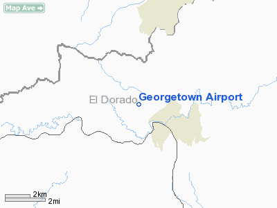
| Location |
Georgetown, California |
| Elevation AMSL |
2,623 ft / 799 m |
| Coordinates |
38°55′16.01″N 120°51′53.26″W / 38.9211139°N 120.8647944°W / 38.9211139; -120.8647944Coordinates: 38°55′16.01″N 120°51′53.26″W / 38.9211139°N 120.8647944°W / 38.9211139; -120.8647944 |
| Runways |
| Direction |
Length |
Surface |
| ft |
m |
| 16/34 |
2,980 |
908 |
Asphalt |
Georgetown Airport (FAA LID: E36), formerly Q61, is a public airport located two miles (3.2 km) northwest of Georgetown, serving El Dorado County, California, USA. The airport has one runway and is mostly used for general aviation.
Facilities
Georgetown Airport has one runway:
- Runway 16/34: 2,980 x 60 ft (908 x 18 m). Surface: Asphalt
The above content comes from Wikipedia and is published under free licenses – click here to read more.
Location
& QuickFacts
|
FAA
Information Effective: |
2006-06-08 |
|
Airport
Identifier: |
E36 |
|
Longitude/Latitude: |
120-51-53.2600W/38-55-16.0100N
-120.864794/38.921114 (Estimated) |
|
Elevation: |
2623 ft / 799.49 m (Estimated) |
|
Land: |
148 acres |
|
From
nearest city: |
2 nautical miles NW of Georgetown, CA |
|
Location: |
El Dorado County, CA |
|
Magnetic Variation: |
16E (1985) |
Owner
& Manager
|
Ownership: |
Publicly owned |
|
Owner: |
County Of El Dorado |
|
Address: |
Po Box 85
Placerville, CA 95667 |
|
Phone
number: |
916-621-5330 |
|
Manager: |
Michael Gray |
|
Address: |
Po Box 85
Placerville, CA 95667 |
|
Phone
number: |
916-621-5330
ARPT MGR OFC AT PLACERVILLE (916) 622-0459; FBO AT ARPT
(916) 333-1225. |
Airport
Operations and Facilities
|
Airport
Use: |
Open to public |
|
Wind
indicator: |
Yes |
|
Segmented
Circle: |
No |
|
Control
Tower: |
No |
|
Attendance
Schedule: |
ALL/ALL/0800-1700 |
|
Lighting
Schedule: |
DUSK-DAWN
ACTVT MIRL RY 16/34 - CTAF. |
|
Beacon
Color: |
Clear-Green (lighted land airport) |
|
Landing
fee charge: |
No |
|
Sectional
chart: |
San Francisco |
|
Region: |
AWP - Western-Pacific |
|
Traffic
Pattern Alt: |
800 ft |
|
Boundary
ARTCC: |
ZOA - Oakland |
|
Tie-in
FSS: |
RIU - Rancho Murieta |
|
FSS
on Airport: |
No |
|
FSS
Phone: |
916-354-0161 |
|
FSS
Toll Free: |
1-800-WX-BRIEF |
|
NOTAMs
Facility: |
RIU (NOTAM-d service avaliable) |
|
Federal Agreements: |
NGY |
Airport Communications
|
CTAF: |
123.050 |
|
Unicom: |
123.050 |
Airport
Services
|
Fuel
available: |
100LL |
|
Airframe
Repair: |
MAJOR |
|
Power
Plant Repair: |
MINOR |
|
Bottled
Oxygen: |
NONE |
|
Bulk
Oxygen: |
NONE |
|
Runway Information
Runway 16/34
|
Dimension: |
2980
x 60 ft / 908.3 x 18.3 m
SAFETY AREAS NON-STD LENGTH; RY 34 175 FT; RY 16 100 FT. |
|
Surface: |
ASPH, Good Condition |
|
Weight
Limit: |
Single wheel: 22000 lbs. |
|
Edge
Lights: |
Medium |
|
|
Runway 16 |
Runway 34 |
|
Traffic
Pattern: |
Left |
Left |
|
Markings: |
Basic, Fair Condition |
Basic, Fair Condition |
|
Runway
End Identifier: |
No |
No |
|
Centerline
Lights: |
No |
No |
|
Touchdown
Lights: |
No |
No |
|
Obstruction: |
45 ft trees, 465.0 ft from runway, 140 ft right
of centerline, 5:1 slope to clear |
30 ft trees, 365.0 ft from runway, 140 ft left
of centerline, 5:1 slope to clear
+20 FT TREE 125 FT LEFT, 140 FT FM EOR. |
|
Radio Navigation
Aids
|
ID |
Type |
Name |
Ch |
Freq |
Var |
Dist |
|
MY |
NDB |
Halow |
|
222.00 |
16E |
37.8 nm |
|
OVE |
NDB |
Oroville |
|
212.00 |
16E |
49.3 nm |
|
BAB |
TACAN |
Beale |
023X |
|
16E |
29.8 nm |
|
HNW |
VOR/DME |
Hangtown |
102X |
115.50 |
17E |
13.0 nm |
|
MCC |
VOR/DME |
Mc Clellan |
029X |
109.20 |
17E |
29.5 nm |
|
SWR |
VOR/DME |
Squaw Valley |
079X |
113.20 |
16E |
31.9 nm |
|
MYV |
VOR/DME |
Marysville |
045X |
110.80 |
16E |
34.8 nm |
|
SAC |
VORTAC |
Sacramento |
099X |
115.20 |
17E |
43.2 nm |
|
SMF |
VOT |
Sacramento Metropolitan |
|
111.40 |
|
36.7 nm |
|
SAC |
VOT |
Sacramento Executive |
|
111.40 |
|
38.5 nm |
Remarks
- RWY
16 POLES AT EDGE OF TREE LINE 145'-165' R ARE OBSTRUCTION LGTD.
- RY
34 POLES AT THE EDGE OF TREE LINE 145 FT L ARE OBTSTRUCTION LGTD.
Based Aircraft
|
Aircraft
based on field: |
35 |
|
Single
Engine Airplanes: |
34 |
|
Multi
Engine Airplanes: |
1 |
Operational Statistics
|
Aircraft
Operations: |
62/Day |
|
General
Aviation Local: |
31.1% |
|
General
Aviation Itinerant: |
66.7% |
|
Military: |
2.2% |
Georgetown Airport
Address:
El Dorado County, CA
Tel:
916-621-5330
Images
and information placed above are from
http://www.airport-data.com/airport/E36/
We
thank them for the data!
We don't guarantee the information is fresh and accurate. The data may
be wrong or outdated.
For more up-to-date information please refer to other sources.
|
|


