 |
|
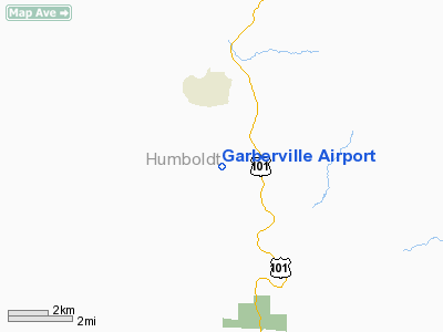
| Garberville Airport |
| IATA: none – ICAO: none – FAA LID: O16 |
| Summary |
| Airport type |
Public |
| Operator |
Humboldt County |
| Location |
Garberville, California |
| Elevation AMSL |
546 ft / 166.4 m |
| Coordinates |
40°05′10″N 123°48′49″W / 40.08611°N 123.81361°W / 40.08611; -123.81361Coordinates: 40°05′10″N 123°48′49″W / 40.08611°N 123.81361°W / 40.08611; -123.81361 |
| Runways |
| Direction |
Length |
Surface |
| ft |
m |
| 18/36 |
3,050 |
930 |
Asphalt |
Garberville Airport (FAA LID: O16) is a public airport located two miles (3.2 km) southwest of the central business district (CBD) of Garberville, a town in Humboldt County, California, USA. The airport covers 44 acres (180,000 m) and has one runway.
The above content comes from Wikipedia and is published under free licenses – click here to read more.
Location
& QuickFacts
|
FAA
Information Effective: |
2006-06-08 |
|
Airport
Identifier: |
O16 |
|
Longitude/Latitude: |
123-48-49.1030W/40-05-09.5210N
-123.813640/40.085978 (Estimated) |
|
Elevation: |
546 ft / 166.42 m (Surveyed) |
|
Land: |
44 acres |
|
From
nearest city: |
2 nautical miles SW of Garberville, CA |
|
Location: |
Humboldt County, CA |
|
Magnetic Variation: |
17E (1985) |
Owner
& Manager
|
Ownership: |
Publicly owned |
|
Owner: |
Humboldt County |
|
Address: |
1106 2nd St
Eureka, CA 95501 |
|
Phone
number: |
707-839-5401 |
|
Manager: |
Jacquelyn Hulsey
AIRPORT MANAGER LOCATED AT ARCATA/EUREKA AIRPORT. |
|
Address: |
3561 Boeing Ave.
Mckinleyville, CA 95519 |
|
Phone
number: |
707-839-5401
AMGRS OFFICE LOCATED ON ARCATA ARPT. |
Airport
Operations and Facilities
|
Airport
Use: |
Open to public |
|
Wind
indicator: |
Yes |
|
Segmented
Circle: |
Yes |
|
Control
Tower: |
No |
|
Attendance
Schedule: |
UNATNDD |
|
Landing
fee charge: |
No |
|
Sectional
chart: |
Klamath Falls |
|
Region: |
AWP - Western-Pacific |
|
Traffic
Pattern Alt: |
1000 ft |
|
Boundary
ARTCC: |
ZOA - Oakland |
|
Tie-in
FSS: |
OAK - Oakland |
|
FSS
on Airport: |
No |
|
FSS
Phone: |
510-273-6111 |
|
FSS
Toll Free: |
1-800-WX-BRIEF |
|
NOTAMs
Facility: |
OAK (NOTAM-d service avaliable) |
|
Federal Agreements: |
NGY |
Airport
Communications
Airport
Services
|
Fuel
available: |
100LL
FUEL FOR EMERG ONLY. |
|
Bottled
Oxygen: |
NONE |
|
Bulk
Oxygen: |
NONE |
|
Runway Information
Runway 18/36
|
Dimension: |
3050 x 75 ft / 929.6 x 22.9 m |
|
Surface: |
ASPH, Fair Condition |
|
Weight
Limit: |
Single wheel: 30000 lbs. |
|
|
Runway 18 |
Runway 36 |
|
Traffic
Pattern: |
Left |
Right |
|
Markings: |
Basic, Good Condition |
Basic, Good Condition |
|
Displaced
threshold: |
80.00 ft |
0.00 ft |
|
Runway
End Identifier: |
No |
No |
|
Centerline
Lights: |
No |
No |
|
Touchdown
Lights: |
No |
No |
|
Obstruction: |
354 ft hill, 4250.0 ft from runway, 11:1 slope
to clear
12:1 TO DSPLCD THR.
RY
18 +6 FT BRUSH @ 50 FT, 90 FT R. |
25 ft trees, 200.0 ft from runway, 70 ft right
of centerline
0-7 FT RISING TERRAIN 0-200 FT. |
|
Radio Navigation
Aids
|
ID |
Type |
Name |
Ch |
Freq |
Var |
Dist |
|
FOT |
VORTAC |
Fortuna |
087X |
114.00 |
19E |
40.1 nm |
Remarks
- DAY
USE ONLY; CLSD NGTS.
- TERRAIN
SLOPES UP FROM THE END OF RY 36 APRXLY 12 FT BEFORE DROPPING OFF.
- ESTABD
PRIOR TO 15 MAY 1959.
Based Aircraft
|
Aircraft
based on field: |
20 |
|
Single
Engine Airplanes: |
20 |
Operational Statistics
|
Aircraft
Operations: |
289/Week |
|
General
Aviation Local: |
53.3% |
|
General
Aviation Itinerant: |
46.7% |
Garberville Airport
Address:
Humboldt County, CA
Tel:
707-839-5401
Images
and information placed above are from
http://www.airport-data.com/airport/O16/
We
thank them for the data!
| General
Info |
| Country |
United
States |
| State |
CALIFORNIA
|
| FAA ID |
O16
|
| Latitude |
40-05-09.521N
|
| Longitude |
123-48-49.103W
|
| Elevation |
546 feet
|
| Near City |
GARBERVILLE
|
We don't guarantee the information is fresh and accurate. The data may
be wrong or outdated.
For more up-to-date information please refer to other sources.
|
|


