|
|
| Franklin Field |
| IATA: none – ICAO: none – FAA LID: F72 |
| Summary |
| Airport type |
Public |
| Operator |
Sacramento County |
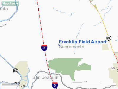
| Location |
Franklin, Sacramento County, California |
| Elevation AMSL |
21 ft / 6.4 m |
| Coordinates |
38°18′18″N 121°25′47″W / 38.305°N 121.42972°W / 38.305; -121.42972Coordinates: 38°18′18″N 121°25′47″W / 38.305°N 121.42972°W / 38.305; -121.42972 |
| Runways |
| Direction |
Length |
Surface |
| ft |
m |
| 18/36 |
3,240 |
988 |
Asphalt |
| 9/27 |
3,100 |
945 |
Asphalt |
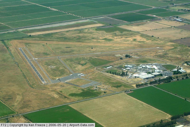
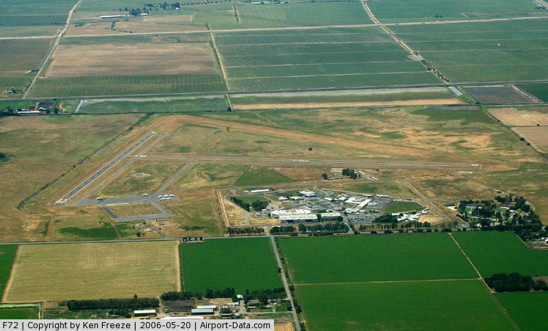
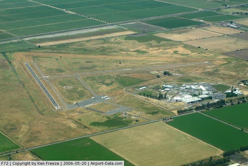
Franklin Field (FAA LID: F72), formerly Q53, is a public airport located four miles (6 km) southeast of the central business district (CBD) of Franklin in Sacramento County, California, USA. It is mostly used for general aviation. The airport was used for bomber training during World War II and in 1947 it was acquired by the County of Sacramento.
Facilities
Franklin Field covers 496 acres (201 ha) and has two runways:
- Runway 18/36: 3,240 x 60 ft (988 x 18 m), Surface: Asphalt
- Runway 9/27: 3,100 x 60 ft (945 x 18 m), Surface: Asphalt
The above content comes from Wikipedia and is published under free licenses – click here to read more.
|
 |
(Click on the photo to enlarge) |
|
 |
(Click on the photo to enlarge) |
Location
& QuickFacts
|
FAA
Information Effective: |
2006-06-08 |
|
Airport
Identifier: |
F72 |
|
Longitude/Latitude: |
121-25-46.8250W/38-18-17.6870N
-121.429674/38.304913 (Estimated) |
|
Elevation: |
21 ft / 6.40 m (Surveyed) |
|
Land: |
496 acres |
|
From
nearest city: |
4 nautical miles SE of Franklin, CA |
|
Location: |
Sacramento County, CA |
|
Magnetic Variation: |
16E (1985) |
Owner
& Manager
|
Ownership: |
Publicly owned |
|
Owner: |
Sacramento County |
|
Address: |
6151 Freeport Blvd
Sacramento, CA 95822-3518 |
|
Phone
number: |
916-875-9035 |
|
Manager: |
Glen M. Sanders
OFFICE AT SACRAMENTO EXECUTIVE AIRPORT. |
|
Address: |
6151 Freeport Blvd
Sacramento, CA 95822-3518 |
|
Phone number: |
916-875-9035
SACRAMENTO EXECUTIVE AIRPORT. |
Airport
Operations and Facilities
|
Airport
Use: |
Open to public |
|
Wind
indicator: |
Yes |
|
Segmented
Circle: |
Yes |
|
Control
Tower: |
No |
|
Attendance
Schedule: |
UNATNDD |
|
Landing
fee charge: |
No |
|
Sectional
chart: |
San Francisco |
|
Region: |
AWP - Western-Pacific |
|
Traffic
Pattern Alt: |
1000 ft |
|
Boundary
ARTCC: |
ZOA - Oakland |
|
Tie-in
FSS: |
RIU - Rancho Murieta |
|
FSS
on Airport: |
No |
|
FSS
Phone: |
916-354-0161 |
|
FSS
Toll Free: |
1-800-WX-BRIEF |
|
NOTAMs
Facility: |
RIU (NOTAM-d service avaliable) |
|
Federal Agreements: |
NGY |
Airport
Communications
Airport
Services
|
Airframe
Repair: |
NONE |
|
Power
Plant Repair: |
NONE |
|
Bottled
Oxygen: |
NONE |
|
Bulk
Oxygen: |
NONE |
|
Runway Information
Runway 09/27
|
Dimension: |
3100 x 60 ft / 944.9 x 18.3 m |
|
Surface: |
ASPH, Good Condition |
|
Weight
Limit: |
Single wheel: 30000 lbs. |
|
|
Runway 09 |
Runway 27 |
|
Traffic
Pattern: |
Right |
Left |
|
Markings: |
Basic, Good Condition |
Basic, Good Condition |
|
Displaced
threshold: |
0.00 ft |
70.00 ft |
|
Runway
End Identifier: |
|
No |
|
Centerline
Lights: |
|
No |
|
Touchdown
Lights: |
|
No |
|
Obstruction: |
60 ft pline, 1500.0 ft from runway, 21:1 slope
to clear |
45 ft pline, 1300.0 ft from runway, 24:1 slope
to clear
APCH RATIO 30:1 FM DSPLCD THLD. |
|
Runway 18/36
|
Dimension: |
3240 x 60 ft / 987.6 x 18.3 m |
|
Surface: |
ASPH, Good Condition |
|
Weight
Limit: |
Single wheel: 30000 lbs. |
|
|
Runway 18 |
Runway 36 |
|
Traffic
Pattern: |
Left |
Right |
|
Markings: |
Basic, Good Condition |
Basic, Good Condition |
|
Displaced
threshold: |
0.00 ft |
255.00 ft |
|
Obstruction: |
5 ft fence, 400.0 ft from runway, 40:1 slope
to clear |
30 ft tree, 1275.0 ft from runway, 210 ft right
of centerline, 35:1 slope to clear
APCH RATIO 32:1 FROM DSPLCD THR. |
|
Radio Navigation
Aids
|
ID |
Type |
Name |
Ch |
Freq |
Var |
Dist |
|
TCY |
NDB |
Tracy |
|
203.00 |
15E |
36.8 nm |
|
LV |
NDB |
Reiga |
|
374.00 |
16E |
38.7 nm |
|
SUU |
TACAN |
Travis |
113X |
|
17E |
24.6 nm |
|
BAB |
TACAN |
Beale |
023X |
|
16E |
49.9 nm |
|
TZZ |
VOR |
Travis |
|
116.40 |
17E |
18.1 nm |
|
MCC |
VOR/DME |
Mc Clellan |
029X |
109.20 |
17E |
21.8 nm |
|
CCR |
VOR/DME |
Concord |
117X |
117.00 |
17E |
33.0 nm |
|
HNW |
VOR/DME |
Hangtown |
102X |
115.50 |
17E |
40.7 nm |
|
MOD |
VOR/DME |
Modesto |
093X |
114.60 |
17E |
46.5 nm |
|
MYV |
VOR/DME |
Marysville |
045X |
110.80 |
16E |
48.2 nm |
|
SAC |
VORTAC |
Sacramento |
099X |
115.20 |
17E |
10.1 nm |
|
LIN |
VORTAC |
Linden |
095X |
114.80 |
17E |
24.4 nm |
|
ECA |
VORTAC |
Manteca |
107X |
116.00 |
17E |
30.9 nm |
|
SGD |
VORTAC |
Scaggs Island |
058X |
112.10 |
17E |
45.2 nm |
|
SAC |
VOT |
Sacramento Executive |
|
111.40 |
|
13.0 nm |
|
SMF |
VOT |
Sacramento Metropolitan |
|
111.40 |
|
24.4 nm |
Remarks
- ALL
RYS LTD TO 15000 LBS GWT.
- MONITOR
122.9 WITHIN 5 MILES. EXTSV STUDENT HELICOPTER & FIXED WING TRAINING
IN AREA.
- CALM
WIND RY 18.
- AVOID
OVERFLIGHT OF DETENTION FACILITY ON EAST SIDE OF ARPT EXCP IN EMERGENCY.
- CONDUCT
HELICOPTER TRAINING N OF RY 09 & W OF RY 36.
- ULTRALIGHTS
ACTIVITY INVOF ARPT.
- TWY
DELTA CLSD TO ALL ACFT INDEFLY.
- EXISTED
PRIOR TO 1959.
Based Aircraft
|
Aircraft
based on field: |
8 |
|
Single
Engine Airplanes: |
7 |
|
Multi
Engine Airplanes: |
1 |
Operational Statistics
|
Aircraft
Operations: |
99/Day |
|
General
Aviation Local: |
5.6% |
|
General
Aviation Itinerant: |
94.4% |
Franklin Field Airport
Address:
Sacramento County, CA
Tel:
916-875-903
Images
and information placed above are from
http://www.airport-data.com/airport/F72/
We
thank them for the data!
| General
Info |
| Country |
United
States |
| State |
CALIFORNIA
|
| FAA ID |
F72
|
| Latitude |
38.304914
38� 18' 17.69" N |
| Longitude |
-121.429675
121� 25' 46.83" W |
| Elevation |
21 feet
6 meters |
| Magnetic
Variation |
014� E
(01/06) |
| Operating
Agency |
U.S.CIVIL
AIRPORT WHEREIN PERMIT COVERS USE BY TRANSIT MILITARY AIRCRAFT
|
| Daylight
Savings Time |
First
Sunday in April at 0200 to last Sunday in October at 0200 local time
(Exception Arizona and that portion of Indiana in the Eastern Time
Zone) |
We don't guarantee the information is fresh and accurate. The data may
be wrong or outdated.
For more up-to-date information please refer to other sources.
|
|