 |
|
|
|
|
|
Location
& QuickFacts
|
FAA
Information Effective: |
2006-06-08 |
|
Airport
Identifier: |
CA76 |
|
Longitude/Latitude: |
116-45-07.0810W/33-04-13.1600N
-116.751967/33.070322 (Estimated) |
|
Elevation: |
2500 ft / 762.00 m (Estimated) |
|
Land: |
0 acres |
|
From
nearest city: |
7 nautical miles NE of Ramona, CA |
|
Location: |
San Diego County, CA |
|
Magnetic Variation: |
13E (1985) |
Owner
& Manager
|
Ownership: |
Privately owned |
|
Owner: |
Galen F. Tustison |
|
Address: |
26702 Highway 78
Ramona, CA 92065 |
|
Phone number: |
619-789-2200 |
|
Address: |
|
Airport
Operations and Facilities
|
Airport
Use: |
Private |
|
Wind
indicator: |
Yes |
|
Segmented
Circle: |
No |
|
Control
Tower: |
No |
|
Attendance
Schedule: |
UNATNDD |
|
Lighting
Schedule: |
PHONE REQ
FOR LIRL RWY 03/21 CALL 619-789-2200. |
|
Landing fee charge: |
No |
|
Sectional chart: |
Los Angeles |
|
Region: |
AWP - Western-Pacific |
|
Boundary ARTCC: |
ZLA - Los Angeles |
|
Tie-in FSS: |
SAN - San Diego |
|
FSS on Airport: |
No |
|
FSS Phone: |
858-277-7043 |
|
FSS Toll Free: |
1-800-WX-BRIEF |
Airport
Communications
Airport
Services
|
Airframe
Repair: |
NONE |
|
Power
Plant Repair: |
NONE |
|
Runway Information
Runway 03/21
|
Dimension: |
2000 x 75 ft / 609.6 x 22.9 m |
|
Surface: |
TURF-DIRT, |
|
Edge
Lights: |
Low |
|
|
Runway 03 |
Runway 21 |
|
Traffic
Pattern: |
Right |
Left |
|
Radio Navigation
Aids
|
ID |
Type |
Name |
Ch |
Freq |
Var |
Dist |
|
SAN |
FAN MARKER |
Encat |
|
|
15E |
27.6 nm |
|
UN |
NDB |
Tijuana |
|
381.00 |
14E |
35.3 nm |
|
SJY |
NDB |
San Jacinto |
|
227.00 |
14E |
45.3 nm |
|
NKX |
TACAN |
Miramar |
033X |
|
15E |
23.6 nm |
|
NZY |
TACAN |
North Island |
117X |
|
14E |
32.2 nm |
|
NFG |
TACAN |
Camp Pendleton |
055X |
|
13E |
34.2 nm |
|
NRS |
TACAN |
Imperial Beach |
029X |
|
14E |
35.4 nm |
|
NKX |
UHF/NDB |
Miramar |
|
352.00 |
15E |
22.9 nm |
|
HDF |
VOR |
Homeland |
|
113.40 |
14E |
47.7 nm |
|
TIJ |
VOR/DME |
Tijuana |
112X |
116.50 |
14E |
33.5 nm |
|
JLI |
VORTAC |
Julian |
087X |
114.00 |
15E |
9.4 nm |
|
MZB |
VORTAC |
Mission Bay |
125X |
117.80 |
15E |
29.5 nm |
|
PGY |
VORTAC |
Poggi |
035X |
109.80 |
14E |
29.9 nm |
|
OCN |
VORTAC |
Oceanside |
100X |
115.30 |
15E |
35.0 nm |
|
TRM |
VORTAC |
Thermal |
109X |
116.20 |
13E |
44.8 nm |
|
SEE |
VOT |
Gillespie Field |
|
110.00 |
|
18.5 nm |
|
SAN |
VOT |
Mount Soledad |
|
109.00 |
|
28.8 nm |
Remarks
Based Aircraft
|
Aircraft
based on field: |
2 |
|
Single
Engine Airplanes: |
1 |
|
Multi
Engine Airplanes: |
1 |
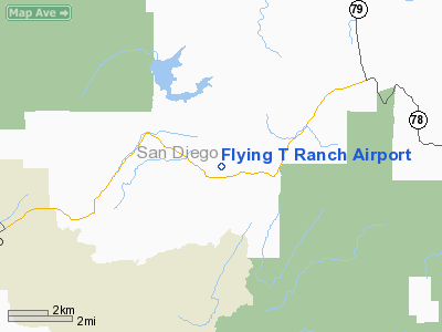
Flying T Ranch Airport
Address:
San Diego County, CA
Tel:
619-789-2200
Images
and information placed above are from
http://www.airport-data.com/airport/CA76/
We
thank them for the data!
| General
Info |
| Country |
United
States |
| State |
CALIFORNIA
|
| FAA ID |
CA76
|
| Latitude |
33-04-13.160N
|
| Longitude |
116-45-07.081W
|
| Elevation |
2500 feet
|
| Near City |
RAMONA
|
We don't guarantee the information is fresh and accurate. The data may
be wrong or outdated.
For more up-to-date information please refer to other sources.
|
|


