 |
|
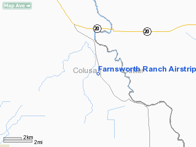
Farnsworth Ranch Airstrip Airport |
|
|
Location
& QuickFacts
|
FAA
Information Effective: |
2006-06-08 |
|
Airport
Identifier: |
35CN |
|
Longitude/Latitude: |
121-56-03.8910W/39-05-59.6160N
-121.934414/39.099893 (Estimated) |
|
Elevation: |
50 ft / 15.24 m (Estimated) |
|
Land: |
0 acres |
|
From
nearest city: |
3 nautical miles NW of Grimes, CA |
|
Location: |
Colusa County, CA |
|
Magnetic Variation: |
16E (1985) |
Owner
& Manager
|
Ownership: |
Privately owned |
|
Owner: |
Carolyn B. Farnsworth |
|
Address: |
Box 9
Grimes, CA 95950 |
|
Phone number: |
916-458-2760 |
|
Manager: |
Carolyn B. Farnsworth |
|
Address: |
Box 9
Grimes, CA 95950 |
|
Phone number: |
916-458-2760 |
Airport
Operations and Facilities
|
Airport Use: |
Private |
|
Wind indicator: |
No |
|
Segmented Circle: |
No |
|
Control Tower: |
No |
|
Attendance Schedule: |
UNATNDD |
|
Landing fee charge: |
No |
|
Sectional chart: |
San Francisco |
|
Region: |
AWP - Western-Pacific |
|
Boundary ARTCC: |
ZOA - Oakland |
|
Tie-in FSS: |
RIU - Rancho Murieta |
|
FSS on Airport: |
No |
|
FSS Phone: |
916-354-0161 |
|
FSS Toll Free: |
1-800-WX-BRIEF |
Airport
Services
|
Airframe
Repair: |
NONE |
|
Power
Plant Repair: |
NONE |
|
Runway
Information
Runway N/S
|
Dimension: |
2600 x 50 ft / 792.5 x 15.2 m |
|
Surface: |
GRAVEL, Poor Condition |
|
|
Runway N |
Runway S |
|
Traffic
Pattern: |
Left |
Left |
|
Radio Navigation
Aids
|
ID |
Type |
Name |
Ch |
Freq |
Var |
Dist |
|
MY |
NDB |
Halow |
|
222.00 |
16E |
15.7 nm |
|
OVE |
NDB |
Oroville |
|
212.00 |
16E |
27.8 nm |
|
LOP |
NDB |
Lampson |
|
217.00 |
16E |
44.8 nm |
|
BAB |
TACAN |
Beale |
023X |
|
16E |
23.1 nm |
|
TZZ |
VOR |
Travis |
|
116.40 |
17E |
45.8 nm |
|
MYV |
VOR/DME |
Marysville |
045X |
110.80 |
16E |
16.9 nm |
|
MCC |
VOR/DME |
Mc Clellan |
029X |
109.20 |
17E |
35.9 nm |
|
CIC |
VOR/DME |
Chico |
035X |
109.80 |
16E |
41.7 nm |
|
ILA |
VORTAC |
Williams |
091X |
114.40 |
18E |
4.7 nm |
|
MXW |
VORTAC |
Maxwell |
037X |
110.00 |
18E |
18.7 nm |
|
SAC |
VORTAC |
Sacramento |
099X |
115.20 |
17E |
43.3 nm |
|
SMF |
VOT |
Sacramento Metropolitan |
|
111.40 |
|
29.4 nm |
|
SAC |
VOT |
Sacramento Executive |
|
111.40 |
|
40.7 nm |
Remarks
- RWY
N/S ROUGH, USED ONLY BY AGRICULTURAL ACFT.
- ESTABD
PRIOR TO MAY 15, 1959.
Farnsworth Ranch Airstrip Airport
Address:
Colusa County, CA
Tel:
916-458-2760
Images
and information placed above are from
http://www.airport-data.com/airport/35CN/
We
thank them for the data!
| General
Info |
| Country |
United
States |
| State |
CALIFORNIA
|
| FAA ID |
35CN
|
| Latitude |
39-05-59.616N
|
| Longitude |
121-56-03.891W
|
| Elevation |
50 feet
|
| Near City |
GRIMES
|
We don't guarantee the information is fresh and accurate. The data may
be wrong or outdated.
For more up-to-date information please refer to other sources.
|
|


