 |
|
|
|
|
|
Location
& QuickFacts
|
FAA
Information Effective: |
2006-06-08 |
|
Airport
Identifier: |
86CL |
|
Longitude/Latitude: |
116-52-58.0800W/33-35-50.0940N
-116.882800/33.597248 (Estimated) |
|
Elevation: |
2860 ft / 871.73 m (Estimated) |
|
Land: |
0 acres |
|
From
nearest city: |
10 nautical miles SE of Hemet, CA |
|
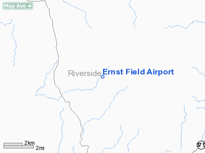
Location: |
Riverside County, CA |
|
Magnetic Variation: |
14E (1985) |
Owner
& Manager
|
Ownership: |
Privately owned |
|
Owner: |
Estay Aviation & Development Corp |
|
Address: |
44455 Benton Rd
Hemet, CA 92544 |
|
Phone number: |
951-925-3404 |
|
Manager: |
Donald P. Taylor |
|
Address: |
44455 Benton Rd
Hemet, CA 92544 |
|
Phone number: |
951-925-3404 |
Airport
Operations and Facilities
|
Airport Use: |
Private |
|
Wind indicator: |
Yes |
|
Segmented Circle: |
No |
|
Control Tower: |
No |
|
Attendance Schedule: |
ALL/ALL/DAWN-DUSK |
|
Landing fee charge: |
No |
|
Sectional chart: |
Los Angeles |
|
Region: |
AWP - Western-Pacific |
|
Boundary ARTCC: |
ZLA - Los Angeles |
|
Tie-in FSS: |
RAL - Riverside |
|
FSS on Airport: |
No |
|
FSS Phone: |
951-351-3020 |
|
FSS Toll Free: |
1-800-WX-BRIEF |
Airport
Services
|
Airframe
Repair: |
NONE |
|
Power
Plant Repair: |
NONE |
|
Runway Information
Runway 02/20
|
Dimension: |
3100 x 50 ft / 944.9 x 15.2 m |
|
Surface: |
DIRT-GRVL, |
|
|
Runway 02 |
Runway 20 |
|
Traffic
Pattern: |
Left |
Right |
|
Obstruction: |
50 ft trees |
|
|
Radio Navigation
Aids
|
ID |
Type |
Name |
Ch |
Freq |
Var |
Dist |
|
SJY |
NDB |
San Jacinto |
|
227.00 |
14E |
13.2 nm |
|
SB |
NDB |
Petis |
|
397.00 |
14E |
36.7 nm |
|
RIV |
TACAN |
March |
077X |
|
14E |
27.0 nm |
|
NFG |
TACAN |
Camp Pendleton |
055X |
|
13E |
31.9 nm |
|
NKX |
TACAN |
Miramar |
033X |
|
15E |
45.8 nm |
|
NKX |
UHF/NDB |
Miramar |
|
352.00 |
15E |
45.3 nm |
|
HDF |
VOR |
Homeland |
|
113.40 |
14E |
18.6 nm |
|
RAL |
VOR |
Riverside |
|
112.40 |
15E |
35.4 nm |
|
ELB |
VOR/DME |
El Toro |
119X |
117.20 |
14E |
42.7 nm |
|
PSP |
VORTAC |
Palm Springs |
102X |
115.50 |
13E |
28.0 nm |
|
JLI |
VORTAC |
Julian |
087X |
114.00 |
15E |
31.2 nm |
|
OCN |
VORTAC |
Oceanside |
100X |
115.30 |
15E |
34.3 nm |
|
TRM |
VORTAC |
Thermal |
109X |
116.20 |
13E |
36.2 nm |
|
PDZ |
VORTAC |
Paradise |
059X |
112.20 |
15E |
37.7 nm |
|
SEE |
VOT |
Gillespie Field |
|
110.00 |
|
46.6 nm |
|
SAN |
VOT |
Mount Soledad |
|
109.00 |
|
49.2 nm |
|
SNA |
VOT |
Santa Ana |
|
110.00 |
|
49.6 nm |
Remarks
- FIRST
800' S ROUGH, PLINES W, HILLS N, FLD IN VALLEY.
- STAY
ON RWY-NO TAXI STRIPS
- IGNORE
WINDMILL W OF FLD. IT IS NON DIRECTIONAL, IT IS FIXED IN 03/21 POSITION.
- N
END OF RWY HAS A 3'-4' WHITE BRAKE-AWAY FENCE.
- FIELD
SOFT AFTER RAIN- WATCH FOR X IF FIELD CLOSED.
- PVT
USE.
Based Aircraft
|
Aircraft
based on field: |
3 |
|
Single
Engine Airplanes: |
3 |
Ernst Field Airport
Address:
Riverside County, CA
Tel:
951-925-3404
Images
and information placed above are from
http://www.airport-data.com/airport/86CL/
We
thank them for the data!
| General
Info |
| Country |
United
States |
| State |
CALIFORNIA
|
| FAA ID |
86CL
|
| Latitude |
33-35-50.094N
|
| Longitude |
116-52-58.080W
|
| Elevation |
2860 feet
|
| Near City |
HEMET
|
We don't guarantee the information is fresh and accurate. The data may
be wrong or outdated.
For more up-to-date information please refer to other sources.
|
|


