 |
|
Emanuel Medical Center Heliport |
|
|
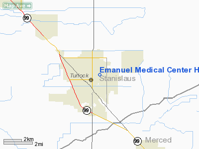
Location
& QuickFacts
|
FAA
Information Effective: |
2006-06-08 |
|
Airport
Identifier: |
CA58 |
|
Longitude/Latitude: |
120-50-21.7370W/37-30-43.7630N
-120.839371/37.512156 (Estimated) |
|
Elevation: |
111 ft / 33.83 m (Estimated) |
|
Land: |
1 acres |
|
From
nearest city: |
0 nautical miles N of Turlock, CA |
|
Location: |
Stanislaus County, CA |
|
Magnetic Variation: |
16E (1985) |
Owner
& Manager
|
Ownership: |
Privately owned |
|
Owner: |
Emanuel Medical Center |
|
Address: |
825 Delbon Ave
Turlock, CA 95380 |
|
Phone number: |
209-667-4200 |
|
Manager: |
Jerry Metcalfe |
|
Address: |
825 Delbon Ave
Turlock, CA 95380 |
|
Phone number: |
209-668-5250 |
Airport
Operations and Facilities
|
Airport
Use: |
Private
MEDICAL. |
|
Wind
indicator: |
Yes |
|
Segmented
Circle: |
No |
|
Control
Tower: |
No |
|
Attendance
Schedule: |
ALL/ALL/ALL |
|
Lighting
Schedule: |
PHONE REQ
FOR PERIMETER LGTS CALL 209-667-5800. |
|
Sectional
chart: |
San Francisco |
|
Region: |
AWP - Western-Pacific |
|
Boundary
ARTCC: |
ZOA - Oakland |
|
Tie-in
FSS: |
RIU - Rancho Murieta |
|
FSS
Phone: |
916-354-0161 |
|
FSS
Toll Free: |
1-800-WX-BRIEF |
|
Runway Information
Helipad H1
|
Dimension: |
72 x 72 ft / 21.9 x 21.9 m |
|
Surface: |
ASPH, Good Condition |
|
|
Runway H1 |
Runway |
|
Traffic
Pattern: |
Left |
Left |
|
Radio Navigation
Aids
|
ID |
Type |
Name |
Ch |
Freq |
Var |
Dist |
|
TCY |
NDB |
Tracy |
|
203.00 |
15E |
30.8 nm |
|
LV |
NDB |
Reiga |
|
374.00 |
16E |
41.7 nm |
|
MOD |
VOR/DME |
Modesto |
093X |
114.60 |
17E |
8.9 nm |
|
HYP |
VOR/DME |
El Nido |
089X |
114.20 |
15E |
27.4 nm |
|
ECA |
VORTAC |
Manteca |
107X |
116.00 |
17E |
25.0 nm |
|
LIN |
VORTAC |
Linden |
095X |
114.80 |
17E |
34.7 nm |
|
PXN |
VORTAC |
Panoche |
073X |
112.60 |
16E |
48.0 nm |
Remarks
- PRVDD
PRIVATE USE/VFR CONDITIONS ONLY.
Emanuel Medical Center Heliport
Address:
Stanislaus County, CA
Tel:
209-667-4200, 209-668-5250
Images
and information placed above are from
http://www.airport-data.com/airport/CA58/
We
thank them for the data!
| General
Info |
| Country |
United
States |
| State |
CALIFORNIA
|
| FAA ID |
CA58
|
| Latitude |
37-30-43.763N
|
| Longitude |
120-50-21.737W
|
| Elevation |
111 feet
|
| Near City |
TURLOCK
|
We don't guarantee the information is fresh and accurate. The data may
be wrong or outdated.
For more up-to-date information please refer to other sources.
|
|


