 |
|
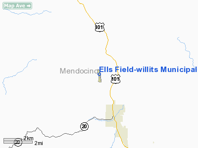
Ells Field-willits Municipal Airport |
Willits Municipal Airport
Ells Field |
| IATA: none – ICAO: none – FAA LID: O28 |
| Summary |
| Airport type |
Public |
| Operator |
City of Willits |
| Location |
Willits, California |
| Elevation AMSL |
2,063 ft / 628.8 m |
| Coordinates |
39°27′05″N 123°22′20″W / 39.45139°N 123.37222°W / 39.45139; -123.37222Coordinates: 39°27′05″N 123°22′20″W / 39.45139°N 123.37222°W / 39.45139; -123.37222 |
| Runways |
| Direction |
Length |
Surface |
| ft |
m |
| 16/34 |
3,000 |
914 |
Asphalt |
Willits Municipal Airport (FAA LID: O28), also known as Ells Field, is a public airport located three miles (4.6 km) northwest of Willits, serving Mendocino County, California, USA. This general aviation airport covers 75 acres and has one runway.
The above content comes from Wikipedia and is published under free licenses – click here to read more.
Location
& QuickFacts
|
FAA
Information Effective: |
2006-06-08 |
|
Airport
Identifier: |
O28 |
|
Longitude/Latitude: |
123-22-20.2240W/39-27-04.6720N
-123.372284/39.451298 (Estimated) |
|
Elevation: |
2063 ft / 628.80 m (Estimated) |
|
Land: |
75
acres |
|
From
nearest city: |
3 nautical miles NW of Willits, CA |
|
Location: |
Mendocino County, CA |
|
Magnetic Variation: |
16E (2000) |
Owner
& Manager
|
Ownership: |
Publicly
owned |
|
Owner: |
City Of Willits |
|
Address: |
111 E Commercial St.
Willits, CA 95490 |
|
Phone
number: |
707-459-4605 |
|
Manager: |
Richard J. Seanor
CITY ENGINEER. |
|
Address: |
111 E Commercial St.
Willits, CA 95490 |
|
Phone
number: |
707-459-4605
FBO & ARPT FUELING SVCS PRVDD BY ACE AERIAL 707-459-4764. |
Airport
Operations and Facilities
|
Airport Use: |
Open
to public |
|
Wind
indicator: |
Yes |
|
Segmented
Circle: |
Yes |
|
Control
Tower: |
No |
|
Attendance
Schedule: |
ALL/ALL/0800-1700 |
|
Lighting
Schedule: |
DUSK-DAWN
ACTVT MIRL RY 16/34 - CTAF. |
|
Beacon
Color: |
Clear-Green (lighted land airport) |
|
Landing
fee charge: |
No |
|
Sectional
chart: |
San
Francisco |
|
Region: |
AWP
- Western-Pacific |
|
Traffic
Pattern Alt: |
1000 ft |
|
Boundary
ARTCC: |
ZOA
- Oakland |
|
Tie-in
FSS: |
OAK
- Oakland |
|
FSS
on Airport: |
No |
|
FSS
Phone: |
510-273-6111 |
|
FSS
Toll Free: |
1-800-WX-BRIEF |
|
NOTAMs
Facility: |
OAK (NOTAM-d service avaliable) |
|
Federal Agreements: |
NY1 |
Airport
Communications
|
CTAF: |
122.800 |
|
Unicom: |
122.800
|
Airport
Services
|
Fuel available: |
100LL
FUEL AVBL 24 HRS WITH CREDIT CARD. |
|
Airframe Repair: |
MINOR |
|
Power Plant Repair: |
MINOR |
|
Runway Information
Runway 16/34
|
Dimension: |
3000
x 75 ft / 914.4 x 22.9 m |
|
Surface: |
ASPH,
Good Condition |
|
Weight
Limit: |
Single
wheel: 30000 lbs. |
|
Edge
Lights: |
Medium |
| |
Runway
16 |
Runway
34 |
|
Longitude: |
123-22-21.8040W |
123-22-18.6450W |
|
Latitude: |
39-27-19.4250N |
39-26-49.9190N |
|
Elevation: |
2063.00 ft |
2023.00 ft |
|
Alignment: |
127 |
127 |
|
Traffic
Pattern: |
Left |
Right |
|
Markings: |
Basic,
Good Condition |
Basic,
Good Condition |
|
Runway
End Identifier: |
No |
No |
|
Touchdown
Lights: |
No |
No |
|
Obstruction: |
11 ft trees, 240.0 ft from runway, 3:1 slope
to clear
RY 16 +5 FT BRUSH @130-150 FT. |
38 ft trees, 1000.0 ft from runway, 200 ft
right of centerline, 21:1 slope to clear
RY 34 +5 FT BRUSH @ 130-150 FT. |
|
Radio Navigation
Aids
|
ID |
Type |
Name |
Ch |
Freq |
Var |
Dist |
|
LOP |
NDB |
Lampson |
|
217.00 |
16E |
35.6
nm |
|
ENI |
VORTAC |
Mendocino |
070X |
112.30 |
16E |
24.4
nm |
Remarks
- DEER
ON AND IN VICINITY OF RWY.
- ACFT
NOT VISIBLE FROM OPPOSITE ENDS OF THE RUNWAY.
Based Aircraft
|
Aircraft
based on field: |
21 |
|
Single
Engine Airplanes: |
20 |
|
Multi
Engine Airplanes: |
1 |
Operational Statistics
|
Aircraft
Operations: |
106/Week |
|
General
Aviation Local: |
45.5% |
|
General
Aviation Itinerant: |
54.5% |
Ells Field-willits Municipal Airport
Address:
Mendocino County, CA
Tel:
707-459-4605,
707-459-4764
Images
and information placed above are from
http://www.airport-data.com/airport/O28/
We
thank them for the data!
| General
Info |
| Country |
United
States |
| State |
CALIFORNIA
|
| FAA ID |
O28
|
| Latitude |
39-27-04.672N
|
| Longitude |
123-22-20.224W
|
| Elevation |
2063 feet
|
| Near City |
WILLITS
|
We don't guarantee the information is fresh and accurate. The data may
be wrong or outdated.
For more up-to-date information please refer to other sources.
|
|


