 |
|
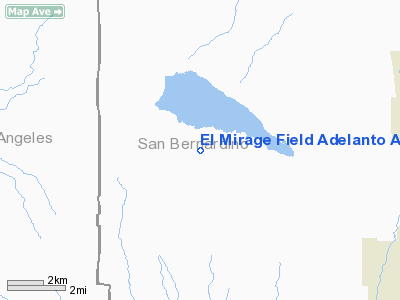
El Mirage Field Adelanto Airport |
Location
& QuickFacts
|
FAA
Information Effective: |
2006-06-08 |
|
Airport
Identifier: |
99CL |
|
Longitude/Latitude: |
117-36-18.2010W/34-37-29.9640N
-117.605056/34.624990 (Estimated) |
|
Elevation: |
2865 ft / 873.25 m (Estimated) |
|
Land: |
647 acres |
|
From
nearest city: |
3 nautical miles W of El Mirage, CA |
|
Location: |
San Bernardino County, CA |
|
Magnetic Variation: |
14E (1985) |
Owner
& Manager
|
Ownership: |
Privately owned |
|
Owner: |
Col. Carter Clark |
|
Address: |
P. O. Box 7146
Capistrano Beach, CA 92690 |
|
Phone number: |
714-240-0418 |
|
Address: |
|
Airport
Operations and Facilities
|
Airport Use: |
Private |
|
Wind indicator: |
Yes |
|
Segmented Circle: |
Yes |
|
Control Tower: |
No |
|
Attendance Schedule: |
ALL/ALL/ALL |
|
Landing fee charge: |
No |
|
Sectional chart: |
Los Angeles |
|
Region: |
AWP - Western-Pacific |
|
Traffic Pattern Alt: |
800 ft |
|
Boundary ARTCC: |
ZLA - Los Angeles |
|
Tie-in FSS: |
RAL - Riverside |
|
FSS on Airport: |
No |
|
FSS Phone: |
951-351-3020 |
|
FSS Toll Free: |
1-800-WX-BRIEF |
Airport
Services
|
Runway Information
Runway 04/22
|
Dimension: |
3700 x 150 ft / 1127.8 x 45.7 m |
|
Surface: |
ASPH,
AND RY 07/25 SOME BREAKUP OF ASPH. |
|
|
Runway 04 |
Runway 22 |
|
Traffic
Pattern: |
Left |
Left |
|
Markings: |
Nonstandard, Poor Condition
RWYS 04/22; 07/25; 16/34 MARKINGS NUMERALS ONLY. |
Nonstandard, Poor Condition |
|
Runway
End Identifier: |
No |
No |
|
Centerline
Lights: |
No |
No |
|
Touchdown
Lights: |
No |
No |
|
Runway 07/25
|
Dimension: |
3200 x 150 ft / 975.4 x 45.7 m |
|
Surface: |
ASPH, Poor Condition
AND RY 07/25 SOME BREAKUP OF ASPH. |
|
|
Runway 07 |
Runway 25 |
|
Traffic
Pattern: |
Left |
Left |
|
Markings: |
Nonstandard, Poor Condition |
Nonstandard, Poor Condition |
|
Runway
End Identifier: |
No |
No |
|
Centerline
Lights: |
No |
No |
|
Touchdown
Lights: |
No |
No |
|
Runway 16/34
|
Dimension: |
3700 x 150 ft / 1127.8 x 45.7 m |
|
Surface: |
ASPH, Poor Condition
AND RY 07/25 SOME BREAKUP OF ASPH. |
|
|
Runway 16 |
Runway 34 |
|
Traffic
Pattern: |
Left |
Left |
|
Markings: |
Nonstandard, Poor Condition |
Nonstandard, Poor Condition |
|
Runway
End Identifier: |
No |
No |
|
Centerline
Lights: |
No |
No |
|
Touchdown
Lights: |
No |
No |
|
Radio Navigation
Aids
|
ID |
Type |
Name |
Ch |
Freq |
Var |
Dist |
|
GWF |
NDB |
Gen William J Fox |
|
282.00 |
15E |
31.0 nm |
|
SB |
NDB |
Petis |
|
397.00 |
14E |
36.2 nm |
|
EMT |
NDB |
El Monte |
|
359.00 |
15E |
38.6 nm |
|
PAI |
NDB |
Pacoima |
|
370.00 |
15E |
45.7 nm |
|
RIV |
TACAN |
March |
077X |
|
14E |
46.2 nm |
|
RAL |
VOR |
Riverside |
|
112.40 |
15E |
41.2 nm |
|
VCV |
VOR/DME |
Victorville |
031X |
109.40 |
14E |
10.8 nm |
|
EDW |
VORTAC |
Edwards |
111X |
116.40 |
15E |
22.4 nm |
|
PMD |
VORTAC |
Palmdale |
092X |
114.50 |
15E |
22.7 nm |
|
POM |
VORTAC |
Pomona |
041X |
110.40 |
15E |
34.1 nm |
|
PDZ |
VORTAC |
Paradise |
059X |
112.20 |
15E |
42.6 nm |
|
LHS |
VORTAC |
Lake Hughes |
021X |
108.40 |
15E |
48.2 nm |
Remarks
- 1000'
+GRAVEL STOPWAY RWYS 04 & 07; 800' GRAVEL STOPWAY RWY 25.
-
< VEHICULAR
SPORTS & RECREATION EXTENSIVE DUE HOLIDAYS WEEKENDS SFC LAKE ON
OPNS LNDG TKOF AVOID ACFT WING>
-
< TFC GLIDER>
- NOTE:
ARPT RESTRICTED FOR TESTING
- VFR,
PRIVATE USE ONLY.
Operational Statistics
|
Aircraft
Operations: |
82/Week |
|
General
Aviation Local: |
76.5% |
|
General
Aviation Itinerant: |
23.5% |
El Mirage Field Adelanto Airport
Address:
San Bernardino County, CA
Tel:
714-240-0418
Images
and information placed above are from
http://www.airport-data.com/airport/99CL/
We
thank them for the data!
| General
Info |
| Country |
United
States |
| State |
CALIFORNIA
|
| FAA ID |
99CL
|
| Latitude |
34-37-29.964N
|
| Longitude |
117-36-18.201W
|
| Elevation |
2865 feet
|
| Near City |
EL MIRAGE
|
We don't guarantee the information is fresh and accurate. The data may
be wrong or outdated.
For more up-to-date information please refer to other sources.
|
|


