 |
|
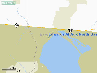
Edwards Af Aux North Base Airport |
|
|
Location
& QuickFacts
|
FAA
Information Effective: |
2006-06-08 |
|
Airport
Identifier: |
9L2 |
|
Longitude/Latitude: |
117-51-47.2370W/34-59-26.9080N
-117.863121/34.990808 (Estimated) |
|
Elevation: |
2299 ft / 700.74 m (Estimated) |
|
Land: |
0 acres |
|
From
nearest city: |
3 nautical miles N of Edwards, CA |
|
Location: |
Kern County, CA |
|
Magnetic Variation: |
14E (1985) |
Owner
& Manager
|
Ownership: |
Air Force owned |
|
Owner: |
Usaf |
|
Address: |
Edwards Afb
Edwards, CA 93523 |
|
Manager: |
Base Operations |
|
Address: |
Edwards Afb
Edwards, CA 93523 |
|
Phone number: |
805-277-1110 |
Airport
Operations and Facilities
|
Airport
Use: |
Private |
|
Wind
indicator: |
No |
|
Segmented
Circle: |
No |
|
Control
Tower: |
No |
|
Attendance
Schedule: |
ALL/ALL/1400-0600Z++, CLSD WKEND AND HOL. |
|
Sectional
chart: |
Los Angeles |
|
Region: |
AWP - Western-Pacific |
|
Boundary
ARTCC: |
ZLA - Los Angeles |
|
Tie-in
FSS: |
RAL - Riverside
FSS-RIVERSIDE RAL- NOTAM KEDW |
|
FSS
on Airport: |
No |
|
FSS
Phone: |
951-351-3020 |
|
FSS
Toll Free: |
1-800-WX-BRIEF |
|
NOTAMs
Facility: |
EDW (NOTAM-d service avaliable) |
Airport
Services
|
Airframe
Repair: |
NONE |
|
Power
Plant Repair: |
NONE |
|
Bottled
Oxygen: |
NONE |
|
Bulk
Oxygen: |
NONE |
|
Runway Information
Runway 06/24
|
Dimension: |
5998 x 150 ft / 1828.2 x 45.7 m |
|
Surface: |
ASPH, |
|
Pavement
Class: |
15/F/B/W/T |
|
Edge
Lights: |
High
HIRL NOT POSITIONED WITHIN 10 FT FR THE EDGE OF THE USABLE RWY SFC. |
|
|
Runway 06 |
Runway 24 |
|
Alignment: |
74 |
127 |
|
Traffic
Pattern: |
Left |
Left |
|
VASI: |
|
4-light PAPI on left side |
|
Visual
Glide Angle: |
0.00� |
3.00� |
|
Runway
End Identifier: |
No |
No |
|
Centerline
Lights: |
No |
No |
|
Touchdown
Lights: |
No |
No |
|
Radio Navigation
Aids
|
ID |
Type |
Name |
Ch |
Freq |
Var |
Dist |
|
GWF |
NDB |
Gen William J Fox |
|
282.00 |
15E |
23.1 nm |
|
NID |
TACAN |
China Lake |
053X |
|
16E |
42.8 nm |
|
VCV |
VOR/DME |
Victorville |
031X |
109.40 |
14E |
33.4 nm |
|
EDW |
VORTAC |
Edwards |
111X |
116.40 |
15E |
6.4 nm |
|
PMD |
VORTAC |
Palmdale |
092X |
114.50 |
15E |
23.8 nm |
|
LHS |
VORTAC |
Lake Hughes |
021X |
108.40 |
15E |
39.8 nm |
Remarks
- RSTD
- PPR STRICTLY ENFORCED. CLSD TO ALL TRAN ACFT WO PRIOR APVL OF COMDR
AFFTC. ATTN:
DOCOO.
- RSTD
- LTD TO BE-20 TYPE ACFT AND SMALLER, 12,500 LB OR LESS. DUE TO RWY
COND, ALL TURNS WILL OCCUR ON THE CONCRETE AREAS OF THE RWY LCTD AT
THE APCH END, DEP END, AND MID-FLD. IF UNABLE TO EXIT AT CNTR TWY, ACFT
MUST PROCEED TO THE DEP END TO INITIATE TURN AND EXIT MID-FLD.
- MISC
- WINDS ARE EST DUE TO FMQ-13 WIND SENSORS BEING ACCURATE TO WITHIN
ONLY +/- 4 KT, ISSUED EST WINDS ARE FOR MAIN BASE RWY 04-22. ATC/WX
WILL NOT INCL/RELAY WIND CORR INTO FCST/PHRASEOLOGY. THEREFORE,AIRCREWS
WILL INCORPORATE A +/- 4 KT ACCURACY INTO THEIR DECISION MAKING PROCESS
FOR FLYING OPR.
- MILITARY
ARPT. AUTHORIZED FOR MILITARY USE ONLY.
Edwards Af Aux North Base Airport
Address:
Kern County, CA
Tel:
805-277-1110
Images
and information placed above are from
http://www.airport-data.com/airport/9L2/
We
thank them for the data!
| General
Info |
| Country |
United
States |
| State |
CALIFORNIA
|
| FAA ID |
9L2
|
| Latitude |
34-59-26.908N
|
| Longitude |
117-51-47.237W
|
| Elevation |
2300 feet
|
| Near City |
EDWARDS
|
We don't guarantee the information is fresh and accurate. The data may
be wrong or outdated.
For more up-to-date information please refer to other sources.
|
|


