 |
|
|
|
|
|
Location
& QuickFacts
|
FAA
Information Effective: |
2006-06-08 |
|
Airport
Identifier: |
1Q1 |
|
Longitude/Latitude: |
119-03-00.3710W/36-09-44.8240N
-119.050103/36.162451 (Estimated) |
|
Elevation: |
426 ft / 129.84 m (Estimated) |
|
Land: |
27 acres |
|
From
nearest city: |
1 nautical miles NE of Strathmore, CA |
|
Location: |
Tulare County, CA |
|
Magnetic Variation: |
15E (1985) |
Owner
& Manager
|
Ownership: |
Privately owned |
|
Owner: |
Dick Schutze |
|
Address: |
23500 Ave 204
Strathmore, CA 93267 |
|
Phone number: |
209-568-0131 |
|
Manager: |
Dick Schutze |
|
Address: |
23500 Ave 204
Strathmore, CA 93267 |
|
Phone number: |
805-646-6042 |
Airport
Operations and Facilities
|
Airport
Use: |
Open to public |
|
Wind
indicator: |
Yes |
|
Segmented
Circle: |
No |
|
Control
Tower: |
No |
|
Attendance
Schedule: |
ALL/ALL/DALGT |
|
Landing
fee charge: |
No |
|
Sectional
chart: |
San Francisco |
|
Region: |
AWP - Western-Pacific |
|
Traffic
Pattern Alt: |
1000 ft |
|
Boundary
ARTCC: |
ZOA - Oakland |
|
Tie-in
FSS: |
RIU - Rancho Murieta |
|
FSS
on Airport: |
No |
|
FSS
Phone: |
916-354-0161 |
|
FSS
Toll Free: |
1-800-WX-BRIEF |
|
NOTAMs
Facility: |
RIU (NOTAM-d service avaliable) |
Airport
Communications
|
CTAF: |
122.800 |
|
Unicom: |
122.800 |
Airport
Services
|
Fuel
available: |
100LL |
|
Airframe
Repair: |
NONE |
|
Power
Plant Repair: |
NONE |
|
Bottled
Oxygen: |
NONE |
|
Bulk
Oxygen: |
NONE |
|
Runway Information
Runway 13/31
|
Dimension: |
2000 x 50 ft / 609.6 x 15.2 m |
|
Surface: |
ASPH, Poor Condition
RY 13/31 ASPHALT CRACKED, WORN AND PONDS WATER. |
|
|
Runway 13 |
Runway 31 |
|
Traffic
Pattern: |
Left |
Left |
|
Markings: |
Nonstandard, Poor Condition
RY 13 MARKINGS FADED AND PARTIALLY OBSCURED. |
Nonstandard, Poor Condition
RY 31 MARKINGS FADED AND PARTIALLY OBSCURED. |
|
Touchdown
Lights: |
No |
No |
|
Obstruction: |
20 ft trees, 200.0 ft from runway
+20' TREES 185'-225' FM THR 125'L-125'R. |
15 ft trees, 200.0 ft from runway
+3 FT BUSHES AT THLD; +15 FT ROAD 0-125 FT FM THLD 125 FT
L-125 FT R; +20 FT TREES 15-150 FT FM THLD 125 FT L-125 FT
R. |
|
Radio Navigation
Aids
|
ID |
Type |
Name |
Ch |
Freq |
Var |
Dist |
|
COR |
NDB |
Salyer Farms |
|
205.00 |
16E |
24.3 nm |
|
CUK |
NDB |
Academy |
|
266.00 |
14E |
44.3 nm |
|
NLC |
TACAN |
Lemoore |
080X |
|
16E |
45.7 nm |
|
TTE |
VOR/DME |
Tule |
029X |
109.20 |
16E |
15.1 nm |
|
VIS |
VOR/DME |
Visalia |
031X |
109.40 |
16E |
24.3 nm |
|
EHF |
VORTAC |
Shafter |
101X |
115.40 |
14E |
40.8 nm |
|
BFL |
VOT |
Bakersfield |
|
111.20 |
|
44.3 nm |
Remarks
- NIGHT
OPNS PROHIBITED.
- OBSTNS
IN RWY TRSN SFCS: +20 FT TREES WEST; +30 FT TREES AND +15 FT HANGERS
EAST.
- NO
FENCE BTN THR AND CO ROAD TO SOUTH.
Based Aircraft
|
Aircraft
based on field: |
24 |
|
Single
Engine Airplanes: |
20 |
|
Multi
Engine Airplanes: |
1 |
|
Gliders: |
2 |
|
Ultralights: |
1 |
Operational Statistics
|
Aircraft
Operations: |
75/Week |
|
General
Aviation Local: |
50.0% |
|
General
Aviation Itinerant: |
50.0% |
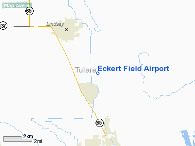
Eckert Field Airport
Address:
Tulare County, CA
Tel:
209-568-0131, 805-646-6042
Images
and information placed above are from
http://www.airport-data.com/airport/1Q1/
We
thank them for the data!
| General
Info |
| Country |
United
States |
| State |
CALIFORNIA
|
| FAA ID |
1Q1
|
| Latitude |
36-09-44.824N
|
| Longitude |
119-03-00.371W
|
| Elevation |
426 feet
|
| Near City |
STRATHMORE
|
We don't guarantee the information is fresh and accurate. The data may
be wrong or outdated.
For more up-to-date information please refer to other sources.
|
|


