 |
|
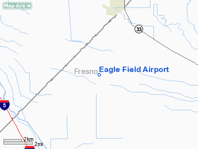
Location
& QuickFacts
|
FAA
Information Effective: |
2006-06-08 |
|
Airport
Identifier: |
CL01 |
|
Longitude/Latitude: |
120-40-03.6570W/36-53-59.8140N
-120.667682/36.899948 (Estimated) |
|
Elevation: |
153 ft / 46.63 m (Estimated) |
|
Land: |
127 acres |
|
From
nearest city: |
7 nautical miles SW of Dos Palos, CA |
|
Location: |
Fresno County, CA |
|
Magnetic Variation: |
15E (1985) |
Owner
& Manager
|
Ownership: |
Privately owned |
|
Owner: |
Joseph L. Davis |
|
Address: |
1522 N. Fruit Avenue
Fresno, CA 93778 |
|
Phone
number: |
209-233-7543
WORK PHONE 209-436-0450 |
|
Manager: |
Joe Davis |
|
Address: |
1522 N. Fruit Avenue
Fresno, CA 93778 |
|
Phone number: |
209-364-6132 |
Airport
Operations and Facilities
|
Airport
Use: |
Private |
|
Wind
indicator: |
Yes |
|
Segmented
Circle: |
No |
|
Control
Tower: |
No |
|
Attendance
Schedule: |
ALL/MON-FRI/1000-1700 |
|
Landing
fee charge: |
No |
|
Sectional
chart: |
San Francisco |
|
Region: |
AWP - Western-Pacific |
|
Boundary
ARTCC: |
ZOA - Oakland |
|
Tie-in
FSS: |
RIU - Rancho Murieta |
|
FSS
on Airport: |
No |
|
FSS
Phone: |
916-354-0161 |
|
FSS
Toll Free: |
1-800-WX-BRIEF |
|
Runway Information
Runway 12/30
|
Dimension: |
2300 x 60 ft / 701.0 x 18.3 m |
|
Surface: |
ASPH, Good Condition |
|
|
Runway 12 |
Runway 30 |
|
Traffic
Pattern: |
Right |
Right |
|
Radio Navigation
Aids
|
ID |
Type |
Name |
Ch |
Freq |
Var |
Dist |
|
FCH |
NDB |
Chandler |
|
344.00 |
15E |
41.5 nm |
|
UAD |
NDB |
Chualar |
|
263.00 |
16E |
46.0 nm |
|
NLC |
TACAN |
Lemoore |
080X |
|
16E |
47.6 nm |
|
ROM |
VOR |
Priest |
|
110.00 |
16E |
45.7 nm |
|
HYP |
VOR/DME |
El Nido |
089X |
114.20 |
15E |
23.1 nm |
|
MOD |
VOR/DME |
Modesto |
093X |
114.60 |
17E |
45.9 nm |
|
PXN |
VORTAC |
Panoche |
073X |
112.60 |
16E |
12.3 nm |
|
CZQ |
VORTAC |
Clovis |
076X |
112.90 |
15E |
41.0 nm |
|
SNS |
VORTAC |
Salinas |
120X |
117.30 |
17E |
47.2 nm |
Remarks
- (AA110-1)
PARACHUTE JUMP SCHOOL.
- PRIVATE,
VFR USE ONLY.
Based Aircraft
|
Aircraft
based on field: |
8 |
|
Single
Engine Airplanes: |
6 |
|
Multi
Engine Airplanes: |
1 |
|
Jet Engine
Airplanes: |
1 |
Eagle Field Airport
Address:
Fresno County, CA
Tel:
209-233-7543.
209-364-6132
Images
and information placed above are from
http://www.airport-data.com/airport/CL01/
We
thank them for the data!
| General
Info |
| Country |
United
States |
| State |
CALIFORNIA
|
| FAA ID |
CL01
|
| Latitude |
36-53-59.814N
|
| Longitude |
120-40-03.657W
|
| Elevation |
153 feet
|
| Near City |
DOS PALOS
|
We don't guarantee the information is fresh and accurate. The data may
be wrong or outdated.
For more up-to-date information please refer to other sources.
|
|


