 |
|
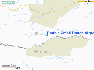
Double Creek Ranch Airport |
|
|
Location
& QuickFacts
|
FAA
Information Effective: |
2006-06-08 |
|
Airport
Identifier: |
CN42 |
|
Longitude/Latitude: |
121-52-55.9660W/40-26-44.5630N
-121.882213/40.445712 (Estimated) |
|
Elevation: |
2030
ft / 618.74 m (Estimated) |
|
Land: |
360
acres |
|
From
nearest city: |
1 nautical miles NW of Manton, CA |
|
Location: |
Shasta County, CA |
|
Magnetic Variation: |
17E (1985) |
Owner
& Manager
|
Ownership: |
Privately owned |
|
Owner: |
Mr & Mrs W.c. Matz |
|
Address: |
960 F Rancheros Dr
San Marcos, CA 92069 |
|
Phone number: |
619-746-9400 |
|
Address: |
|
|
Phone number: |
916-474-5757 |
Airport
Operations and Facilities
|
Airport Use: |
Private |
|
Wind indicator: |
Yes |
|
Segmented Circle: |
No |
|
Control Tower: |
No |
|
Attendance Schedule: |
ALL/ALL/DAWN-DUSK |
|
Landing fee charge: |
No |
|
Sectional chart: |
Klamath Falls |
|
Region: |
AWP - Western-Pacific |
|
Traffic Pattern Alt: |
800 ft |
|
Boundary ARTCC: |
ZOA - Oakland |
|
Tie-in FSS: |
RIU - Rancho Murieta |
|
FSS on Airport: |
No |
|
FSS Phone: |
916-354-0161 |
|
FSS Toll Free: |
1-800-WX-BRIEF |
Airport
Services
|
Airframe
Repair: |
MINOR |
|
Power
Plant Repair: |
MINOR |
|
Bottled
Oxygen: |
NONE |
|
Bulk
Oxygen: |
NONE |
|
Runway Information
Runway 06/24
|
Dimension: |
3400 x 80 ft / 1036.3 x 24.4 m |
|
Surface: |
TURF-DIRT, |
|
|
Runway 06 |
Runway 24 |
|
Traffic
Pattern: |
Left |
Left |
|
Runway
End Identifier: |
No |
No |
|
Centerline
Lights: |
No |
No |
|
Touchdown
Lights: |
No |
No |
|
Obstruction: |
20 ft trees, 1500.0 ft from runway, 20:1 slope
to clear |
20 ft trees, 225.0 ft from runway, 7:1 slope
to clear |
|
Radio Navigation
Aids
|
ID |
Type |
Name |
Ch |
Freq |
Var |
Dist |
|
PBT |
NDB |
Proberta |
|
338.00 |
16E |
25.7 nm |
|
RDD |
VOR/DME |
Redding |
021X |
108.40 |
18E |
19.1 nm |
|
CIC |
VOR/DME |
Chico |
035X |
109.80 |
16E |
39.5 nm |
|
RBL |
VORTAC |
Red Bluff |
104X |
115.70 |
18E |
26.4 nm |
Remarks
- DO
NOT USE TWYS WHEN WET--USE RWYS FOR TAXI.
- VFR
USE ONLY.
Operational Statistics
|
Aircraft
Operations: |
14/Month |
|
General
Aviation Local: |
6.3% |
|
General
Aviation Itinerant: |
93.8% |
Double Creek Ranch Airport
Address:
Shasta County, CA
Tel:
619-746-9400, 916-474-5757
Images
and information placed above are from
http://www.airport-data.com/airport/CN42/
We
thank them for the data!
| General
Info |
| Country |
United
States |
| State |
CALIFORNIA
|
| FAA ID |
CN42
|
| Latitude |
40-26-44.563N
|
| Longitude |
121-52-55.966W
|
| Elevation |
2030 feet
|
| Near City |
MANTON
|
We don't guarantee the information is fresh and accurate. The data may
be wrong or outdated.
For more up-to-date information please refer to other sources.
|
|


