 |
|
|
|
|
|
Location
& QuickFacts
|
FAA
Information Effective: |
2006-06-08 |
|
Airport
Identifier: |
28CA |
|
Longitude/Latitude: |
120-37-48.6580W/36-57-44.8100N
-120.630183/36.962447 (Estimated) |
|
Elevation: |
118
ft / 35.97 m (Surveyed) |
|
Land: |
40
acres |
|
From
nearest city: |
2 nautical miles S of Dos Palos, CA |
|
Location: |
Fresno County, CA |
|
Magnetic Variation: |
15E (1985) |
Owner
& Manager
|
Ownership: |
Privately owned |
|
Owner: |
Spain Air Inc. |
|
Address: |
Box 217
Dos Palos, CA 93620 |
|
Phone number: |
209-392-2120 |
|
Manager: |
Bob Spain, Jr |
|
Address: |
Box 217
Dos Palos, CA 93620 |
|
Phone number: |
209-392-2120 |
Airport
Operations and Facilities
|
Airport
Use: |
Private |
|
Wind
indicator: |
Yes |
|
Segmented
Circle: |
No |
|
Control
Tower: |
No |
|
Attendance
Schedule: |
ALL/MON-FRI/0800-1700,ALL/SAT/0800-1200 |
|
Landing
fee charge: |
No |
|
Sectional
chart: |
San Francisco |
|
Region: |
AWP - Western-Pacific |
|
Traffic
Pattern Alt: |
800
ft |
|
Boundary ARTCC: |
ZOA - Oakland |
|
Tie-in FSS: |
RIU - Rancho Murieta |
|
FSS on Airport: |
No |
|
FSS Phone: |
916-354-0161 |
|
FSS Toll Free: |
1-800-WX-BRIEF |
Airport
Services
|
Airframe
Repair: |
NONE |
|
Power
Plant Repair: |
NONE |
|
Bottled
Oxygen: |
NONE |
|
Bulk
Oxygen: |
NONE |
|
Runway Information
Runway 13/31
|
Dimension: |
2210 x 60 ft / 673.6 x 18.3 m |
|
Surface: |
DIRT, Good Condition |
|
|
Runway 13 |
Runway 31 |
|
Traffic
Pattern: |
Left |
Left |
|
Markings: |
None, |
None, |
|
Runway
End Identifier: |
No |
No |
|
Centerline
Lights: |
No |
No |
|
Touchdown
Lights: |
No |
No |
|
Obstruction: |
15 ft road, 300.0 ft from runway, 20:1 slope
to clear |
15 ft road, 80.0 ft from runway, 4:1 slope
to clear |
|
Radio Navigation
Aids
|
ID |
Type |
Name |
Ch |
Freq |
Var |
Dist |
|
FCH |
NDB |
Chandler |
|
344.00 |
15E |
40.9 nm |
|
UAD |
NDB |
Chualar |
|
263.00 |
16E |
49.6 nm |
|
CUK |
NDB |
Academy |
|
266.00 |
14E |
49.8 nm |
|
NLC |
TACAN |
Lemoore |
080X |
|
16E |
49.1 nm |
|
ROM |
VOR |
Priest |
|
110.00 |
16E |
49.4 nm |
|
HYP |
VOR/DME |
El Nido |
089X |
114.20 |
15E |
19.0 nm |
|
MOD |
VOR/DME |
Modesto |
093X |
114.60 |
17E |
42.9 nm |
|
PXN |
VORTAC |
Panoche |
073X |
112.60 |
16E |
16.5 nm |
|
CZQ |
VORTAC |
Clovis |
076X |
112.90 |
15E |
39.4 nm |
Remarks
- RWY
13/31 UNUSABLE WHEN WET.
- RWY
13/31 MARKED WITH R'S.
- EXISTED
PRIOR TO 1959.
Based Aircraft
|
Aircraft
based on field: |
7 |
|
Single
Engine Airplanes: |
7 |
Operational Statistics
|
Aircraft
Operations: |
254/Week |
|
General
Aviation Local: |
98.5% |
|
General
Aviation Itinerant: |
1.5% |
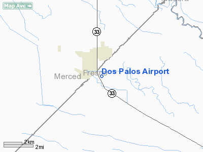
Dos Palos Airport
Address:
Fresno County, CA
Tel:
209-392-2120
Images
and information placed above are from
http://www.airport-data.com/airport/28CA/
We
thank them for the data!
| General
Info |
| Country |
United
States |
| State |
CALIFORNIA
|
| FAA ID |
28CA
|
| Latitude |
36-57-44.810N
|
| Longitude |
120-37-48.658W
|
| Elevation |
118 feet
|
| Near City |
DOS PALOS
|
We don't guarantee the information is fresh and accurate. The data may
be wrong or outdated.
For more up-to-date information please refer to other sources.
|
|


