 |
|
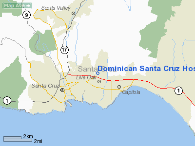
Dominican Santa Cruz Hospital Heliport |
|
|
Location
& QuickFacts
|
FAA
Information Effective: |
2006-06-08 |
|
Airport
Identifier: |
CA37 |
|
Longitude/Latitude: |
121-58-57.8610W/36-59-25.8190N
-121.982739/36.990505 (Estimated) |
|
Elevation: |
115
ft / 35.05 m (Estimated) |
|
Land: |
0
acres |
|
From
nearest city: |
3 nautical miles NE of Santa Cruz, CA |
|
Location: |
Santa Cruz County, CA |
|
Magnetic Variation: |
16E (1985) |
Owner
& Manager
|
Ownership: |
Privately
owned |
|
Owner: |
Dominican
Santa Cruz Hosp |
|
Address: |
1555 Soquel Dr
Santa Cruz, CA 95065 |
|
Phone
number: |
408-462-7700 |
|
Manager: |
Sister Julie Hyer
ADMINISTRATOR, PRESIDENT, BOARD OF DIRECTORS. |
|
Address: |
1555 Soquel Dr
Santa Cruz, CA 95065 |
|
Phone number: |
408-462-7700 |
Airport Operations and Facilities
|
Airport
Use: |
Private
MEDICAL. |
|
Wind
indicator: |
Yes |
|
Segmented Circle: |
No |
|
Control
Tower: |
No |
|
Attendance Schedule: |
UNATNDD |
|
Landing
fee charge: |
No |
|
Sectional chart: |
San
Francisco |
|
Region: |
AWP
- Western-Pacific |
|
Boundary
ARTCC: |
ZOA
- Oakland |
|
Tie-in
FSS: |
OAK
- Oakland |
|
FSS
on Airport: |
No |
|
FSS
Phone: |
510-273-6111 |
|
FSS
Toll Free: |
1-800-WX-BRIEF |
|
Runway Information
Helipad H1
|
Dimension: |
80
x 80 ft / 24.4 x 24.4 m |
|
Surface: |
ASPH, |
|
|
Runway H1 |
Runway |
|
Traffic
Pattern: |
Left |
Left |
|
Radio Navigation
Aids
|
ID |
Type |
Name |
Ch |
Freq |
Var |
Dist |
|
PDG |
NDB |
Pajar |
|
327.00 |
17E |
9.6 nm |
|
UAD |
NDB |
Chualar |
|
263.00 |
16E |
38.7 nm |
|
LV |
NDB |
Reiga |
|
374.00 |
16E |
44.5 nm |
|
TCY |
NDB |
Tracy |
|
203.00 |
15E |
49.4 nm |
|
NUQ |
TACAN |
Moffett |
123X |
|
17E |
26.8 nm |
|
SJC |
VOR/DME |
San Jose |
088X |
114.10 |
16E |
23.2 nm |
|
SFO |
VOR/DME |
San Francisco |
105X |
115.80 |
17E |
42.2 nm |
|
SNS |
VORTAC |
Salinas |
120X |
117.30 |
17E |
26.8 nm |
|
OSI |
VORTAC |
Woodside |
086X |
113.90 |
17E |
28.1 nm |
|
OAK |
VORTAC |
Oakland |
115X |
116.80 |
17E |
45.7 nm |
|
SFO |
VOT |
San Francisco Intl |
|
111.00 |
|
42.2 nm |
Remarks
Dominican Santa Cruz Hospital Heliport
Address: Santa
Cruz County, CA
Tel:
408-462-7700
Images
and information placed above are from
http://www.airport-data.com/airport/CA37/
We
thank them for the data!
| General
Info |
| Country |
United
States |
| State |
CALIFORNIA
|
| FAA ID |
CA37 |
| Latitude |
36-59-25.819N
|
| Longitude |
121-58-57.861W
|
| Elevation |
115 feet
|
| Near City |
SANTA
CRUZ |
We don't guarantee the information is fresh and accurate. The data may
be wrong or outdated.
For more up-to-date information please refer to other sources.
|
|


