 |
|
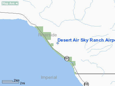
Desert Air Sky Ranch Airport |
Location
& QuickFacts
|
FAA
Information Effective: |
2006-06-08 |
|
Airport
Identifier: |
63CA |
|
Longitude/Latitude: |
115-52-26.9850W/33-28-52.1000N
-115.874162/33.481139 (Estimated) |
|
Elevation: |
0
ft / 0.00 m (Estimated) |
|
Land: |
160
acres |
|
From
nearest city: |
5 nautical miles SE of North Shore, CA |
|
Location: |
Riverside County, CA |
|
Magnetic Variation: |
13E (1985) |
Owner
& Manager
|
Ownership: |
Privately owned |
|
Owner: |
Bradley Bertling |
|
Address: |
101-111 Desertaire Dr
North Shore, CA 92254 |
|
Phone
number: |
619-393-3994 |
|
Manager: |
Bradley Bertling |
|
Address: |
101-111 Desertaire Dr
North Shore, CA 92254 |
|
Phone number: |
619-393-3994 |
Airport
Operations and Facilities
|
Airport
Use: |
Private |
|
Wind
indicator: |
Yes |
|
Segmented
Circle: |
No |
|
Control
Tower: |
No |
|
Attendance
Schedule: |
ALL/ALL/ALL |
|
Landing
fee charge: |
No |
|
Sectional
chart: |
Phoenix |
|
Region: |
AWP - Western-Pacific |
|
Boundary
ARTCC: |
ZLA - Los Angeles |
|
Tie-in
FSS: |
RAL - Riverside |
|
FSS
Phone: |
951-351-3020 |
|
FSS
Toll Free: |
1-800-WX-BRIEF |
|
Runway Information
Runway 10/28
|
Dimension: |
3000 x 100 ft / 914.4 x 30.5 m |
|
Surface: |
DIRT, |
|
|
Runway 10 |
Runway 28 |
|
Traffic
Pattern: |
Right |
Left |
|
Radio Navigation
Aids
|
ID |
Type |
Name |
Ch |
Freq |
Var |
Dist |
|
NJK |
TACAN |
El Centro |
047X |
|
13E |
40.2 nm |
|
TRM |
VORTAC |
Thermal |
109X |
116.20 |
13E |
16.8 nm |
|
PSP |
VORTAC |
Palm Springs |
102X |
115.50 |
13E |
36.3 nm |
|
TNP |
VORTAC |
Twentynine Palms |
089X |
114.20 |
15E |
38.3 nm |
|
JLI |
VORTAC |
Julian |
087X |
114.00 |
15E |
41.2 nm |
|
IPL |
VORTAC |
Imperial |
106X |
115.90 |
14E |
47.7 nm |
Remarks
- VFR;
PVT USE; PRVDD LNDGS ARE MADE TO THE SE & TKOFS TO THE NW DUE TO
THE 320' AGL TOWER 1 MILE SE OF AER 28.
Based Aircraft
|
Aircraft
based on field: |
5 |
|
Single
Engine Airplanes: |
3 |
|
Multi
Engine Airplanes: |
2 |
Desert Air Sky Ranch Airport
Address:
Riverside County, CA
Tel:
619-393-3994
Images
and information placed above are from
http://www.airport-data.com/airport/63CA/
We
thank them for the data!
| General
Info |
| Country |
United
States |
| State |
CALIFORNIA
|
| FAA ID |
63CA
|
| Latitude |
33-28-52.100N
|
| Longitude |
115-52-26.985W
|
| Elevation |
0 feet
|
| Near City |
NORTH
SHORE |
We don't guarantee the information is fresh and accurate. The data may
be wrong or outdated.
For more up-to-date information please refer to other sources.
|
|


