 |
|
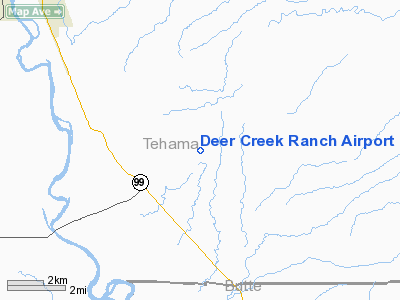
Location
& QuickFacts
|
FAA
Information Effective: |
2006-06-08 |
|
Airport
Identifier: |
CA60 |
|
Longitude/Latitude: |
121-59-48.9420W/39-56-59.5700N
-121.996928/39.949881 (Estimated) |
|
Elevation: |
280
ft / 85.34 m (Estimated) |
|
Land: |
0
acres |
|
From
nearest city: |
3 nautical miles NE of Vina, CA |
|
Location: |
Tehama County, CA |
|
Magnetic Variation: |
17E (1985) |
Owner
& Manager
|
Ownership: |
Privately owned |
|
Owner: |
Joshua L. Soske, Jr. |
|
Address: |
Deer Creek Ranch
Vina, CA 96092 |
|
Phone
number: |
916-839-2192 |
|
Manager: |
Joshua L. Soske, Jr. |
|
Address: |
Deer Creek Ranch
Vina, CA 96092 |
|
Phone number: |
916-839-2192 |
Airport
Operations and Facilities
|
Airport
Use: |
Private |
|
Wind
indicator: |
No |
|
Segmented
Circle: |
No |
|
Control
Tower: |
No |
|
Attendance
Schedule: |
UNATNDD |
|
Landing
fee charge: |
No |
|
Sectional
chart: |
San Francisco |
|
Region: |
AWP - Western-Pacific |
|
Boundary
ARTCC: |
ZOA - Oakland |
|
Tie-in
FSS: |
RIU - Rancho Murieta |
|
FSS
on Airport: |
No |
|
FSS
Phone: |
916-354-0161 |
|
FSS
Toll Free: |
1-800-WX-BRIEF |
|
Runway Information
Runway 16/34
|
Dimension: |
3000 x 400 ft / 914.4 x 121.9 m |
|
Surface: |
ASPH, |
|
|
Runway 16 |
Runway 34 |
|
Traffic
Pattern: |
Left |
Left |
|
Radio Navigation
Aids
|
ID |
Type |
Name |
Ch |
Freq |
Var |
Dist |
|
PBT |
NDB |
Proberta |
|
338.00 |
16E |
14.8 nm |
|
OVE |
NDB |
Oroville |
|
212.00 |
16E |
32.4 nm |
|
CIC |
VOR/DME |
Chico |
035X |
109.80 |
16E |
11.8 nm |
|
RDD |
VOR/DME |
Redding |
021X |
108.40 |
18E |
36.0 nm |
|
RBL |
VORTAC |
Red Bluff |
104X |
115.70 |
18E |
14.2 nm |
|
MXW |
VORTAC |
Maxwell |
037X |
110.00 |
18E |
39.4 nm |
Remarks
Based Aircraft
|
Aircraft
based on field: |
1 |
|
Single
Engine Airplanes: |
1 |
Deer Creek Ranch Airport
Address:
Tehama County, CA
Tel:
916-839-2192
Images
and information placed above are from
http://www.airport-data.com/airport/CA60/
We
thank them for the data!
| General
Info |
| Country |
United
States |
| State |
CALIFORNIA
|
| FAA ID |
CA60
|
| Latitude |
39-56-59.570N
|
| Longitude |
121-59-48.942W
|
| Elevation |
280 feet
|
| Near City |
VINA
|
We don't guarantee the information is fresh and accurate. The data may
be wrong or outdated.
For more up-to-date information please refer to other sources.
|
|


