 |
|
Location
& QuickFacts
|
FAA
Information Effective: |
2006-06-08 |
|
Airport
Identifier: |
67CL |
|
Longitude/Latitude: |
122-02-54.9040W/39-12-03.6050N
-122.048584/39.201001 (Estimated) |
|
Elevation: |
45
ft / 13.72 m (Estimated) |
|
Land: |
0
acres |
|
From
nearest city: |
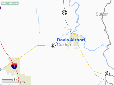
2 nautical miles SW of Colusa, CA |
|
Location: |
Colusa County, CA |
|
Magnetic Variation: |
16E (1985) |
Owner
& Manager
|
Ownership: |
Privately owned |
|
Owner: |
John W. Davis |
|
Address: |
Po Box 28
Colusa, CA 95932 |
|
Phone number: |
916-458-4300 |
|
Manager: |
Dennos W. Foley |
|
Address: |
Po Box 28
Colusa, CA 95932 |
|
Phone number: |
916-458-4300 |
Airport
Operations and Facilities
|
Airport Use: |
Private |
|
Wind indicator: |
Yes |
|
Segmented Circle: |
No |
|
Control Tower: |
No |
|
Attendance Schedule: |
ALL/ALL/ALL |
|
Landing fee charge: |
No |
|
Sectional chart: |
San Francisco |
|
Region: |
AWP - Western-Pacific |
|
Boundary ARTCC: |
ZOA - Oakland |
|
Tie-in FSS: |
RIU - Rancho Murieta |
|
FSS on Airport: |
No |
|
FSS Phone: |
916-354-0161 |
|
FSS Toll Free: |
1-800-WX-BRIEF |
Airport
Services
|
Airframe
Repair: |
MAJOR |
|
Power
Plant Repair: |
MAJOR |
|
Runway
Information
Runway N/S
|
Dimension: |
2000
x 75 ft / 609.6 x 22.9 m
400' GRADED OVRN NORTH END OF RWY N/S. |
|
Surface: |
GRAVEL, |
|
|
Runway N |
Runway S |
|
Traffic
Pattern: |
Left |
Left |
|
Radio Navigation
Aids
|
ID |
Type |
Name |
Ch |
Freq |
Var |
Dist |
|
MY |
NDB |
Halow |
|
222.00 |
16E |
20.5 nm |
|
OVE |
NDB |
Oroville |
|
212.00 |
16E |
26.5 nm |
|
LOP |
NDB |
Lampson |
|
217.00 |
16E |
40.9 nm |
|
BAB |
TACAN |
Beale |
023X |
|
16E |
28.6 nm |
|
MYV |
VOR/DME |
Marysville |
045X |
110.80 |
16E |
23.0 nm |
|
CIC |
VOR/DME |
Chico |
035X |
109.80 |
16E |
36.6 nm |
|
MCC |
VOR/DME |
Mc Clellan |
029X |
109.20 |
17E |
44.0 nm |
|
ILA |
VORTAC |
Williams |
091X |
114.40 |
18E |
7.9 nm |
|
MXW |
VORTAC |
Maxwell |
037X |
110.00 |
18E |
10.7 nm |
|
SMF |
VOT |
Sacramento Metropolitan |
|
111.40 |
|
37.4 nm |
|
SAC |
VOT |
Sacramento Executive |
|
111.40 |
|
48.7 nm |
Remarks
- ESTABD
PRIOR TO 15 MAY 1959.
Based Aircraft
|
Aircraft
based on field: |
6 |
|
Single
Engine Airplanes: |
5 |
|
Helicopters: |
1 |
Davis Airport
Address:
Colusa County, CA
Tel:
916-458-4300
Images
and information placed above are from
http://www.airport-data.com/airport/67CL/
We
thank them for the data!
| General
Info |
| Country |
United
States |
| State |
CALIFORNIA
|
| FAA ID |
67CL
|
| Latitude |
39-12-03.605N
|
| Longitude |
122-02-54.904W
|
| Elevation |
45 feet
|
| Near City |
COLUSA
|
We don't guarantee the information is fresh and accurate. The data may
be wrong or outdated.
For more up-to-date information please refer to other sources.
|
|


