 |
|
|
|
|
|
Location
& QuickFacts
|
FAA
Information Effective: |
2006-06-08 |
|
Airport
Identifier: |
46CN |
|
Longitude/Latitude: |
117-49-35.2300W/34-29-04.9800N
-117.826453/34.484717 (Estimated) |
|
Elevation: |
3420
ft / 1042.42 m (Estimated) |
|
Land: |
120
acres |
|
From
nearest city: |
1 nautical miles S of Llano, CA |
|
Location: |
Los Angeles County, CA |
|
Magnetic Variation: |
14E (1985) |
Owner
& Manager
|
Ownership: |
Privately owned |
|
Owner: |
Blalock Eddy Ranch |
|
Address: |
32810 165th St
Llano, CA 93544 |
|
Phone number: |
661-944-1234 |
|
Manager: |
John Blalock |
|
Address: |
32810 165th St
Llano, CA 93544 |
|
Phone number: |
661-944-1234 |
Airport
Operations and Facilities
|
Airport Use: |
Private |
|
Wind indicator: |
Yes |
|
Segmented Circle: |
Yes |
|
Control Tower: |
No |
|
Attendance Schedule: |
ALL/THU-MON/0800-DUSK |
|
Landing fee charge: |
No |
|
Sectional chart: |
Los Angeles |
|
Region: |
AWP - Western-Pacific |
|
Traffic Pattern Alt: |
1000 ft |
|
Boundary ARTCC: |
ZLA - Los Angeles |
|
Tie-in FSS: |
RAL - Riverside |
|
FSS on Airport: |
No |
|
FSS Phone: |
951-351-3020 |
|
FSS Toll Free: |
1-800-WX-BRIEF |
Airport
Communications
Airport
Services
|
Airframe
Repair: |
NONE |
|
Power
Plant Repair: |
NONE |
|
Runway Information
Runway 07/25
|
Dimension: |
4500 x 250 ft / 1371.6 x 76.2 m |
|
Surface: |
ASPH-DIRT, Good Condition
2700 X 32' ASPH STRIP SUPERIMPOSED ON DIRT RWY. |
|
|
Runway 07 |
Runway 25 |
|
Traffic
Pattern: |
Right |
Left |
|
Markings: |
None, |
None, |
|
Runway
End Identifier: |
No |
No |
|
Centerline
Lights: |
No |
No |
|
Touchdown
Lights: |
No |
No |
|
Obstruction: |
30 ft pline, 670.0 ft from runway, 22:1 slope
to clear |
13 ft road, 40.0 ft from runway, 3:1 slope
to clear |
|
Radio Navigation
Aids
|
ID |
Type |
Name |
Ch |
Freq |
Var |
Dist |
|
GWF |
NDB |
Gen William J Fox |
|
282.00 |
15E |
24.6 nm |
|
EMT |
NDB |
El Monte |
|
359.00 |
15E |
25.9 nm |
|
PAI |
NDB |
Pacoima |
|
370.00 |
15E |
32.1 nm |
|
SB |
NDB |
Petis |
|
397.00 |
14E |
34.4 nm |
|
CPM |
NDB |
Compton |
|
378.00 |
15E |
41.5 nm |
|
RIV |
TACAN |
March |
077X |
|
14E |
44.3 nm |
|
RAL |
VOR |
Riverside |
|
112.40 |
15E |
37.1 nm |
|
VCV |
VOR/DME |
Victorville |
031X |
109.40 |
14E |
22.6 nm |
|
VNY |
VOR/DME |
Van Nuys |
078X |
113.10 |
15E |
36.6 nm |
|
SMO |
VOR/DME |
Santa Monica |
045X |
110.80 |
15E |
42.4 nm |
|
ELB |
VOR/DME |
El Toro |
119X |
117.20 |
14E |
48.8 nm |
|
PMD |
VORTAC |
Palmdale |
092X |
114.50 |
15E |
14.7 nm |
|
POM |
VORTAC |
Pomona |
041X |
110.40 |
15E |
24.5 nm |
|
EDW |
VORTAC |
Edwards |
111X |
116.40 |
15E |
30.3 nm |
|
PDZ |
VORTAC |
Paradise |
059X |
112.20 |
15E |
37.1 nm |
|
LHS |
VORTAC |
Lake Hughes |
021X |
108.40 |
15E |
39.0 nm |
|
SLI |
VORTAC |
Seal Beach |
104X |
115.70 |
15E |
43.7 nm |
|
LAX |
VORTAC |
Los Angeles |
083X |
113.60 |
15E |
44.8 nm |
|
SNA |
VOT |
Santa Ana |
|
110.00 |
|
48.6 nm |
Remarks
- ARPT
RESTRICTED USE TO GLIDERS AND BASED ACFT ALL OTHERS PPR CALL 661-944-1234.
- GLIDERS
USE NORTH TFC PAT, RIGHT TFC TO RWY 25 & LEFT TFC TO RWY 07.
- AIRPLANES:
USE SOUTH TFC PAT, LEFT TFC TO RWY 25 & RIGHT TFC TO RWY 07.
- NO
NIGHT OPNS.
- ARPT
EXISTED PRIOR TO MAY 15, 1959.
Based Aircraft
|
Aircraft
based on field: |
38 |
|
Single
Engine Airplanes: |
11 |
|
Gliders: |
27 |
Operational Statistics
|
Aircraft
Operations: |
29/Week |
|
General
Aviation Local: |
93.3% |
|
General
Aviation Itinerant: |
6.7% |
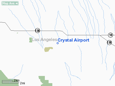
Crystal Airport
Address:
Los Angeles County, CA
Tel:
661-944-1234
Images
and information placed above are from
http://www.airport-data.com/airport/46CN/
We
thank them for the data!
| General
Info |
| Country |
United
States |
| State |
CALIFORNIA
|
| FAA ID |
46CN
|
| Latitude |
34-29-04.980N
|
| Longitude |
117-49-35.230W
|
| Elevation |
3420 feet
|
| Near City |
LLANO
|
We don't guarantee the information is fresh and accurate. The data may
be wrong or outdated.
For more up-to-date information please refer to other sources.
|
|


