 |
|
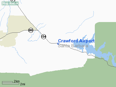
Location
& QuickFacts
|
FAA
Information Effective: |
2006-06-08 |
|
Airport
Identifier: |
0CA3 |
|
Longitude/Latitude: |
120-00-48.5130W/34-35-14.9570N
-120.013476/34.587488 (Estimated) |
|
Elevation: |
570
ft / 173.74 m (Surveyed) |
|
Land: |
0
acres |
|
From
nearest city: |
3 nautical miles E of Santa Ynez, CA |
|
Location: |
Santa Barbara County, CA |
|
Magnetic Variation: |
14E (1985) |
Owner
& Manager
|
Ownership: |
Privately owned |
|
Owner: |
J. V. Crawford |
|
Address: |
Box 338
Santa Ynez, CA 93460 |
|
Phone number: |
805-688-4241 |
|
Manager: |
J.v. Crawford |
|
Address: |
Box 338
Santa Ynez, CA 93460 |
Airport
Operations and Facilities
|
Airport Use: |
Private |
|
Wind indicator: |
Yes |
|
Segmented Circle: |
No |
|
Control Tower: |
No |
|
Attendance Schedule: |
UNATNDD |
|
Landing fee charge: |
No |
|
Sectional chart: |
Los Angeles |
|
Region: |
AWP - Western-Pacific |
|
Boundary ARTCC: |
ZLA - Los Angeles |
|
Tie-in FSS: |
HHR - Hawthorne |
|
FSS on Airport: |
No |
|
FSS Phone: |
310-970-0102 |
|
FSS Toll Free: |
1-800-WX-BRIEF |
Airport
Services
|
Airframe Repair: |
NONE |
|
Power Plant Repair: |
NONE |
|
Runway Information
Runway 10/28
|
Dimension: |
2100
x 20 ft / 640.1 x 6.1 m |
|
Surface: |
ASPH,
|
| |
Runway
10 |
Runway
28 |
|
Traffic
Pattern: |
Left |
Left |
|
Radio Navigation
Aids
|
ID |
Type |
Name |
Ch |
Freq |
Var |
Dist |
|
VBG |
TACAN |
Vandenberg |
059Y |
|
15E |
29.5
nm |
|
GLJ |
VOR |
Guadalupe |
|
111.00 |
16E |
33.3
nm |
|
GVO |
VORTAC |
Gaviota |
085X |
113.80 |
16E |
5.1
nm |
|
RZS |
VORTAC |
San
Marcus |
096X |
114.90 |
14E |
12.9
nm |
|
FLW |
VORTAC |
Fellows |
122X |
117.50 |
16E |
31.3
nm |
Remarks
- (E3A)
ADDNL PHONE NR TO HHR FSS 1-WX-BRIEF.
Based Aircraft
|
Aircraft
based on field: |
2 |
|
Single
Engine Airplanes: |
1 |
|
Multi
Engine Airplanes: |
1 |
Crawford Airport
Address:
Santa Barbara County, CA
Tel:
805-688-4241
Images
and information placed above are from
http://www.airport-data.com/airport/0CA3/
We
thank them for the data!
| General
Info |
| Country |
United
States |
| State |
CALIFORNIA
|
| FAA ID |
0CA3
|
| Latitude |
34-35-14.957N
|
| Longitude |
120-00-48.513W
|
| Elevation |
570 feet
|
| Near City |
SANTA
YNEZ |
We don't guarantee the information is fresh and accurate. The data may
be wrong or outdated.
For more up-to-date information please refer to other sources.
|
|


