 |
|
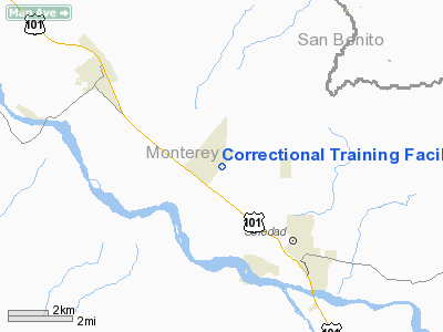
Correctional Training Facility Heliport |
Location
& QuickFacts
|
FAA
Information Effective: |
2006-06-08 |
|
Airport
Identifier: |
CA56 |
|
Longitude/Latitude: |
121-22-12.7570W/36-28-01.8700N
-121.370210/36.467186 (Estimated) |
|
Elevation: |
180
ft / 54.86 m (Estimated) |
|
Land: |
50
acres |
|
From
nearest city: |
3 nautical miles W of Soledad, CA |
|
Location: |
Monterey County, CA |
|
Magnetic Variation: |
15E (1985) |
Owner
& Manager
|
Ownership: |
Privately owned |
|
Owner: |
California Dept Of Correction |
|
Address: |
Po Box 686
Soledad, CA 93960 |
|
Phone number: |
408-675-2411
EXT 2411 |
|
Manager: |
D.g. Carleton |
|
Address: |
Po Box 686
Soledad, CA 93960 |
|
Phone number: |
408-675-2411
EXT 2431 |
Airport
Operations and Facilities
|
Airport
Use: |
Private |
|
Wind
indicator: |
Yes |
|
Segmented
Circle: |
No |
|
Control
Tower: |
No |
|
Attendance
Schedule: |
ALL/ALL/ALL |
|
Sectional
chart: |
San Francisco |
|
Region: |
AWP - Western-Pacific |
|
Boundary
ARTCC: |
ZOA - Oakland |
|
Tie-in
FSS: |
OAK - Oakland |
|
FSS
Phone: |
510-273-6111 |
|
FSS
Toll Free: |
1-800-WX-BRIEF |
|
Runway Information
Helipad H1
|
Dimension: |
50 x 50 ft / 15.2 x 15.2 m |
|
Surface: |
CONC, |
|
|
Runway H1 |
Runway |
|
Traffic
Pattern: |
Left |
Left |
|
Radio Navigation
Aids
|
ID |
Type |
Name |
Ch |
Freq |
Var |
Dist |
|
UAD |
NDB |
Chualar |
|
263.00 |
16E |
5.3 nm |
|
HGT |
NDB |
Hunter Liggett |
|
209.00 |
15E |
31.7 nm |
|
PDG |
NDB |
Pajar |
|
327.00 |
17E |
34.1 nm |
|
ROM |
VOR |
Priest |
|
110.00 |
16E |
39.4 nm |
|
SNS |
VORTAC |
Salinas |
120X |
117.30 |
17E |
16.3 nm |
|
BSR |
VORTAC |
Big Sur |
087X |
114.00 |
16E |
21.6 nm |
|
PXN |
VORTAC |
Panoche |
073X |
112.60 |
16E |
32.2 nm |
Remarks
- PRVDD
PR USE/VFR CONDITIONS ONLY; & LIGHTING IS INSTALLED IAW HELIPORT
DESIGN GUIDE.
Correctional Training Facility Heliport
Address:
Monterey County, CA
Tel:
408-675-2411
Images
and information placed above are from
http://www.airport-data.com/airport/CA56/
We
thank them for the data!
| General
Info |
| Country |
United
States |
| State |
CALIFORNIA
|
| FAA ID |
CA56
|
| Latitude |
36-28-01.870N
|
| Longitude |
121-22-12.757W
|
| Elevation |
180 feet
|
| Near City |
SOLEDAD
|
We don't guarantee the information is fresh and accurate. The data may
be wrong or outdated.
For more up-to-date information please refer to other sources.
|
|


