 |
|
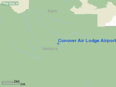
Conover Air Lodge Airport |
|
|
Location
& QuickFacts
|
FAA
Information Effective: |
2006-06-08 |
|
Airport
Identifier: |
02CL |
|
Longitude/Latitude: |
119-03-32.3750W/34-45-39.9310N
-119.058993/34.761092 (Estimated) |
|
Elevation: |
5160
ft / 1572.77 m (Estimated) |
|
Land: |
0
acres |
|
From
nearest city: |
7 nautical miles SW of Frazier Park, CA |
|
Location: |
Ventura County, CA |
|
Magnetic Variation: |
14E (1985) |
Owner
& Manager
|
Ownership: |
Privately owned |
|
Owner: |
Kall's Landing |
|
Address: |
575 East Surfside Dr
Port Hueneme, CA 93041 |
|
Phone
number: |
805-488-2787 |
|
Manager: |
Beachfront Studios |
|
Address: |
C/o Tracey Kall, 575 East Surfside Drive
Port Hueneme, CA 93041 |
|
Phone number: |
805-488-2787 |
Airport
Operations and Facilities
|
Airport Use: |
Private |
|
Wind indicator: |
Yes |
|
Segmented Circle: |
No |
|
Control Tower: |
No |
|
Attendance Schedule: |
IREG |
|
Landing fee charge: |
No |
|
Sectional chart: |
Los Angeles |
|
Region: |
AWP - Western-Pacific |
|
Boundary ARTCC: |
ZLA - Los Angeles |
|
Tie-in FSS: |
RIU - Rancho Murieta |
|
FSS on Airport: |
No |
|
FSS Phone: |
916-354-0161 |
|
FSS Toll Free: |
1-800-WX-BRIEF |
Airport
Services
|
Airframe
Repair: |
MINOR |
|
Power
Plant Repair: |
MINOR |
|
Runway Information
Runway 16/34
|
Dimension: |
3000
x 60 ft / 914.4 x 18.3 m
600 FT OVERRUN. |
|
Surface: |
DIRT, |
|
|
Runway 16 |
Runway 34 |
|
Traffic
Pattern: |
Left |
Left |
|
Radio Navigation
Aids
|
ID |
Type |
Name |
Ch |
Freq |
Var |
Dist |
|
GWF |
NDB |
Gen William J Fox |
|
282.00 |
15E |
41.6 nm |
|
PAI |
NDB |
Pacoima |
|
370.00 |
15E |
43.9 nm |
|
NTD |
TACAN |
Point Mugu |
043X |
|
15E |
38.5 nm |
|
CMA |
VOR/DME |
Camarillo |
105X |
115.80 |
15E |
33.0 nm |
|
VTU |
VOR/DME |
Ventura |
019X |
108.20 |
15E |
38.8 nm |
|
VNY |
VOR/DME |
Van Nuys |
078X |
113.10 |
15E |
42.8 nm |
|
GMN |
VORTAC |
Gorman |
108X |
116.10 |
16E |
10.1 nm |
|
LHS |
VORTAC |
Lake Hughes |
021X |
108.40 |
15E |
24.3 nm |
|
FIM |
VORTAC |
Fillmore |
072X |
112.50 |
15E |
25.9 nm |
|
RZS |
VORTAC |
San Marcus |
096X |
114.90 |
14E |
38.3 nm |
|
EHF |
VORTAC |
Shafter |
101X |
115.40 |
14E |
43.5 nm |
|
FLW |
VORTAC |
Fellows |
122X |
117.50 |
16E |
44.5 nm |
|
PMD |
VORTAC |
Palmdale |
092X |
114.50 |
15E |
49.8 nm |
|
BFL |
VOT |
Bakersfield |
|
111.20 |
|
39.9 nm |
Remarks
- LAND
UPHILL-TAKEOFF DOWNHILL.
Based Aircraft
|
Aircraft
based on field: |
1 |
|
Single
Engine Airplanes: |
1 |
Conover Air Lodge Airport
Address:
Ventura County, CA
Tel:
805-488-2787
Images
and information placed above are from
http://www.airport-data.com/airport/02CL/
We
thank them for the data!
| General
Info |
| Country |
United
States |
| State |
CALIFORNIA
|
| FAA ID |
02CL
|
| Latitude |
34-45-39.931N
|
| Longitude |
119-03-32.375W
|
| Elevation |
5160 feet
|
| Near City |
FRAZIER
PARK |
We don't guarantee the information is fresh and accurate. The data may
be wrong or outdated.
For more up-to-date information please refer to other sources.
|
|


