 |
|
Columbia Tuolumne Heliport |
|
|
Location
& QuickFacts
|
FAA
Information Effective: |
2006-06-08 |
|
Airport
Identifier: |
6Q0 |
|
Longitude/Latitude: |
120-24-43.7020W/38-02-04.7220N
-120.412139/38.034645 (Estimated) |
|
Elevation: |
2122
ft / 646.79 m (Estimated) |
|
Land: |
1
acres |
|
From
nearest city: |
1 nautical miles SW of Columbia, CA |
|
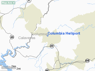
Location: |
Tuolumne County, CA |
|
Magnetic Variation: |
16E (1985) |
Owner
& Manager
|
Ownership: |
Publicly owned |
|
Owner: |
Tuolumne County |
|
Address: |
10723 Airport Rd
Columbia, CA 95310 |
|
Phone number: |
209-533-5685 |
|
Manager: |
Timothy Deike, Airports Director |
|
Address: |
10723 Airport Road
Columbia, CA 95310 |
|
Phone number: |
209-533-5685 |
Airport
Operations and Facilities
|
Airport
Use: |
Private
HELIPAD USED BY CALIFORNIA DEPT OF FORESTRY. |
|
Wind
indicator: |
Yes |
|
Segmented
Circle: |
No |
|
Control
Tower: |
No |
|
Attendance
Schedule: |
ALL/ALL/ALL |
|
Sectional
chart: |
San Francisco |
|
Region: |
AWP - Western-Pacific |
|
Boundary
ARTCC: |
ZOA - Oakland |
|
Tie-in
FSS: |
RIU - Rancho Murieta |
|
FSS
on Airport: |
No |
|
FSS
Phone: |
916-354-0161 |
|
FSS
Toll Free: |
1-800-WX-BRIEF |
|
Runway Information
Helipad H1
|
Dimension: |
27
x 27 ft / 8.2 x 8.2 m |
|
Surface: |
CONC, |
|
|
Runway H1 |
Runway |
|
Traffic
Pattern: |
Left |
Left |
|
Radio Navigation
Aids
|
ID |
Type |
Name |
Ch |
Freq |
Var |
Dist |
|
MOD |
VOR/DME |
Modesto |
093X |
114.60 |
17E |
35.6 nm |
|
HNW |
VOR/DME |
Hangtown |
102X |
115.50 |
17E |
44.4 nm |
|
HYP |
VOR/DME |
El Nido |
089X |
114.20 |
15E |
49.0 nm |
|
LIN |
VORTAC |
Linden |
095X |
114.80 |
17E |
28.1 nm |
|
ECA |
VORTAC |
Manteca |
107X |
116.00 |
17E |
38.0 nm |
Based Aircraft
|
Aircraft
based on field: |
1 |
|
Helicopters: |
1
DURING FIRE SEASON. |
Columbia Tuolumne Heliport
Address:
Tuolumne County, CA
Tel:
209-533-5685
Images
and information placed above are from
http://www.airport-data.com/airport/6Q0/
We
thank them for the data!
| General
Info |
| Country |
United
States |
| State |
CALIFORNIA
|
| FAA ID |
6Q0
|
| Latitude |
38-02-04.722N
|
| Longitude |
120-24-43.702W
|
| Elevation |
2122 feet
|
| Near City |
COLUMBIA
|
We don't guarantee the information is fresh and accurate. The data may
be wrong or outdated.
For more up-to-date information please refer to other sources.
|
|


