 |
|
Location
& QuickFacts
|
FAA
Information Effective: |
2006-06-08 |
|
Airport
Identifier: |
20CA |
|
Longitude/Latitude: |
114-38-42.8470W/33-36-14.0880N
-114.645235/33.603913 (Estimated) |
|
Elevation: |
261
ft / 79.55 m (Estimated) |
|
Land: |
18
acres |
|
From
nearest city: |
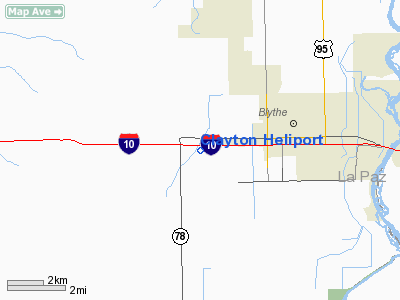
3 nautical miles W of Blythe, CA |
|
Location: |
Riverside County, CA |
|
Magnetic Variation: |
13E (1985) |
Owner
& Manager
|
Ownership: |
Privately owned |
|
Owner: |
James C Clayton |
|
Address: |
Route 2 Box 36-h
Blythe, CA 92225 |
|
Phone
number: |
619-922-0331 |
|
Manager: |
James C Clayton |
|
Address: |
Route 2 Box 36-h
Blythe, CA 92225 |
|
Phone number: |
619-922-0331 |
Airport
Operations and Facilities
|
Airport Use: |
Private |
|
Wind indicator: |
No |
|
Segmented Circle: |
No |
|
Control Tower: |
No |
|
Attendance Schedule: |
ALL/ALL/DALGT |
|
Landing fee charge: |
No |
|
Sectional chart: |
Phoenix |
|
Region: |
AWP - Western-Pacific |
|
Boundary ARTCC: |
ZLA - Los Angeles |
|
Tie-in FSS: |
RAL - Riverside |
|
FSS on Airport: |
No |
|
FSS Phone: |
951-351-3020 |
|
FSS Toll Free: |
1-800-WX-BRIEF |
Airport
Services
|
Runway Information
Helipad H1
|
Dimension: |
150 x 125 ft / 45.7 x 38.1 m |
|
Surface: |
DIRT, |
|
|
Runway H1 |
Runway |
|
Traffic
Pattern: |
Left |
Left |
|
Radio Navigation
Aids
|
ID |
Type |
Name |
Ch |
Freq |
Var |
Dist |
|
OEG |
NDB |
Golden Eagle |
|
413.00 |
12E |
46.2 nm |
|
BLH |
VORTAC |
Blythe |
121X |
117.40 |
14E |
5.8 nm |
|
PKE |
VORTAC |
Parker |
126X |
117.90 |
15E |
30.0 nm |
Remarks
- ABSOLUTELY
NO APCHS FROM OR DEPARTURES TO THE EAST, OVER GAS PLANT.
- LNDGS
BY PRIOR ARRANGEMENT ONLY.
- PVT
USE; VFR CONDITIONS ONLY.
Based Aircraft
|
Aircraft
based on field: |
3 |
|
Helicopters: |
3 |
Clayton Heliport
Address:
Riverside County, CA
Tel:
619-922-0331
Images
and information placed above are from
http://www.airport-data.com/airport/20CA/
We
thank them for the data!
| General
Info |
| Country |
United
States |
| State |
CALIFORNIA
|
| FAA ID |
20CA |
| Latitude |
33-36-14.088N
|
| Longitude |
114-38-42.847W
|
| Elevation |
261 feet
|
| Near City |
BLYTHE
|
We don't guarantee the information is fresh and accurate. The data may
be wrong or outdated.
For more up-to-date information please refer to other sources.
|
|


