 |
|
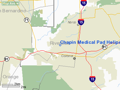
Chapin Medical Pad Heliport |
|
|
Location
& QuickFacts
|
FAA
Information Effective: |
2006-06-08 |
|
Airport
Identifier: |
45CA |
|
Longitude/Latitude: |
117-35-51.1830W/33-53-37.0550N
-117.597551/33.893626 (Estimated) |
|
Elevation: |
578 ft / 176.17 m (Estimated) |
|
Land: |
0 acres |
|
From
nearest city: |
0 nautical miles N of Corona, CA |
|
Location: |
Riverside County, CA |
|
Magnetic Variation: |
14E (1985) |
Owner
& Manager
|
Ownership: |
Privately owned |
|
Owner: |
Mark Johnson Enterprises, Inc |
|
Address: |
P.o. Box 699
Corona, CA 91718
DBA CHAPIN MEDICAL COMPANY. |
|
Phone
number: |
951-735-5300 |
|
Manager: |
Mark C. Johnson |
|
Address: |
P.o. Box 699
Corona, CA 91718
DBA CHAPIN MEDICAL CO. |
|
Phone number: |
951-735-5300 |
Airport
Operations and Facilities
|
Airport
Use: |
Private
MEDICAL USE. |
|
Wind
indicator: |
Yes |
|
Segmented
Circle: |
No |
|
Control
Tower: |
No |
|
Attendance
Schedule: |
ALL/MON-FRI/0700-1800 |
|
Lighting
Schedule: |
PHONE REQ
FOR PERIMETER LGTS CALL 909-735-5300. |
|
Sectional
chart: |
Los Angeles |
|
Region: |
AWP - Western-Pacific |
|
Boundary
ARTCC: |
ZLA - Los Angeles |
|
Tie-in
FSS: |
RAL - Riverside |
|
FSS
Phone: |
951-351-3020 |
|
FSS
Toll Free: |
1-800-WX-BRIEF |
|
Runway Information
Helipad H1
|
Dimension: |
80 x 80 ft / 24.4 x 24.4 m |
|
Surface: |
CONC, |
|
|
Runway H1 |
Runway |
|
Traffic
Pattern: |
Left |
Left |
|
Radio Navigation
Aids
|
ID |
Type |
Name |
Ch |
Freq |
Var |
Dist |
|
SB |
NDB |
Petis |
|
397.00 |
14E |
15.1 nm |
|
EMT |
NDB |
El Monte |
|
359.00 |
15E |
24.6 nm |
|
SJY |
NDB |
San Jacinto |
|
227.00 |
14E |
30.5 nm |
|
CPM |
NDB |
Compton |
|
378.00 |
15E |
32.4 nm |
|
PAI |
NDB |
Pacoima |
|
370.00 |
15E |
46.2 nm |
|
RIV |
TACAN |
March |
077X |
|
14E |
16.2 nm |
|
NFG |
TACAN |
Camp Pendleton |
055X |
|
13E |
38.7 nm |
|
RAL |
VOR |
Riverside |
|
112.40 |
15E |
8.2 nm |
|
HDF |
VOR |
Homeland |
|
113.40 |
14E |
21.8 nm |
|
ELB |
VOR/DME |
El Toro |
119X |
117.20 |
14E |
14.7 nm |
|
VCV |
VOR/DME |
Victorville |
031X |
109.40 |
14E |
43.4 nm |
|
SMO |
VOR/DME |
Santa Monica |
045X |
110.80 |
15E |
43.4 nm |
|
VNY |
VOR/DME |
Van Nuys |
078X |
113.10 |
15E |
48.7 nm |
|
PDZ |
VORTAC |
Paradise |
059X |
112.20 |
15E |
3.7 nm |
|
POM |
VORTAC |
Pomona |
041X |
110.40 |
15E |
14.6 nm |
|
SLI |
VORTAC |
Seal Beach |
104X |
115.70 |
15E |
23.8 nm |
|
OCN |
VORTAC |
Oceanside |
100X |
115.30 |
15E |
40.3 nm |
|
LAX |
VORTAC |
Los Angeles |
083X |
113.60 |
15E |
41.7 nm |
|
SNA |
VOT |
Santa Ana |
|
110.00 |
|
18.9 nm |
|
LAX |
VOT |
San Pedro Hill |
|
113.90 |
|
37.9 nm |
Remarks
- PROVIDED
HELIPORT FOR PRIVATE USE CONDUCTED DURING VFR ONLY AND IF CONDUCTED
BETWEEN SS AND SR THAT LIGHTING BE INSTALLED.
Based Aircraft
|
Aircraft
based on field: |
1 |
|
Helicopters: |
1 |
Chapin Medical Pad Heliport
Address:
Riverside County, CA
Tel:
951-735-5300
Images
and information placed above are from
http://www.airport-data.com/airport/45CA/
We
thank them for the data!
| General
Info |
| Country |
United
States |
| State |
CALIFORNIA
|
| FAA ID |
45CA
|
| Latitude |
33-53-37.055N
|
| Longitude |
117-35-51.183W
|
| Elevation |
578 feet
|
| Near City |
CORONA |
We don't guarantee the information is fresh and accurate. The data may
be wrong or outdated.
For more up-to-date information please refer to other sources.
|
|


