 |
|
Location
& QuickFacts
|
FAA
Information Effective: |
2006-06-08 |
|
Airport
Identifier: |
2CL1 |
|
Longitude/Latitude: |
121-47-50.8260W/37-06-29.8110N
-121.797452/37.108281 (Estimated) |
|
Elevation: |
695 ft / 211.84 m (Estimated) |
|
Land: |
119 acres |
|
From
nearest city: |
6 nautical miles E of Morgan Hill, CA |
|
Location: |
Santa Clara County, CA |
|
Magnetic Variation: |
16E (1985) |
Owner
& Manager
|
Ownership: |
Privately owned |
|
Owner: |
Lawrence A Stephen |
|
Address: |
5785 Little Uvas Road
Morgan Hill, CA 95037 |
|
Phone number: |
408-779-9562
408-778-3662 MESSAGE/FAX. |
|
Address: |
|
Airport
Operations and Facilities
|
Airport Use: |
Private |
|
Wind indicator: |
Yes |
|
Segmented Circle: |
No |
|
Control Tower: |
No |
|
Attendance Schedule: |
ALL/ALL/ALL |
|
Sectional chart: |
San Francisco |
|
Region: |
AWP - Western-Pacific |
|
Boundary ARTCC: |
ZOA - Oakland |
|
Tie-in FSS: |
OAK - Oakland |
|
FSS Phone: |
510-273-6111 |
|
FSS Toll Free: |
1-800-WX-BRIEF |
Airport
Services
|
Fuel
available: |
A
EMERGENCY USE ONLY. |
|
Runway Information
Helipad H1
|
Dimension: |
30 x 30 ft / 9.1 x 9.1 m |
|
Surface: |
CONC, |
|
|
Runway H1 |
Runway |
|
Traffic
Pattern: |
Left |
Left |
|
Radio Navigation
Aids
|
ID |
Type |
Name |
Ch |
Freq |
Var |
Dist |
|
PDG |
NDB |
Pajar |
|
327.00 |
17E |
11.7 nm |
|
LV |
NDB |
Reiga |
|
374.00 |
16E |
35.5 nm |
|
TCY |
NDB |
Tracy |
|
203.00 |
15E |
38.9 nm |
|
UAD |
NDB |
Chualar |
|
263.00 |
16E |
40.2 nm |
|
NUQ |
TACAN |
Moffett |
123X |
|
17E |
23.1 nm |
|
SJC |
VOR/DME |
San Jose |
088X |
114.10 |
16E |
17.5 nm |
|
SFO |
VOR/DME |
San Francisco |
105X |
115.80 |
17E |
41.3 nm |
|
SNS |
VORTAC |
Salinas |
120X |
117.30 |
17E |
28.3 nm |
|
OSI |
VORTAC |
Woodside |
086X |
113.90 |
17E |
28.8 nm |
|
OAK |
VORTAC |
Oakland |
115X |
116.80 |
17E |
42.3 nm |
|
SFO |
VOT |
San Francisco Intl |
|
111.00 |
|
41.3 nm |
Remarks
Based Aircraft
|
Aircraft
based on field: |
1 |
|
Helicopters: |
1 |
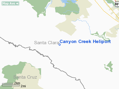
Canyon Creek Heliport
Address:
Santa Clara County, CA
Tel:
408-779-9562
FAX:
408-778-3662
Images
and information placed above are from
http://www.airport-data.com/airport/2CL1/
We
thank them for the data!
| General
Info |
| Country |
United
States |
| State |
CALIFORNIA
|
| FAA ID |
2CL1
|
| Latitude |
37-06-29.811N
|
| Longitude |
121-47-50.826W
|
| Elevation |
695 feet
|
| Near City |
MORGAN
HILL |
We don't guarantee the information is fresh and accurate. The data may
be wrong or outdated.
For more up-to-date information please refer to other sources.
|
|


