 |
|
|
|
|
|
Location
& QuickFacts
|
FAA
Information Effective: |
2006-06-08 |
|
Airport
Identifier: |
A24 |
|
Longitude/Latitude: |
120-41-03.8550W/41-24-44.6110N
-120.684404/41.412392 (Estimated) |
|
Elevation: |
4398 ft / 1340.51 m (Estimated) |
|
Land: |
59 acres |
|
From
nearest city: |
8 nautical miles SW of Alturas, CA |
|
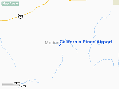
Location: |
Modoc County, CA |
|
Magnetic Variation: |
17E (1985) |
Owner
& Manager
|
Ownership: |
Publicly owned |
|
Owner: |
Calif Pines Comm Svc Dist |
|
Address: |
Hcr 4, Box 43002
Alturas, CA 96101 |
|
Phone number: |
530-233-2766 |
|
Manager: |
John Spoonhower |
|
Address: |
Hcr 4, Box 43002
Alturas, CA 96101 |
|
Phone number: |
530-233-2766
CALIFORNIA PINES FIRE STATION. |
Airport
Operations and Facilities
|
Airport
Use: |
Open to public |
|
Wind
indicator: |
Yes |
|
Segmented
Circle: |
Yes
SEGMENTED CIRCLE MISSING RY 05 TFC PAT BAR. |
|
Control
Tower: |
No |
|
Attendance
Schedule: |
UNATNDD |
|
Sectional
chart: |
Klamath Falls |
|
Region: |
AWP - Western-Pacific |
|
Traffic
Pattern Alt: |
800 ft |
|
Boundary
ARTCC: |
ZSE - Seattle |
|
Tie-in
FSS: |
RNO - Reno |
|
FSS
on Airport: |
No |
|
FSS
Phone: |
775-858-1300 |
|
FSS
Toll Free: |
1-800-WX-BRIEF |
|
NOTAMs
Facility: |
RNO (NOTAM-d service avaliable) |
Airport
Communications
|
CTAF: |
123.000 |
|
Unicom: |
123.000 |
|
Runway Information
Runway 05/23
|
Dimension: |
4250 x 60 ft / 1295.4 x 18.3 m |
|
Surface: |
ASPH, Poor Condition
LOOSE GRAVEL, CRACKED PAVEMENT WITH ERODED EDGES |
|
Weight
Limit: |
Single wheel: 12000 lbs. |
|
|
Runway 05 |
Runway 23 |
|
Traffic
Pattern: |
Left |
Right |
|
Markings: |
Basic, Good Condition |
Basic, Good Condition |
|
Runway
End Identifier: |
No |
No |
|
Centerline
Lights: |
No |
No |
|
Touchdown
Lights: |
No |
No |
|
Obstruction: |
, 50:1 slope to clear |
20 ft pole, 600.0 ft from runway, 140 ft right
of centerline, 20:1 slope to clear |
|
Radio Navigation
Aids
|
ID |
Type |
Name |
Ch |
Freq |
Var |
Dist |
|
ARU |
NDB |
Alturas |
|
215.00 |
18E |
6.7 nm |
Remarks
Operational Statistics
|
Aircraft
Operations: |
34/Month |
|
General
Aviation Local: |
12.5% |
|
General
Aviation Itinerant: |
87.5% |
California Pines Airport
Address:
Modoc County, CA
Tel:
530-233-2766
Images
and information placed above are from
http://www.airport-data.com/airport/A24/
We
thank them for the data!
| General
Info |
| Country |
United
States |
| State |
CALIFORNIA
|
| FAA ID |
A24
|
| Latitude |
41-24-44.611N
|
| Longitude |
120-41-03.855W
|
| Elevation |
4398 feet
|
| Near City |
ALTURAS
|
We don't guarantee the information is fresh and accurate. The data may
be wrong or outdated.
For more up-to-date information please refer to other sources.
|
|


