 |
|
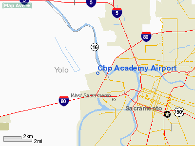
California Highway Patrol Academy Airport |
Location
& QuickFacts
|
FAA
Information Effective: |
2006-06-08 |
|
Airport
Identifier: |
60CL |
|
Longitude/Latitude: |
121-33-37.8430W/38-35-55.6580N
-121.560512/38.598794 (Estimated) |
|
Elevation: |
20 ft / 6.10 m (Estimated) |
|
Land: |
0 acres |
|
From
nearest city: |
2 nautical miles NW of Bryte, CA |
|
Location: |
Yolo County, CA |
|
Magnetic Variation: |
16E (1985) |
Owner
& Manager
|
Ownership: |
Publicly owned |
|
Owner: |
California Highway Patrol |
|
Address: |
Po Box 898
Sacto, CA 95804 |
|
Phone number: |
916-322-9717 |
|
Manager: |
F. M. Steisberg |
|
Address: |
Po Box 898
Sacto, CA 95804 |
|
Phone number: |
916-322-9717 |
Airport
Operations and Facilities
|
Airport
Use: |
Private |
|
Wind
indicator: |
Yes |
|
Segmented
Circle: |
No |
|
Control
Tower: |
No |
|
Attendance
Schedule: |
UNATNDD |
|
Landing
fee charge: |
No |
|
Sectional
chart: |
San Francisco |
|
Region: |
AWP - Western-Pacific |
|
Boundary
ARTCC: |
ZOA - Oakland |
|
Tie-in
FSS: |
RIU - Rancho Murieta |
|
FSS
on Airport: |
No |
|
FSS
Phone: |
916-354-0161 |
|
FSS
Toll Free: |
1-800-WX-BRIEF |
|
Runway Information
Runway 05/23
|
Dimension: |
1400 x 24 ft / 426.7 x 7.3 m |
|
Surface: |
ASPH, |
|
|
Runway 05 |
Runway 23 |
|
Traffic
Pattern: |
Left |
Right |
|
Runway 16/34
|
Dimension: |
1200 x 20 ft / 365.8 x 6.1 m |
|
Surface: |
ASPH, |
|
|
Runway 16 |
Runway 34 |
|
Traffic
Pattern: |
Right |
Left |
|
Radio Navigation
Aids
|
ID |
Type |
Name |
Ch |
Freq |
Var |
Dist |
|
MY |
NDB |
Halow |
|
222.00 |
16E |
34.4 nm |
|
SUU |
TACAN |
Travis |
113X |
|
17E |
27.9 nm |
|
BAB |
TACAN |
Beale |
023X |
|
16E |
32.7 nm |
|
TZZ |
VOR |
Travis |
|
116.40 |
17E |
19.3 nm |
|
MCC |
VOR/DME |
Mc Clellan |
029X |
109.20 |
17E |
8.4 nm |
|
MYV |
VOR/DME |
Marysville |
045X |
110.80 |
16E |
30.1 nm |
|
HNW |
VOR/DME |
Hangtown |
102X |
115.50 |
17E |
38.8 nm |
|
CCR |
VOR/DME |
Concord |
117X |
117.00 |
17E |
40.4 nm |
|
SAC |
VORTAC |
Sacramento |
099X |
115.20 |
17E |
9.3 nm |
|
ILA |
VORTAC |
Williams |
091X |
114.40 |
18E |
35.8 nm |
|
LIN |
VORTAC |
Linden |
095X |
114.80 |
17E |
41.0 nm |
|
SGD |
VORTAC |
Scaggs Island |
058X |
112.10 |
17E |
45.8 nm |
|
ECA |
VORTAC |
Manteca |
107X |
116.00 |
17E |
49.5 nm |
|
SMF |
VOT |
Sacramento Metropolitan |
|
111.40 |
|
5.7 nm |
|
SAC |
VOT |
Sacramento Executive |
|
111.40 |
|
5.9 nm |
Remarks
- PVT
USE DURING VFR CONDS ONLY.
Based Aircraft
|
Aircraft
based on field: |
2 |
|
Single
Engine Airplanes: |
1 |
|
Helicopters: |
1 |
Chp Academy Airport
Address:
Yolo County, CA
Tel:
916-322-9717
Images
and information placed above are from
http://www.airport-data.com/airport/60CL/
We
thank them for the data!
| General
Info |
| Country |
United
States |
| State |
CALIFORNIA
|
| FAA ID |
60CL
|
| Latitude |
38-35-55.658N
|
| Longitude |
121-33-37.843W
|
| Elevation |
20 feet
|
| Near City |
BRYTE
|
We don't guarantee the information is fresh and accurate. The data may
be wrong or outdated.
For more up-to-date information please refer to other sources.
|
|


