 |
|
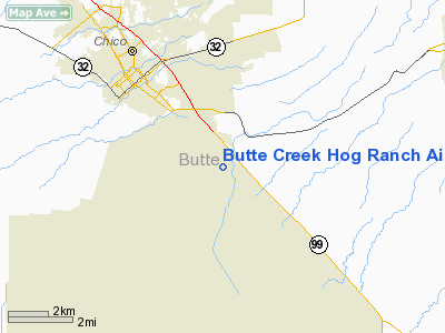
Butte Creek Hog Ranch Airport |
Location
& QuickFacts
|
FAA
Information Effective: |
2006-06-08 |
|
Airport
Identifier: |
CL90 |
|
Longitude/Latitude: |
121-47-01.9170W/39-41-19.5830N
-121.783866/39.688773 (Estimated) |
|
Elevation: |
200 ft / 60.96 m (Estimated) |
|
Land: |
11 acres |
|
From
nearest city: |
4 nautical miles SE of Chico, CA |
|
Location: |
Butte County, CA |
|
Magnetic Variation: |
17E (1985) |
Owner
& Manager
|
Ownership: |
Privately owned |
|
Owner: |
Cliff Johnsen |
|
Address: |
200 Stillwater Dr.
Chico, CA 95928 |
|
Phone number: |
916-895-3719 |
|
Manager: |
Cliff Johnsen |
|
Address: |
200 Stillwater Dr.
Chico, CA 95928 |
|
Phone number: |
916-895-3719 |
Airport
Operations and Facilities
|
Airport Use: |
Private |
|
Wind indicator: |
Yes |
|
Segmented Circle: |
No |
|
Control Tower: |
No |
|
Attendance Schedule: |
UNATNDD |
|
Landing fee charge: |
No |
|
Sectional chart: |
San Francisco |
|
Region: |
AWP - Western-Pacific |
|
Boundary ARTCC: |
ZOA - Oakland |
|
Tie-in FSS: |
RIU - Rancho Murieta |
|
FSS Phone: |
916-354-0161 |
|
FSS Toll Free: |
1-800-WX-BRIEF |
Airport
Communications
|
Runway
Information
Runway N/S
|
Dimension: |
1600 x 25 ft / 487.7 x 7.6 m |
|
Surface: |
GRVL, |
|
|
Runway N |
Runway S |
|
Traffic
Pattern: |
Left |
Right |
|
Displaced
threshold: |
0.00 ft |
600.00 ft |
|
Obstruction: |
|
30 ft pline, 400.0 ft from runway |
|
Radio Navigation
Aids
|
ID |
Type |
Name |
Ch |
Freq |
Var |
Dist |
|
OVE |
NDB |
Oroville |
|
212.00 |
16E |
13.9 nm |
|
MY |
NDB |
Halow |
|
222.00 |
16E |
32.2 nm |
|
PBT |
NDB |
Proberta |
|
338.00 |
16E |
33.0 nm |
|
BAB |
TACAN |
Beale |
023X |
|
16E |
36.9 nm |
|
CIC |
VOR/DME |
Chico |
035X |
109.80 |
16E |
6.7 nm |
|
MYV |
VOR/DME |
Marysville |
045X |
110.80 |
16E |
36.8 nm |
|
MXW |
VORTAC |
Maxwell |
037X |
110.00 |
18E |
30.2 nm |
|
RBL |
VORTAC |
Red Bluff |
104X |
115.70 |
18E |
32.3 nm |
|
ILA |
VORTAC |
Williams |
091X |
114.40 |
18E |
38.8 nm |
Remarks
- OWNER
DESIRES ARPT NOT BE CHARTED.
- VFR,
PRIVATE USE ONLY; TRAFFIC PATTERNS TO WEST-SOUTHWEST; 20:1 APCH SLOPE
BE MAINTAINED.
Based Aircraft
|
Aircraft
based on field: |
3 |
|
Single
Engine Airplanes: |
2 |
|
Ultralights: |
1 |
Butte Creek Hog Ranch Airport
Address:
Butte County, CA
Tel:
916-895-3719
Images
and information placed above are from
http://www.airport-data.com/airport/CL90/
We
thank them for the data!
| General
Info |
| Country |
United
States |
| State |
CALIFORNIA
|
| FAA ID |
CL90
|
| Latitude |
39-41-19.583N
|
| Longitude |
121-47-01.917W
|
| Elevation |
200 feet
|
| Near City |
CHICO
|
We don't guarantee the information is fresh and accurate. The data may
be wrong or outdated.
For more up-to-date information please refer to other sources.
|
|


