 |
|
Location
& QuickFacts
|
FAA
Information Effective: |
2006-06-08 |
|
Airport
Identifier: |
3CA0 |
|
Longitude/Latitude: |
119-22-35.4120W/35-42-14.8390N
-119.376503/35.704122 (Estimated) |
|
Elevation: |
262 ft / 79.86 m (Estimated) |
|
Land: |
3 acres |
|
From
nearest city: |
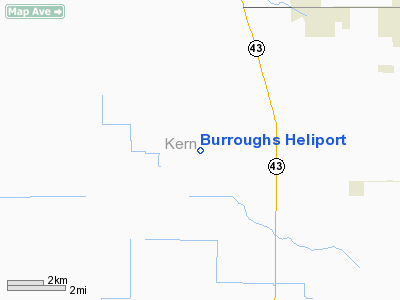
10 nautical miles NW of Wasco, CA |
|
Location: |
Kern County, CA |
|
Magnetic Variation: |
15E (1985) |
Owner
& Manager
|
Ownership: |
Privately owned |
|
Owner: |
Burroughs & Burroughs |
|
Address: |
3000 Alma Way
Bakersfield, CA 93304 |
|
Phone number: |
805-792-2574 |
|
Manager: |
James Burroughs |
|
Address: |
28198 Peterson Rd
Wasco, CA 93280 |
|
Phone number: |
805-792-2574 |
Airport
Operations and Facilities
|
Airport
Use: |
Private |
|
Wind
indicator: |
Yes |
|
Segmented
Circle: |
No |
|
Control
Tower: |
No |
|
Attendance
Schedule: |
ALL/MON-SAT/0600-1800 |
|
Sectional
chart: |
Los Angeles |
|
Region: |
AWP - Western-Pacific |
|
Boundary
ARTCC: |
ZLA - Los Angeles |
|
Tie-in
FSS: |
RIU - Rancho Murieta |
|
FSS
Phone: |
916-354-0161 |
|
FSS
Toll Free: |
1-800-WX-BRIEF |
|
Runway Information
Helipad H1
|
Dimension: |
20 x 20 ft / 6.1 x 6.1 m |
|
Surface: |
CONC, |
|
|
Runway H1 |
Runway |
|
Traffic
Pattern: |
Left |
Left |
|
Radio Navigation
Aids
|
ID |
Type |
Name |
Ch |
Freq |
Var |
Dist |
|
COR |
NDB |
Salyer Farms |
|
205.00 |
16E |
23.1 nm |
|
NLC |
TACAN |
Lemoore |
080X |
|
16E |
48.0 nm |
|
TTE |
VOR/DME |
Tule |
029X |
109.20 |
16E |
21.4 nm |
|
VIS |
VOR/DME |
Visalia |
031X |
109.40 |
16E |
40.2 nm |
|
EHF |
VORTAC |
Shafter |
101X |
115.40 |
14E |
19.0 nm |
|
AVE |
VORTAC |
Avenal |
118X |
117.10 |
16E |
29.6 nm |
|
FLW |
VORTAC |
Fellows |
122X |
117.50 |
16E |
43.9 nm |
|
BFL |
VOT |
Bakersfield |
|
111.20 |
|
23.3 nm |
Remarks
- PLINES
S & E OF HELIPORT.
- VFR
PVT USE ONLY
Based Aircraft
|
Aircraft
based on field: |
1 |
|
Helicopters: |
1 |
Burroughs Heliport
Address:
Kern County, CA
Tel:
805-792-2574
Images
and information placed above are from
http://www.airport-data.com/airport/3CA0/
We
thank them for the data!
| General
Info |
| Country |
United
States |
| State |
CALIFORNIA
|
| FAA ID |
3CA0
|
| Latitude |
35-42-14.839N
|
| Longitude |
119-22-35.412W
|
| Elevation |
262 feet
|
| Near City |
WASCO
|
We don't guarantee the information is fresh and accurate. The data may
be wrong or outdated.
For more up-to-date information please refer to other sources.
|
|


