 |
|
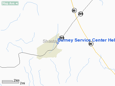
Burney Service Center Heliport |
|
|
Location
& QuickFacts
|
FAA
Information Effective: |
2006-06-08 |
|
Airport
Identifier: |
34CL |
|
Longitude/Latitude: |
121-38-59.9520W/40-53-40.5730N
-121.649987/40.894604 (Estimated) |
|
Elevation: |
3116 ft / 949.76 m (Estimated) |
|
Land: |
1 acres |
|
From
nearest city: |
2 nautical miles NE of Burney, CA |
|
Location: |
Shasta County, CA |
|
Magnetic Variation: |
17E (1985) |
Owner
& Manager
|
Ownership: |
Privately owned |
|
Owner: |
Pacific Gas & Electric Co |
|
Address: |
Route 1, Box 50
Burney, CA 96013 |
|
Phone
number: |
916-335-4536 |
|
Manager: |
Randy Livingston |
|
Address: |
Pacific Gas & Electric, 201 Mission St
Rm 1012
San Francisco, CA 94105 |
|
Phone number: |
415-973-4603
EXT 2482. |
Airport
Operations and Facilities
|
Airport Use: |
Private |
|
Wind indicator: |
Yes |
|
Segmented Circle: |
No |
|
Control Tower: |
No |
|
Attendance Schedule: |
ALL/MON-FRI/0800-1700 |
|
Landing fee charge: |
No |
|
Sectional chart: |
Klamath Falls |
|
Region: |
AWP - Western-Pacific |
|
Boundary ARTCC: |
ZOA - Oakland |
|
Tie-in FSS: |
RIU - Rancho Murieta |
|
FSS on Airport: |
No |
|
FSS Phone: |
916-354-0161 |
|
FSS Toll Free: |
1-800-WX-BRIEF |
Airport
Services
|
Airframe
Repair: |
NONE |
|
Power
Plant Repair: |
NONE |
|
Runway Information
Helipad H1
|
Dimension: |
115 x 100 ft / 35.1 x 30.5 m |
|
Surface: |
ASPH-CONC, |
|
|
Runway H1 |
Runway |
|
Traffic
Pattern: |
Left |
Left |
|
Radio Navigation
Aids
|
ID |
Type |
Name |
Ch |
Freq |
Var |
Dist |
|
RDD |
VOR/DME |
Redding |
021X |
108.40 |
18E |
37.5 nm |
Remarks
- 8-1
CLEAR PLANE APCH AND DEP.
- FAA
FORM 7480-1 SUBMITTED; FILED FOR RECORD KEEPING PURPOSES.
Based Aircraft
|
Aircraft
based on field: |
1 |
|
Helicopters: |
1 |
Burney Service Center Heliport
Address:
Shasta County, CA
Tel:
916-335-4536,
415-973-4603
Images
and information placed above are from
http://www.airport-data.com/airport/34CL/
We
thank them for the data!
| General
Info |
| Country |
United
States |
| State |
CALIFORNIA
|
| FAA ID |
34CL
|
| Latitude |
40-53-40.573N
|
| Longitude |
121-38-59.952W
|
| Elevation |
3116 feet
|
| Near City |
BURNEY
|
We don't guarantee the information is fresh and accurate. The data may
be wrong or outdated.
For more up-to-date information please refer to other sources.
|
|


