|
|
| Buchanan Field Airport |
 |
| IATA: CCR – ICAO: KCCR |
| Summary |
| Airport type |
Public |
| Operator |
Contra Costa County |
| Location |
Contra Costa County, near Concord, California |
| Elevation AMSL |
26 ft / 7.9 m |
| Coordinates |
37°59′23″N 122°03′25″W / 37.98972°N 122.05694°W / 37.98972; -122.05694Coordinates: 37°59′23″N 122°03′25″W / 37.98972°N 122.05694°W / 37.98972; -122.05694 |
| Runways |
| Direction |
Length |
Surface |
| ft |
m |
| 1L/19R |
5,001 |
1,524 |
Asphalt/Concrete |
| 1R/19L |
2,770 |
844 |
Asphalt |
| 14L/32R |
4,602 |
1,403 |
Asphalt/Concrete |
| 14R/32L |
2,799 |
853 |
Asphalt |
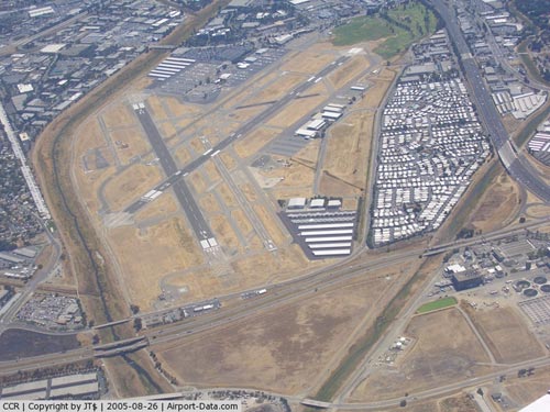
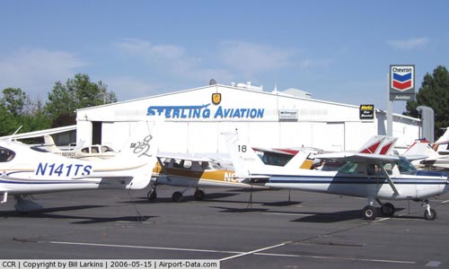
Buchanan Field Airport (IATA: CCR, ICAO: KCCR) is located in Concord and Pacheco, California, USA, 27 nautical miles (50 km) northeast of San Francisco International Airport, in Contra Costa County. The airport has a control tower and a high volume of general aviation traffic, with over 500 aircraft based on the field (mostly single-engine). History
In 1942 Contra Costa County, California purchased land to build an airport in Central County for $88,000. The airport was being developed by the County when World War II broke-out and the United States Army Air Forces Fourth Air Force expropriated the site. The Army added additional land and built the airport facilities. They also built a training base for pilots and the base was known as Concord Army Airfeld.
After World War II was over, in 1946 the War Assets Administration (WAA) returned the airport to the County for public use. In August 1946, the airport was renamed after County Supervisor William J. Buchanan, who served was a board member for more than forty years. The airport continued to be used on occasion by the U.S. Army to transport troops, especially during the Korean War.
Although the airport did not have commercial passenger service, in 1977 Buchanan Field Airport reached its peak level of activity with 357,000 operations. Buchanan Field was ranked the 16th busiest airport in the nation, ahead of San Francisco International Airport, John F. Kennedy International Airport, and LaGuardia Airport. Passenger service began in 1986, but ended in 1992. During this time noise became a concern and in 1988 the county Board of Supervisors instituted a county noise restriction ordinance restricting certain aircraft from operating at Buchanan Field.
Beginning in the 1990s, the Board of Supervisors updated the Buchanan Field Airport Master Plan. Commercial development of adjacent property such as Sams Club, Taco Bell, Sports Authority, and Jiffy Lube was allowed in 1992. The future direction of this airport is always in question because of its location on prime property in the middle of the city of Concord with no room to grow, and noise concerns. The County has developed a new airport in Byron in the eastern part of the county.
Accidents
On the evening of December 23, 1985, a Beechcraft Baron N1494G, executing a missed instrument approach procedure from an approach to runway 19R, lost control and crashed into the roof of the Macy's Department Store at nearby Sunvalley Mall, killing the pilot and two passengers and seriously injuring 84 Christmas shoppers in the crowded mall below, mainly by spraying them with burning fuel. Four of the victims on the ground later died from their injuries. The accident brought increased local opposition to the airport, and caused Pacific Southwest Airlines to delay scheduled passenger service that had been planned to start in January 1986.
Another plane crashed on April 13, 2004, shortly after leaving Buchanan Field. The plane landed on a minivan traveling down nearby Interstate 680 in Pleasant Hill and nearly severed the left leg of a 12-year-old girl (Her leg was successfully reattached and she has made a near full recovery). Officials determined the crash was the fault of a mechanic who had worked on the plane.
On December 21, 2006, at approximately 1900 Zulu, a Piper Malibu (PA46) crashed while flying the LDA (Localizer Directional Aid) approach into CCR. The aircraft was flying too low to terrain and impacted obstructions on the ground. The plane hit the median of Highway 4, crashing between the highway and Marsh Drive just directly north of the runway. Four passengers were killed.
Airlines and destinations
Buchanan Field does not currently have scheduled commercial air service.
Pacific Southwest Airlines (PSA) offered service from Buchanan Field to Los Angeles International Airport, beginning May 1, 1986. PSA offered between four and five daily roundtrips on the route, using its 100-seat BAe 146 aircraft. USAir continued the service after purchasing PSA in 1987. In 1991, however, USAir announced that it was parking its BAe 146 fleet and dismantling most of the West Coast network that it had acquired from PSA, including its Concord station. Buchanan Field has yet to be served by another airline following USAir's departure. The airport will unlikely be once again used as an airport for an airline, as airlines use the much larger facilities in Oakland, San Francisco, and San Jose.
The above content comes from Wikipedia and is published under free licenses – click here to read more.
|
 |
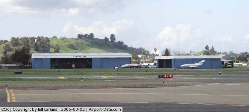
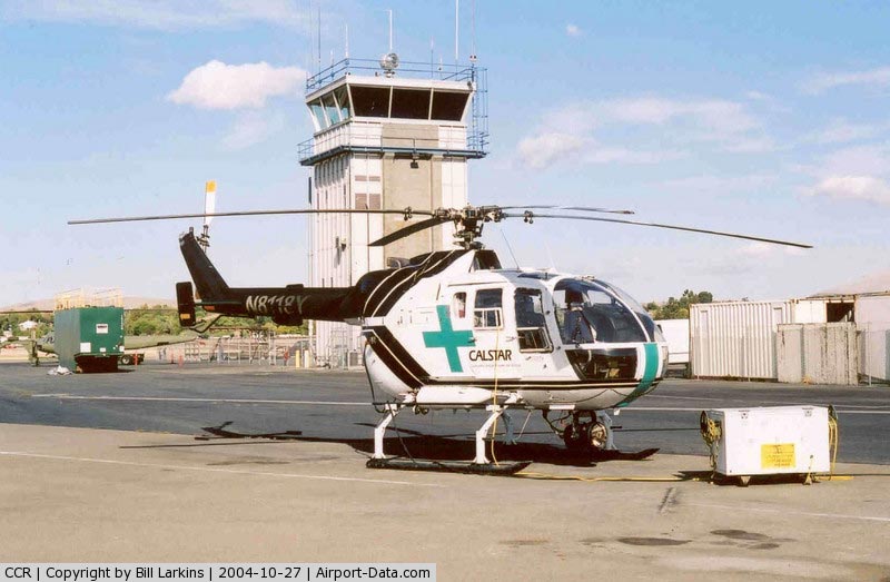
(Click on the photo to enlarge) |
|
 |
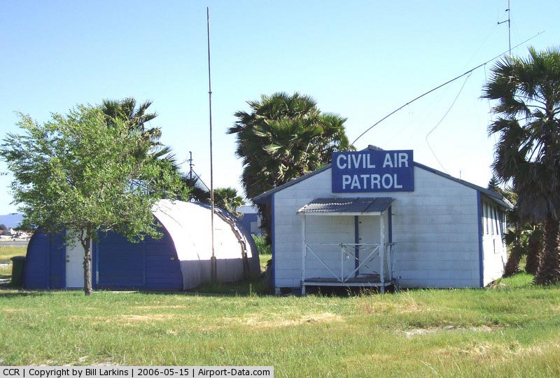
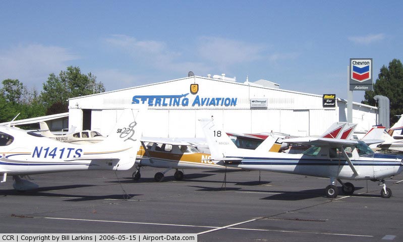
(Click on the photo to enlarge) |
|
 |
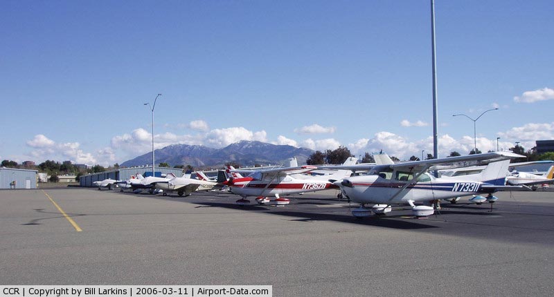
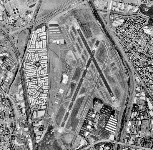
(Click on the photo to enlarge) |
|
 |
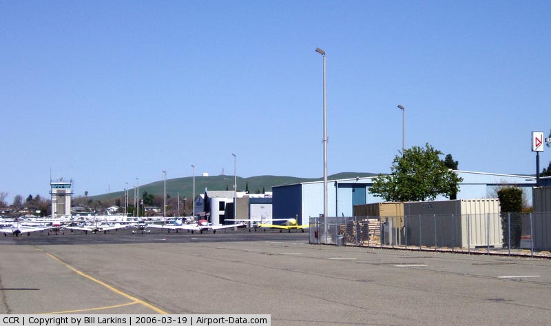
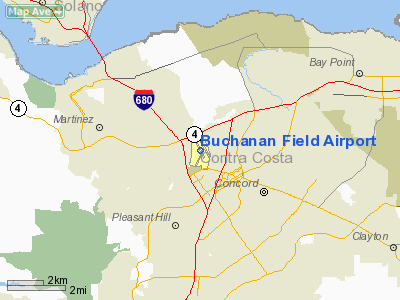
(Click on the photo to enlarge) |
|
 |
(Click on the photo to enlarge) |
|
 |
(Click on the photo to enlarge) |
|
 |
(Click on the photo to enlarge) |
|
 |
(Click on the photo to enlarge) |
Location
& QuickFacts
|
FAA
Information Effective: |
2006-06-08 |
|
Airport
Identifier: |
CCR |
|
Longitude/Latitude: |
122-03-24.8000W/37-59-22.8000N
-122.056889/37.989667 (Estimated) |
|
Elevation: |
26 ft / 7.92 m (Surveyed) |
|
Land: |
495 acres |
|
From
nearest city: |
1 nautical miles W of Concord, CA |
|
Location: |
Contra Costa County, CA |
|
Magnetic Variation: |
16E (1985) |
Owner
& Manager
|
Ownership: |
Publicly owned |
|
Owner: |
Contra Costa County |
|
Address: |
550 Sally Ride Dr.
Concord, CA 94520 |
|
Phone
number: |
925-646-5722 |
|
Manager: |
Dave Mendez |
|
Address: |
550 Sally Ride Dr.
Concord, CA 94520 |
|
Phone number: |
925-646-5722 |
Airport
Operations and Facilities
|
Airport
Use: |
Open to public |
|
Wind
indicator: |
Yes |
|
Segmented
Circle: |
Yes |
|
Control
Tower: |
Yes |
|
Attendance
Schedule: |
ALL/ALL/ALL |
|
Lighting
Schedule: |
DUSK-DAWN
ACTVT MALS RWY 19R 2200-0600 - 119.7. |
|
Beacon
Color: |
Clear-Green (lighted land airport) |
|
Landing
fee charge: |
No |
|
Sectional
chart: |
San Francisco |
|
Region: |
AWP - Western-Pacific |
|
Boundary
ARTCC: |
ZOA - Oakland |
|
Tie-in
FSS: |
OAK - Oakland |
|
FSS
on Airport: |
No |
|
FSS
Phone: |
510-273-6111 |
|
FSS
Toll Free: |
1-800-WX-BRIEF |
|
NOTAMs
Facility: |
CCR (NOTAM-d service avaliable) |
|
Certification
type/date: |
I AU 5/1986
CLSD TO ACR OPNS WITH MORE THAN 30 PSGR SEATS EXCP PPR CALL
AMGR (925) 646-5722 . |
|
Federal Agreements: |
NGRY |
Airport
Communications
|
CTAF: |
119.700 |
|
Unicom: |
122.950 |
Airport
Services
|
Fuel
available: |
100LLA1+ |
|
Airframe
Repair: |
MAJOR |
|
Power
Plant Repair: |
MAJOR |
|
Bottled
Oxygen: |
NONE |
|
Bulk
Oxygen: |
HIGH/LOW |
|
Runway Information
Runway 01L/19R
|
Dimension: |
5001 x 150 ft / 1524.3 x 45.7 m |
|
Surface: |
ASPH-CONC, Good Condition |
|
Surface
Treatment: |
Porous Friction Course |
|
Weight
Limit: |
Single wheel: 60000 lbs.
Dual wheel: 90000 lbs.
Dual
tandem wheel: 140000 lbs. |
|
Edge
Lights: |
High |
|
|
Runway 01L |
Runway 19R |
|
Longitude: |
122-03-40.7820W |
122-03-15.8504W |
|
Latitude: |
37-58-55.0261N |
37-59-40.3546N |
|
Elevation: |
24.00 ft |
21.00 ft |
|
Alignment: |
24 |
127 |
|
ILS
Type: |
|
LDA |
|
Traffic
Pattern: |
Left |
Right |
|
Markings: |
Precision instrument, Good Condition |
Precision instrument, Good Condition |
|
Crossing
Height: |
67.00 ft |
28.00 ft |
|
Displaced
threshold: |
0.00 ft |
601.00 ft |
|
VASI: |
2-box on left side |
2-box on left side |
|
Visual
Glide Angle: |
4.00� |
4.00� |
|
Approach
lights: |
|
MALS |
|
Runway
End Identifier: |
Yes
REIL RY 01L OTS INDEFLY. |
No |
|
Centerline
Lights: |
No |
No |
|
Touchdown
Lights: |
No |
No |
|
Obstruction: |
58 ft tree, 1480.0 ft from runway, 550 ft right
of centerline, 22:1 slope to clear
CLOSE IN OBSTN FENCE 0:1 100' RIGHT. |
44 ft pole, 900.0 ft from runway, 590 ft left
of centerline, 15:1 slope to clear |
|
Decleard
distances: |
Take off run available 4710.00 ft
Take off distance available 5010.00 ft
Actual stop distance available 4410.00 ft
Landing distance available 4410.00 ft
RY 01L 612 FT STWY; RY 19R 200 FT STWY. |
Take off run available 5010.00 ft
Take off distance available 5010.00 ft
Actual stop distance available 5010.00 ft
Landing distance available 4410.00 ft |
|
Runway 01R/19L
|
Dimension: |
2770 x 75 ft / 844.3 x 22.9 m |
|
Surface: |
ASPH, Good Condition |
|
Weight
Limit: |
Single wheel: 17000 lbs. |
|
Edge
Lights: |
Medium |
|
|
Runway 01R |
Runway 19L |
|
Longitude: |
122-03-30.1664W |
122-03-16.3488W |
|
Latitude: |
37-59-01.9609N |
37-59-27.0673N |
|
Elevation: |
23.00 ft |
22.00 ft |
|
Alignment: |
24 |
127 |
|
Traffic
Pattern: |
Right |
Left |
|
Markings: |
Basic, Good Condition |
Basic, Good Condition |
|
Runway
End Identifier: |
No |
No |
|
Centerline
Lights: |
No |
No |
|
Touchdown
Lights: |
No |
No |
|
Obstruction: |
50 ft tree, 1675.0 ft from runway, 150 ft right
of centerline, 30:1 slope to clear |
69 ft tree, 2000.0 ft from runway, 257 ft left
of centerline, 26:1 slope to clear |
|
Runway 14L/32R
|
Dimension: |
4602 x 150 ft / 1402.7 x 45.7 m |
|
Surface: |
ASPH-CONC, Good Condition |
|
Surface
Treatment: |
Porous Friction Course |
|
Weight
Limit: |
Single wheel: 60000 lbs.
Dual wheel: 90000 lbs.
Dual
tandem wheel: 140000 lbs. |
|
Edge
Lights: |
Medium |
|
|
Runway 14L |
Runway 32R |
|
Longitude: |
122-03-31.8793W |
122-03-06.2645W |
|
Latitude: |
37-59-47.4460N |
37-59-06.7230N |
|
Elevation: |
18.00 ft |
26.00 ft |
|
Alignment: |
127 |
127 |
|
Traffic
Pattern: |
Left |
Right |
|
Markings: |
Non-precision instrument, Good Condition |
Non-precision instrument, Good Condition |
|
Crossing
Height: |
0.00 ft |
37.00 ft |
|
Displaced
threshold: |
300.00 ft |
350.00 ft |
|
VASI: |
|
4-box on right side |
|
Visual
Glide Angle: |
0.00� |
4.00� |
|
Runway
End Identifier: |
No |
Yes |
|
Centerline
Lights: |
No |
No |
|
Touchdown
Lights: |
No |
No |
|
Obstruction: |
15 ft road, 850.0 ft from runway, 43:1 slope
to clear
APCH RATIO 50:1 TO DSPLCD THR. |
32 ft tree, 1335.0 ft from runway, 225 ft right
of centerline, 35:1 slope to clear
APCH RATIO 50:1 TO DSPLCD THR. |
|
Decleard
distances: |
Take off run available 4601.00 ft
Take off distance available 4601.00 ft
Actual stop distance available 4001.00 ft
Landing distance available 3701.00 ft |
Take off run available 4601.00 ft
Take off distance available 5081.00 ft
Actual stop distance available 4481.00 ft
Landing distance available 4131.00 ft |
|
Runway 14R/32L
|
Dimension: |
2799 x 75 ft / 853.1 x 22.9 m |
|
Surface: |
ASPH, Good Condition |
|
Weight
Limit: |
Single wheel: 12500 lbs. |
|
|
Runway 14R |
Runway 32L |
|
Longitude: |
122-03-37.4729W |
122-03-21.8795W |
|
Latitude: |
37-59-45.2356N |
37-59-20.4670N |
|
Elevation: |
17.00 ft |
22.00 ft |
|
Alignment: |
127 |
127 |
|
Traffic
Pattern: |
Right |
Left |
|
Markings: |
Basic, Good Condition |
Basic, Good Condition |
|
Runway
End Identifier: |
No |
No |
|
Centerline
Lights: |
No |
No |
|
Touchdown
Lights: |
No |
No |
|
Obstruction: |
15 ft road, 580.0 ft from runway, 25:1 slope
to clear |
46 ft light, 1260.0 ft from runway, 175 ft
left of centerline, 23:1 slope to clear |
|
Radio Navigation
Aids
|
ID |
Type |
Name |
Ch |
Freq |
Var |
Dist |
|
LV |
NDB |
Reiga |
|
374.00 |
16E |
25.2 nm |
|
TCY |
NDB |
Tracy |
|
203.00 |
15E |
34.1 nm |
|
SUU |
TACAN |
Travis |
113X |
|
17E |
16.3 nm |
|
NUQ |
TACAN |
Moffett |
123X |
|
17E |
33.5 nm |
|
TZZ |
VOR |
Travis |
|
116.40 |
17E |
24.3 nm |
|
CCR |
VOR/DME |
Concord |
117X |
117.00 |
17E |
3.4 nm |
|
SFO |
VOR/DME |
San Francisco |
105X |
115.80 |
17E |
26.9 nm |
|
SJC |
VOR/DME |
San Jose |
088X |
114.10 |
16E |
37.3 nm |
|
STS |
VOR/DME |
Santa Rosa |
077X |
113.00 |
16E |
47.3 nm |
|
OAK |
VORTAC |
Oakland |
115X |
116.80 |
17E |
17.7 nm |
|
SGD |
VORTAC |
Scaggs Island |
058X |
112.10 |
17E |
18.8 nm |
|
SAU |
VORTAC |
Sausalito |
109X |
116.20 |
17E |
23.5 nm |
|
SAC |
VORTAC |
Sacramento |
099X |
115.20 |
17E |
36.2 nm |
|
OSI |
VORTAC |
Woodside |
086X |
113.90 |
17E |
37.4 nm |
|
PYE |
VORTAC |
Point Reyes |
084X |
113.70 |
17E |
38.8 nm |
|
ECA |
VORTAC |
Manteca |
107X |
116.00 |
17E |
43.0 nm |
|
SFO |
VOT |
San Francisco Intl |
|
111.00 |
|
26.9 nm |
|
SAC |
VOT |
Sacramento Executive |
|
111.40 |
|
41.1 nm |
|
SMF |
VOT |
Sacramento Metropolitan |
|
111.40 |
|
47.5 nm |
Remarks
- ARPT
HAS NOISE ABATEMENT PROCEDURES CTC AMGR PRIOR TO ARR (925) 646-5722.
- RY
19R STOP BAR LGTS OTS INDEFLY.
- TWY
D CLSD BTN RY 32R AND TWY A INDEFLY.
- BIRDS
ON & INVOF ARPT HEAVIEST CONCENTRATION NOV-MAR AND AFTER RAINSTORMS.
- WHEN
ATCT CLSD RYS 14L/32R; 14R/32L & 01R/19L CLSD.
- NO
TRAINING OPERATIONS MON-FRI 2200-0700; SAT SUN & HOL 2200-0800.
- NOISE
SENSITIVE AREA PRACTICE NOISE ABATEMENT (FLY QUIET) PROCS.
- LNDG
FEE FOR COML OPNS & TIE DOWN FEE FOR OVERNIGHT PARKING.
- MIRL
RY 01R/19L OTS INDEFLY.
- +8
FT FENCE 110 FT BYD RY 01L TODA DSTC OF 5010 AND +7 FT FENCE 210 FT
BYD RY 14L TODA DSTC OF 4601 FT ALONG THE EXTDD RY CNTRL.
Based Aircraft
|
Aircraft
based on field: |
591 |
|
Single
Engine Airplanes: |
495 |
|
Multi
Engine Airplanes: |
74 |
|
Jet Engine
Airplanes: |
11 |
|
Helicopters: |
11 |
Operational Statistics
|
Aircraft
Operations: |
430/Day |
|
Air Taxi: |
1.9% |
|
General
Aviation Local: |
41.9% |
|
General
Aviation Itinerant: |
56.0% |
|
Military: |
0.2% |
Buchanan Field Airport
Address:
Contra Costa County, CA
Tel:
925-646-5722
Images
and information placed above are from
http://www.airport-data.com/airport/CCR/
We
thank them for the data!
| General
Info |
| Country |
United
States |
| State |
CALIFORNIA
|
| FAA ID |
CCR
|
| Latitude |
37-59-22.800N
|
| Longitude |
122-03-24.800W
|
| Elevation |
26 feet
|
| Near City |
CONCORD
|
We don't guarantee the information is fresh and accurate. The data may
be wrong or outdated.
For more up-to-date information please refer to other sources.
|
|