 |
|
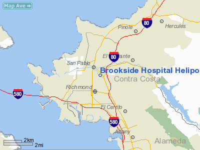
Brookside Hospital Heliport |
Location
& QuickFacts
|
FAA
Information Effective: |
2006-06-08 |
|
Airport
Identifier: |
17CA |
|
Longitude/Latitude: |
122-20-13.8930W/37-57-14.7250N
-122.337193/37.954090 (Estimated) |
|
Elevation: |
85 ft / 25.91 m (Estimated) |
|
Land: |
0 acres |
|
From
nearest city: |
0 nautical miles N of San Pablo, CA |
|
Location: |
Contra Costa County, CA |
|
Magnetic Variation: |
16E (1985) |
Owner
& Manager
|
Ownership: |
Privately owned |
|
Owner: |
Brookside Hospital |
|
Address: |
2000 Vale Road
San Pablo, CA 94806 |
|
Phone
number: |
415-235-7000 |
|
Manager: |
Harold C. Flinn |
|
Address: |
2000 Vale Road
San Pablo, CA 94806 |
|
Phone number: |
415-235-7000 |
Airport
Operations and Facilities
|
Airport
Use: |
Private
MEDICAL. |
|
Wind
indicator: |
Yes |
|
Segmented
Circle: |
No |
|
Control
Tower: |
No |
|
Attendance
Schedule: |
ALL/ALL/ALL |
|
Landing
fee charge: |
No |
|
Sectional
chart: |
San Francisco |
|
Region: |
AWP - Western-Pacific |
|
Boundary
ARTCC: |
ZOA - Oakland |
|
Tie-in
FSS: |
OAK - Oakland |
|
FSS
on Airport: |
No |
|
FSS
Phone: |
510-273-6111 |
|
FSS
Toll Free: |
1-800-WX-BRIEF |
|
Runway Information
Helipad H1
|
Dimension: |
65 x 65 ft / 19.8 x 19.8 m |
|
Surface: |
ASPH, |
|
|
Runway H1 |
Runway |
|
Traffic
Pattern: |
Left |
Left |
|
Radio Navigation
Aids
|
ID |
Type |
Name |
Ch |
Freq |
Var |
Dist |
|
LV |
NDB |
Reiga |
|
374.00 |
16E |
34.8 nm |
|
TCY |
NDB |
Tracy |
|
203.00 |
15E |
45.2 nm |
|
SUU |
TACAN |
Travis |
113X |
|
17E |
25.5 nm |
|
NUQ |
TACAN |
Moffett |
123X |
|
17E |
34.1 nm |
|
TZZ |
VOR |
Travis |
|
116.40 |
17E |
34.2 nm |
|
CCR |
VOR/DME |
Concord |
117X |
117.00 |
17E |
14.9 nm |
|
SFO |
VOR/DME |
San Francisco |
105X |
115.80 |
17E |
20.2 nm |
|
SJC |
VOR/DME |
San Jose |
088X |
114.10 |
16E |
39.5 nm |
|
STS |
VOR/DME |
Santa Rosa |
077X |
113.00 |
16E |
40.1 nm |
|
SAU |
VORTAC |
Sausalito |
109X |
116.20 |
17E |
10.6 nm |
|
SGD |
VORTAC |
Scaggs Island |
058X |
112.10 |
17E |
13.6 nm |
|
OAK |
VORTAC |
Oakland |
115X |
116.80 |
17E |
14.7 nm |
|
PYE |
VORTAC |
Point Reyes |
084X |
113.70 |
17E |
26.2 nm |
|
OSI |
VORTAC |
Woodside |
086X |
113.90 |
17E |
33.9 nm |
|
SAC |
VORTAC |
Sacramento |
099X |
115.20 |
17E |
47.4 nm |
|
SFO |
VOT |
San Francisco Intl |
|
111.00 |
|
20.2 nm |
Remarks
- HELI
RSTRD TO HOSPITAL USE.
- ESTAB
APCH/DEP PATHS 044 DEG AND 170 DEG MAG; REMOVE OR TOP TREES IN APCH/DEP
PATHS TO OBTAIN 8:1 OBSTN FREE SURF. HELI LGTD IN ACCORDANCE WITH AC
150/5390-1A FOR NGT OPS. LGT POWER POLES ALONG VALE RD WHICH PENETRATE
2:1 TRANSITIONAL SURF IN ACCORDANCE WITH AC 70/7460-1 FOR NGT OPS.
Brookside Hospital Heliport
Address:
Contra Costa County, CA
Tel:
415-235-7000
Images
and information placed above are from
http://www.airport-data.com/airport/17CA/
We
thank them for the data!
| General
Info |
| Country |
United
States |
| State |
CALIFORNIA
|
| FAA ID |
17CA
|
| Latitude |
37-57-14.725N
|
| Longitude |
122-20-13.893W
|
| Elevation |
85 feet
|
| Near City |
SAN PABLO
|
We don't guarantee the information is fresh and accurate. The data may
be wrong or outdated.
For more up-to-date information please refer to other sources.
|
|


