 |
|
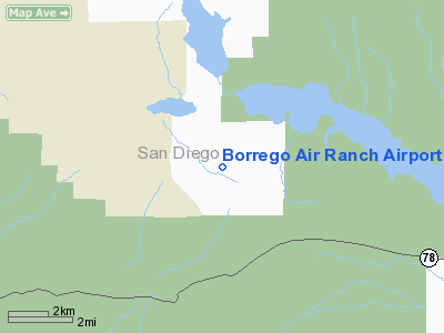
Borrego Air Ranch Airport |
|
|
Location
& QuickFacts
|
FAA
Information Effective: |
2006-06-08 |
|
Airport
Identifier: |
58CL |
|
Longitude/Latitude: |
116-16-33.0330W/33-11-30.1480N
-116.275842/33.191708 (Estimated) |
|
Elevation: |
575 ft / 175.26 m (Estimated) |
|
Land: |
0 acres |
|
From
nearest city: |
6 nautical miles SE of Borrego Springs, CA |
|
Location: |
San Diego County, CA |
|
Magnetic Variation: |
13E (1985) |
Owner
& Manager
|
Ownership: |
Privately owned |
|
Owner: |
Borrego Air Ranch
MUTUAL WATER & IMPROVEMENT CO INC. |
|
Address: |
Box 1782
Borrego Springs, CA 92004 |
|
Phone
number: |
760-767-7481 |
|
Manager: |
Bill Carpenter |
|
Address: |
P.o. 1782
Borrego Springs, CA 92004 |
|
Phone number: |
760-767-7481 |
Airport
Operations and Facilities
|
Airport Use: |
Private |
|
Wind indicator: |
Yes |
|
Segmented Circle: |
Yes |
|
Control Tower: |
No |
|
Attendance Schedule: |
UNATNDD |
|
Landing fee charge: |
No |
|
Sectional chart: |
Los Angeles |
|
Region: |
AWP - Western-Pacific |
|
Boundary ARTCC: |
ZLA - Los Angeles |
|
Tie-in FSS: |
SAN - San Diego |
|
FSS on Airport: |
No |
|
FSS Phone: |
858-277-7043 |
|
FSS Toll Free: |
1-800-WX-BRIEF |
Airport
Services
|
Airframe
Repair: |
NONE |
|
Power
Plant Repair: |
NONE |
|
Runway Information
Runway 08/26
|
Dimension: |
2650 x 45 ft / 807.7 x 13.7 m |
|
Surface: |
ASPH,
SURFACE COMPOSITION SOUTH 1200' ASPH NORTH 800' DIRT. |
|
|
Runway 08 |
Runway 26 |
|
Traffic
Pattern: |
Left |
Left |
|
Displaced
threshold: |
250.00 ft |
0.00 ft |
|
Runway 18/36
|
Dimension: |
2000 x 100 ft / 609.6 x 30.5 m |
|
Surface: |
ASPH-DIRT,
SURFACE COMPOSITION SOUTH 1200' ASPH NORTH 800' DIRT. |
|
|
Runway 18 |
Runway 36 |
|
Traffic
Pattern: |
Left |
Left |
|
Radio Navigation
Aids
|
ID |
Type |
Name |
Ch |
Freq |
Var |
Dist |
|
NJK |
TACAN |
El Centro |
047X |
|
13E |
37.0 nm |
|
NKX |
TACAN |
Miramar |
033X |
|
15E |
48.3 nm |
|
NKX |
UHF/NDB |
Miramar |
|
352.00 |
15E |
47.6 nm |
|
JLI |
VORTAC |
Julian |
087X |
114.00 |
15E |
15.9 nm |
|
TRM |
VORTAC |
Thermal |
109X |
116.20 |
13E |
26.9 nm |
|
PSP |
VORTAC |
Palm Springs |
102X |
115.50 |
13E |
41.5 nm |
|
IPL |
VORTAC |
Imperial |
106X |
115.90 |
14E |
47.0 nm |
|
PGY |
VORTAC |
Poggi |
035X |
109.80 |
14E |
49.8 nm |
|
SEE |
VOT |
Gillespie Field |
|
110.00 |
|
41.5 nm |
Remarks
- NO
NIGHT OPNS PERMITTED.
- RY
08 PREFERRED RY.
- VEHICLES
CROSS AT THLD OF RY 08.
- MOUNTAINS
N, S, W.
- VFR
ONLY.
Based Aircraft
|
Aircraft
based on field: |
20 |
|
Single
Engine Airplanes: |
19 |
|
Gliders: |
1 |
Borrego Air Ranch Airport
Address:
San Diego County, CA
Tel:
760-767-7481
Images
and information placed above are from
http://www.airport-data.com/airport/58CL/
We
thank them for the data!
| General
Info |
| Country |
United
States |
| State |
CALIFORNIA
|
| FAA ID |
58CL
|
| Latitude |
33-11-30.148N
|
| Longitude |
116-16-33.033W
|
| Elevation |
575 feet
|
| Near City |
BORREGO
SPRINGS |
We don't guarantee the information is fresh and accurate. The data may
be wrong or outdated.
For more up-to-date information please refer to other sources.
|
|


