 |
|
|
|
|
|
Location
& QuickFacts
|
FAA
Information Effective: |
2006-06-08 |
|
Airport
Identifier: |
CN32 |
|
Longitude/Latitude: |
118-35-07.3120W/34-14-05.0130N
-118.585364/34.234726 (Estimated) |
|
Elevation: |
875 ft / 266.70 m (Estimated) |
|
Land: |
0 acres |
|
From
nearest city: |
2 nautical miles NE of Canoga Park, CA |
|
Location: |
Los Angeles County, CA |
|
Magnetic Variation: |
14E (1985) |
Owner
& Manager
|
Ownership: |
Privately owned |
|
Owner: |
The Boeing Company |
|
Address: |
3250 Airflite Way
Long Beach, CA 90807 |
|
Phone
number: |
562-426-0248 |
|
Manager: |
Thomas J. Murphy |
|
Address: |
3250 Airflite Way
Long Beach, CA 90807 |
|
Phone number: |
562-426-0248 |
Airport
Operations and Facilities
|
Airport
Use: |
Private |
|
Wind
indicator: |
Yes |
|
Segmented
Circle: |
No |
|
Control
Tower: |
No |
|
Attendance
Schedule: |
ALL/MON-FRI/0800-1700 |
|
Landing
fee charge: |
No |
|
Sectional
chart: |
Los Angeles |
|
Region: |
AWP - Western-Pacific |
|
Boundary ARTCC: |
ZLA - Los Angeles |
|
Tie-in FSS: |
HHR - Hawthorne |
|
FSS on Airport: |
No |
|
FSS Phone: |
310-970-0102 |
|
FSS Toll Free: |
1-800-WX-BRIEF |
Airport
Communications
Airport
Services
|
Airframe
Repair: |
NONE |
|
Power
Plant Repair: |
NONE |
|
Runway Information
Helipad H1
|
Dimension: |
55 x 55 ft / 16.8 x 16.8 m |
|
Surface: |
ASPH, |
|
|
Runway H1 |
Runway |
|
Traffic
Pattern: |
Left |
Left |
|
Radio Navigation
Aids
|
ID |
Type |
Name |
Ch |
Freq |
Var |
Dist |
|
PAI |
NDB |
Pacoima |
|
370.00 |
15E |
8.7 nm |
|
CPM |
NDB |
Compton |
|
378.00 |
15E |
26.7 nm |
|
EMT |
NDB |
El Monte |
|
359.00 |
15E |
28.9 nm |
|
GWF |
NDB |
Gen William J Fox |
|
282.00 |
15E |
35.4 nm |
|
NTD |
TACAN |
Point Mugu |
043X |
|
15E |
27.5 nm |
|
VNY |
VOR/DME |
Van Nuys |
078X |
113.10 |
15E |
4.7 nm |
|
SMO |
VOR/DME |
Santa Monica |
045X |
110.80 |
15E |
14.9 nm |
|
VTU |
VOR/DME |
Ventura |
019X |
108.20 |
15E |
24.2 nm |
|
CMA |
VOR/DME |
Camarillo |
105X |
115.80 |
15E |
25.3 nm |
|
FIM |
VORTAC |
Fillmore |
072X |
112.50 |
15E |
16.4 nm |
|
LAX |
VORTAC |
Los Angeles |
083X |
113.60 |
15E |
19.7 nm |
|
LHS |
VORTAC |
Lake Hughes |
021X |
108.40 |
15E |
26.9 nm |
|
PMD |
VORTAC |
Palmdale |
092X |
114.50 |
15E |
35.2 nm |
|
GMN |
VORTAC |
Gorman |
108X |
116.10 |
16E |
36.8 nm |
|
SLI |
VORTAC |
Seal Beach |
104X |
115.70 |
15E |
37.9 nm |
|
POM |
VORTAC |
Pomona |
041X |
110.40 |
15E |
40.8 nm |
|
LAX |
VOT |
San Pedro Hill |
|
113.90 |
|
31.9 nm |
|
SNA |
VOT |
Santa Ana |
|
110.00 |
|
49.0 nm |
Remarks
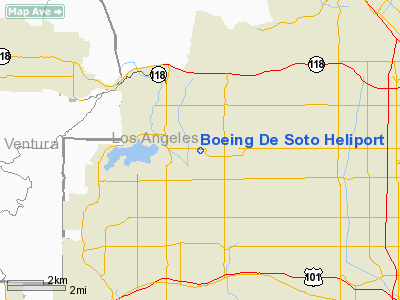
Boeing De Soto Heliport
Address:
Los Angeles County, CA
Tel:
562-426-0248
Images
and information placed above are from
http://www.airport-data.com/airport/CN32/
We
thank them for the data!
We don't guarantee the information is fresh and accurate. The data may
be wrong or outdated.
For more up-to-date information please refer to other sources.
|
|


