 |
|
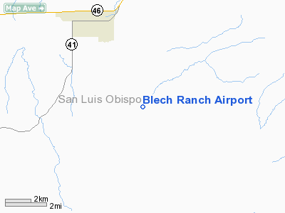
Location
& QuickFacts
|
FAA
Information Effective: |
2006-06-08 |
|
Airport
Identifier: |
0CA9 |
|
Longitude/Latitude: |
120-20-19.5550W/35-35-41.8890N
-120.338765/35.594969 (Estimated) |
|
Elevation: |
1140 ft / 347.47 m (Estimated) |
|
Land: |
0 acres |
|
From
nearest city: |
4 nautical miles SE of Shandon, CA |
|
Location: |
San Luis Obispo County, CA |
|
Magnetic Variation: |
15E (1985) |
Owner
& Manager
|
Ownership: |
Privately owned |
|
Owner: |
Arthur Blech |
|
Address: |
Po Box 318
Shandon, CA 93461 |
|
Phone number: |
805-238-5580 |
|
Manager: |
Ray Blech |
|
Address: |
Po Box 318
Shandon, CA 93461 |
|
Phone number: |
805-238-5329 |
Airport
Operations and Facilities
|
Airport
Use: |
Private |
|
Wind
indicator: |
Yes |
|
Segmented
Circle: |
No |
|
Control
Tower: |
No |
|
Attendance
Schedule: |
UNATNDD |
|
Landing
fee charge: |
No |
|
Sectional
chart: |
Los Angeles |
|
Region: |
AWP - Western-Pacific |
|
Boundary
ARTCC: |
ZLA - Los Angeles |
|
Tie-in
FSS: |
HHR - Hawthorne |
|
FSS
on Airport: |
No |
|
FSS
Phone: |
310-970-0102 |
|
FSS
Toll Free: |
1-800-WX-BRIEF |
|
Runway Information
Runway 16/34
|
Dimension: |
3300 x 60 ft / 1005.8 x 18.3 m |
|
Surface: |
ASPH, |
|
|
Runway 16 |
Runway 34 |
|
Traffic
Pattern: |
Left |
Left |
|
Obstruction: |
45 ft plines, 600.0 ft from runway |
|
|
Radio Navigation
Aids
|
ID |
Type |
Name |
Ch |
Freq |
Var |
Dist |
|
HGT |
NDB |
Hunter Liggett |
|
209.00 |
15E |
46.9 nm |
|
COR |
NDB |
Salyer Farms |
|
205.00 |
16E |
48.2 nm |
|
NLC |
TACAN |
Lemoore |
080X |
|
16E |
48.5 nm |
|
ROM |
VOR |
Priest |
|
110.00 |
16E |
36.4 nm |
|
GLJ |
VOR |
Guadalupe |
|
111.00 |
16E |
39.7 nm |
|
PRB |
VORTAC |
Paso Robles |
090X |
114.30 |
16E |
14.8 nm |
|
AVE |
VORTAC |
Avenal |
118X |
117.10 |
16E |
17.9 nm |
|
MQO |
VORTAC |
Morro Bay |
071X |
112.40 |
16E |
29.1 nm |
|
FLW |
VORTAC |
Fellows |
122X |
117.50 |
16E |
38.1 nm |
Blech Ranch Airport
Address:
San Luis Obispo County, CA
Tel:
805-238-5580, 805-238-5329
Images
and information placed above are from
http://www.airport-data.com/airport/0CA9/
We
thank them for the data!
| General
Info |
| Country |
United
States |
| State |
CALIFORNIA
|
| FAA ID |
0CA9
|
| Latitude |
35-35-41.889N
|
| Longitude |
120-20-19.555W
|
| Elevation |
1140 feet
|
| Near City |
SHANDON
|
We don't guarantee the information is fresh and accurate. The data may
be wrong or outdated.
For more up-to-date information please refer to other sources.
|
|


