 |
|
|
|
|
|
Location
& QuickFacts
|
FAA
Information Effective: |
2006-06-08 |
|
Airport
Identifier: |
CA57 |
|
Longitude/Latitude: |
122-02-43.8890W/38-27-29.6690N
-122.045525/38.458241 (Estimated) |
|
Elevation: |
310 ft / 94.49 m (Estimated) |
|
Land: |
0 acres |
|
From
nearest city: |
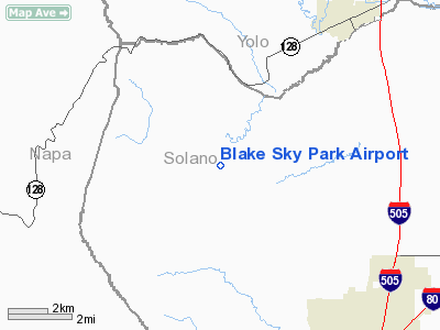
6 nautical miles NW of Vacaville, CA |
|
Location: |
Solano County, CA |
|
Magnetic Variation: |
16E (1985) |
Owner
& Manager
|
Ownership: |
Privately owned |
|
Owner: |
Wm K Blake |
|
Address: |
8100 Pleasants Valley Rd.
Vacaville, CA 95688 |
|
Phone
number: |
707-448-7280 |
|
Manager: |
Wm K Blake |
|
Address: |
8100 Pleasants Valley Rd.
Vacaville, CA 95688 |
|
Phone number: |
707-448-7280 |
Airport
Operations and Facilities
|
Airport Use: |
Private |
|
Wind indicator: |
Yes |
|
Segmented Circle: |
Yes |
|
Control Tower: |
No |
|
Attendance Schedule: |
ALL/ALL/DALGT |
|
Landing fee charge: |
No |
|
Sectional chart: |
San Francisco |
|
Region: |
AWP - Western-Pacific |
|
Boundary ARTCC: |
ZOA - Oakland |
|
Tie-in FSS: |
RIU - Rancho Murieta |
|
FSS on Airport: |
No |
|
FSS Phone: |
916-354-0161 |
|
FSS Toll Free: |
1-800-WX-BRIEF |
Airport
Services
|
Airframe
Repair: |
MINOR |
|
Power
Plant Repair: |
MINOR |
|
Runway Information
Runway 17/35
|
Dimension: |
1600 x 75 ft / 487.7 x 22.9 m |
|
Surface: |
TURF, |
|
|
Runway 17 |
Runway 35 |
|
Traffic
Pattern: |
Right |
Left |
|
Obstruction: |
30 ft plines, 400.0 ft from runway |
|
|
Radio Navigation
Aids
|
ID |
Type |
Name |
Ch |
Freq |
Var |
Dist |
|
MY |
NDB |
Halow |
|
222.00 |
16E |
47.4 nm |
|
LV |
NDB |
Reiga |
|
374.00 |
16E |
49.1 nm |
|
SUU |
TACAN |
Travis |
113X |
|
17E |
13.6 nm |
|
BAB |
TACAN |
Beale |
023X |
|
16E |
49.6 nm |
|
TZZ |
VOR |
Travis |
|
116.40 |
17E |
13.0 nm |
|
CCR |
VOR/DME |
Concord |
117X |
117.00 |
17E |
24.8 nm |
|
MCC |
VOR/DME |
Mc Clellan |
029X |
109.20 |
17E |
32.7 nm |
|
STS |
VOR/DME |
Santa Rosa |
077X |
113.00 |
16E |
36.1 nm |
|
MYV |
VOR/DME |
Marysville |
045X |
110.80 |
16E |
44.4 nm |
|
SGD |
VORTAC |
Scaggs Island |
058X |
112.10 |
17E |
22.8 nm |
|
SAC |
VORTAC |
Sacramento |
099X |
115.20 |
17E |
23.3 nm |
|
ILA |
VORTAC |
Williams |
091X |
114.40 |
18E |
36.9 nm |
|
SAU |
VORTAC |
Sausalito |
109X |
116.20 |
17E |
42.7 nm |
|
OAK |
VORTAC |
Oakland |
115X |
116.80 |
17E |
44.8 nm |
|
PYE |
VORTAC |
Point Reyes |
084X |
113.70 |
17E |
45.0 nm |
|
SMF |
VOT |
Sacramento Metropolitan |
|
111.40 |
|
25.5 nm |
|
SAC |
VOT |
Sacramento Executive |
|
111.40 |
|
26.0 nm |
Based Aircraft
|
Aircraft
based on field: |
1 |
|
Helicopters: |
1 |
Blake Sky Park Airport
Address:
Solano County, CA
Tel:
707-448-7280
Images
and information placed above are from
http://www.airport-data.com/airport/CA57/
We
thank them for the data!
| General
Info |
| Country |
United
States |
| State |
CALIFORNIA
|
| FAA ID |
CA57
|
| Latitude |
38-27-29.669N
|
| Longitude |
122-02-43.889W
|
| Elevation |
310 feet
|
| Near City |
VACAVILLE
|
We don't guarantee the information is fresh and accurate. The data may
be wrong or outdated.
For more up-to-date information please refer to other sources.
|
|


