 |
|
Location
& QuickFacts
|
FAA
Information Effective: |
2006-06-08 |
|
Airport
Identifier: |
61CA |
|
Longitude/Latitude: |
116-04-01.0000W/34-10-29.0000N
-116.066944/34.174722 (Estimated) |
|
Elevation: |
1950 ft / 594.36 m () |
|
Land: |
0 acres |
|
From
nearest city: |
0 nautical miles of Twentynine Palms, CA |
|
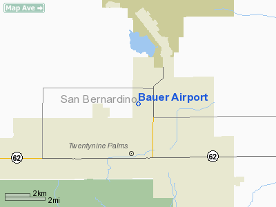
Location: |
San Bernardino County, CA |
|
Magnetic Variation: |
13E (2000) |
Owner
& Manager
|
Ownership: |
Privately owned |
|
Owner: |
Brooks L. Bauer |
|
Address: |
4344 Mesquite Springs Rd
Twenty Nine Palms, CA 92277 |
|
Phone number: |
760-367-0522 |
|
Address: |
|
Airport
Operations and Facilities
|
Airport
Use: |
Private |
|
Segmented
Circle: |
No |
|
Control
Tower: |
No |
|
Region: |
AWP - Western-Pacific |
|
Boundary
ARTCC: |
ZLA - Los Angeles |
|
Tie-in
FSS: |
RAL - Riverside |
|
FSS
Phone: |
951-351-3020 |
|
FSS
Toll Free: |
1-800-WX-BRIEF |
|
Runway Information
Runway 08/26
|
Dimension: |
1300 x 80 ft / 396.2 x 24.4 m |
|
Surface: |
DIRT, |
|
|
Runway 08 |
Runway 26 |
|
Traffic
Pattern: |
Left |
Left |
|
Obstruction: |
30 ft pline, 200.0 ft from runway |
|
|
Radio Navigation
Aids
|
ID |
Type |
Name |
Ch |
Freq |
Var |
Dist |
|
NXP |
TACAN |
Coyote |
063X |
|
14E |
8.6 nm |
|
TNP |
VORTAC |
Twentynine Palms |
089X |
114.20 |
15E |
15.2 nm |
|
PSP |
VORTAC |
Palm Springs |
102X |
115.50 |
13E |
25.7 nm |
|
TRM |
VORTAC |
Thermal |
109X |
116.20 |
13E |
33.2 nm |
|
HEC |
VORTAC |
Hector |
074X |
112.70 |
15E |
42.2 nm |
Remarks
- PROVIDED
PVT USE ONLY, OPNS ARE VFR AND OBSTRUCTION FREE ROUTES TO LANDING AREA.
Based Aircraft
|
Aircraft
based on field: |
1 |
|
Single
Engine Airplanes: |
1 |
Bauer Airport
Address:
San Bernardino County, CA
Tel:
760-367-0522
Images
and information placed above are from
http://www.airport-data.com/airport/61CA/
We
thank them for the data!
| General
Info |
| Country |
United
States |
| State |
CALIFORNIA
|
| FAA ID |
61CA
|
| Latitude |
34-10-29.000N
|
| Longitude |
116-04-01.000W
|
| Elevation |
1950 feet
|
| Near City |
TWENTYNINE
PALMS |
We don't guarantee the information is fresh and accurate. The data may
be wrong or outdated.
For more up-to-date information please refer to other sources.
|
|


