 |
|
|
|
|
|
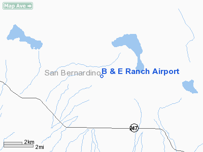
Location
& QuickFacts
|
FAA
Information Effective: |
2006-06-08 |
|
Airport
Identifier: |
2CA8 |
|
Longitude/Latitude: |
116-36-38.0820W/34-25-13.9980N
-116.610578/34.420555 (Estimated) |
|
Elevation: |
2793 ft / 851.31 m (Estimated) |
|
Land: |
160 acres |
|
From
nearest city: |
10 nautical miles NW of Yucca Valley, CA |
|
Location: |
San Bernardino County, CA |
|
Magnetic Variation: |
14E (1985) |
Owner
& Manager
|
Ownership: |
Privately owned |
|
Owner: |
Ez Or Bev Young |
|
Address: |
13707 Cornishcrest Rd
Whittier, CA 90605 |
|
Phone number: |
310-944-7880
(213) 727-8950. |
|
Manager: |
Ez Or Bev Young |
|
Address: |
13707 Cornishcrest Rd
Whittier, CA 90605
(213) 727-8950. |
|
Phone number: |
310-944-7880 |
Airport
Operations and Facilities
|
Airport
Use: |
Private |
|
Wind
indicator: |
Yes |
|
Segmented
Circle: |
No |
|
Control
Tower: |
No |
|
Attendance
Schedule: |
IREG
HOME LCTD AT APT, SOMEONE THERE 90% OF THE TIME. |
|
Landing fee charge: |
No |
|
Sectional chart: |
Los Angeles |
|
Region: |
AWP - Western-Pacific |
|
Boundary ARTCC: |
ZLA - Los Angeles |
|
Tie-in FSS: |
RAL - Riverside |
|
FSS Phone: |
951-351-3020 |
|
FSS Toll Free: |
1-800-WX-BRIEF |
Airport
Services
|
Airframe
Repair: |
NONE |
|
Power
Plant Repair: |
NONE |
|
Bottled
Oxygen: |
NONE |
|
Bulk
Oxygen: |
NONE |
|
Runway Information
Runway N/S
|
Dimension: |
2600 x 55 ft / 792.5 x 16.8 m |
|
Surface: |
DIRT, |
|
|
Runway N |
Runway S |
|
Traffic
Pattern: |
Left |
Left |
|
Runway
End Identifier: |
No |
No |
|
Centerline
Lights: |
No |
No |
|
Touchdown
Lights: |
No |
No |
|
Obstruction: |
5 ft fence |
37 ft pline, 720.0 ft from runway |
|
Runway NW/SE
|
Dimension: |
2400 x 55 ft / 731.5 x 16.8 m |
|
Surface: |
DIRT, |
|
|
Runway NW |
Runway SE |
|
Traffic
Pattern: |
Left |
Left |
|
Obstruction: |
32 ft pline, 650.0 ft from runway |
5 ft fence, 0.0 ft from runway |
|
Radio Navigation
Aids
|
ID |
Type |
Name |
Ch |
Freq |
Var |
Dist |
|
SJY |
NDB |
San Jacinto |
|
227.00 |
14E |
42.3 nm |
|
SB |
NDB |
Petis |
|
397.00 |
14E |
43.5 nm |
|
NXP |
TACAN |
Coyote |
063X |
|
14E |
23.7 nm |
|
RIV |
TACAN |
March |
077X |
|
14E |
45.2 nm |
|
HDF |
VOR |
Homeland |
|
113.40 |
14E |
48.1 nm |
|
VCV |
VOR/DME |
Victorville |
031X |
109.40 |
14E |
40.0 nm |
|
HEC |
VORTAC |
Hector |
074X |
112.70 |
15E |
23.8 nm |
|
DAG |
VORTAC |
Daggett |
079X |
113.20 |
15E |
32.6 nm |
|
PSP |
VORTAC |
Palm Springs |
102X |
115.50 |
13E |
34.3 nm |
|
TNP |
VORTAC |
Twentynine Palms |
089X |
114.20 |
15E |
45.7 nm |
Remarks
- PVT
USE, VFR WX CONDS ONLY.
B & E Ranch Airport
Address:
San Bernardino County, CA
Tel:
310-944-7880
Images
and information placed above are from
http://www.airport-data.com/airport/2CA8/
We
thank them for the data!
| General
Info |
| Country |
United
States |
| State |
CALIFORNIA
|
| FAA ID |
2CA8
|
| Latitude |
34-25-13.998N
|
| Longitude |
116-36-38.082W
|
| Elevation |
2793 feet
|
| Near City |
YUCCA
VALLEY |
We don't guarantee the information is fresh and accurate. The data may
be wrong or outdated.
For more up-to-date information please refer to other sources.
|
|


