 |
|
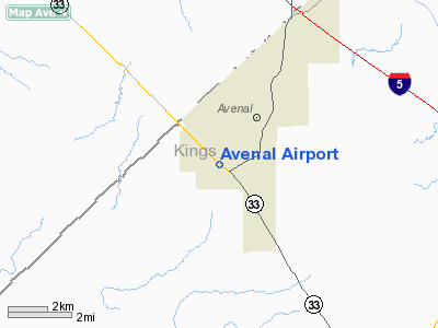
Location
& QuickFacts
|
FAA
Information Effective: |
2006-06-08 |
|
Airport
Identifier: |
CA69 |
|
Longitude/Latitude: |
120-08-32.4990W/36-00-14.8410N
-120.142361/36.004123 (Estimated) |
|
Elevation: |
790 ft / 240.79 m (Estimated) |
|
Land: |
80 acres |
|
From
nearest city: |
0 nautical miles W of Avenal, CA |
|
Location: |
Kings County, CA |
|
Magnetic Variation: |
15E (1985) |
Owner
& Manager
|
Ownership: |
Privately owned |
|
Owner: |
Chevron U S A Inc |
|
Address: |
|
|
Manager: |
Avenal Airport Assoc |
|
Address: |
Laneva Boulevard
Avenal, CA 93204 |
|
Phone number: |
209-386-5574 |
Airport
Operations and Facilities
|
Airport
Use: |
Private |
|
Wind
indicator: |
Yes |
|
Segmented
Circle: |
Yes |
|
Control
Tower: |
No |
|
Attendance
Schedule: |
ALL/ALL/ALL |
|
Landing
fee charge: |
No |
|
Sectional
chart: |
San Francisco |
|
Region: |
AWP - Western-Pacific |
|
Boundary
ARTCC: |
ZOA - Oakland |
|
Tie-in
FSS: |
RIU - Rancho Murieta |
|
FSS
on Airport: |
No |
|
FSS
Phone: |
916-354-0161 |
|
FSS
Toll Free: |
1-800-WX-BRIEF |
|
Runway Information
Runway 12/30
|
Dimension: |
2880 x 100 ft / 877.8 x 30.5 m |
|
Surface: |
DIRT, Fair Condition |
|
|
Runway 12 |
Runway 30 |
|
Traffic
Pattern: |
Right |
Left |
|
Displaced
threshold: |
0.00 ft |
230.00 ft |
|
Obstruction: |
, 50.0 ft from runway |
4 ft fence, 130.0 ft from runway |
|
Radio Navigation
Aids
|
ID |
Type |
Name |
Ch |
Freq |
Var |
Dist |
|
COR |
NDB |
Salyer Farms |
|
205.00 |
16E |
29.7 nm |
|
FCH |
NDB |
Chandler |
|
344.00 |
15E |
45.8 nm |
|
NLC |
TACAN |
Lemoore |
080X |
|
16E |
22.1 nm |
|
ROM |
VOR |
Priest |
|
110.00 |
16E |
26.7 nm |
|
VIS |
VOR/DME |
Visalia |
031X |
109.40 |
16E |
38.8 nm |
|
AVE |
VORTAC |
Avenal |
118X |
117.10 |
16E |
22.9 nm |
|
PRB |
VORTAC |
Paso Robles |
090X |
114.30 |
16E |
30.9 nm |
Remarks
- FLD
COND FAIR TO GOOD.
- ESTABD
PRIOR TO 15 MAY 1959.
Based Aircraft
|
Aircraft
based on field: |
6 |
|
Single
Engine Airplanes: |
6 |
Avenal Airport
Address:
Kings County, CA
Tel:
209-386-5574
Images
and information placed above are from
http://www.airport-data.com/airport/CA69/
We
thank them for the data!
| General
Info |
| Country |
United
States |
| State |
CALIFORNIA
|
| FAA ID |
CA69
|
| Latitude |
36-00-14.841N
|
| Longitude |
120-08-32.499W
|
| Elevation |
790 feet
|
| Near City |
AVENAL
|
We don't guarantee the information is fresh and accurate. The data may
be wrong or outdated.
For more up-to-date information please refer to other sources.
|
|


