 |
|
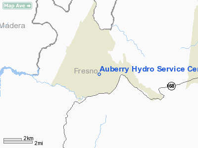
Auberry Hydro Service Center Heliport |
|
|
Location
& QuickFacts
|
FAA
Information Effective: |
2006-06-08 |
|
Airport
Identifier: |
CL91 |
|
Longitude/Latitude: |
119-29-03.4790W/37-03-53.8170N
-119.484300/37.064949 (Estimated) |
|
Elevation: |
2000 ft / 609.60 m (Estimated) |
|
Land: |
0 acres |
|
From
nearest city: |
1 nautical miles S of Auberry, CA |
|
Location: |
Fresno County, CA |
|
Magnetic Variation: |
15E (1985) |
Owner
& Manager
|
Ownership: |
Privately owned |
|
Owner: |
Pacific Gas & Electric Co. |
|
Address: |
Po Box 425
Auberry, CA 93602-0425 |
|
Phone
number: |
209-855-3523 |
|
Manager: |
D.c. Landes |
|
Address: |
Po Box 425
Auberry, CA 93602-0425 |
|
Phone number: |
209-855-3523 |
Airport
Operations and Facilities
|
Airport
Use: |
Private |
|
Wind
indicator: |
Yes |
|
Segmented
Circle: |
No |
|
Control
Tower: |
No |
|
Attendance
Schedule: |
UNATNDD |
|
Lighting
Schedule: |
PHONE REQ
FOR PERIMETER LGTS CALL 209-855-3523. |
|
Landing
fee charge: |
No |
|
Sectional
chart: |
San Francisco |
|
Region: |
AWP - Western-Pacific |
|
Boundary
ARTCC: |
ZOA - Oakland |
|
Tie-in
FSS: |
RIU - Rancho Murieta |
|
FSS
on Airport: |
No |
|
FSS
Phone: |
916-354-0161 |
|
FSS
Toll Free: |
1-800-WX-BRIEF |
|
Runway Information
Helipad H1
|
Dimension: |
60 x 60 ft / 18.3 x 18.3 m |
|
Surface: |
ASPH, |
|
|
Runway H1 |
Runway |
|
Traffic
Pattern: |
Left |
Left |
|
Radio Navigation
Aids
|
ID |
Type |
Name |
Ch |
Freq |
Var |
Dist |
|
CUK |
NDB |
Academy |
|
266.00 |
14E |
21.4 nm |
|
FCH |
NDB |
Chandler |
|
344.00 |
15E |
26.5 nm |
|
NLC |
TACAN |
Lemoore |
080X |
|
16E |
49.2 nm |
|
VIS |
VOR/DME |
Visalia |
031X |
109.40 |
16E |
41.9 nm |
|
HYP |
VOR/DME |
El Nido |
089X |
114.20 |
15E |
44.9 nm |
|
FRA |
VORTAC |
Friant |
103X |
115.60 |
17E |
5.8 nm |
|
CZQ |
VORTAC |
Clovis |
076X |
112.90 |
15E |
19.2 nm |
Remarks
Auberry Hydro Service Center Heliport
Address:
Fresno County, CA
Tel:
209-855-3523
Images
and information placed above are from
http://www.airport-data.com/airport/CL91/
We
thank them for the data!
| General
Info |
| Country |
United
States |
| State |
CALIFORNIA
|
| FAA ID |
CL91
|
| Latitude |
37-03-53.817N
|
| Longitude |
119-29-03.479W
|
| Elevation |
2000 feet
|
| Near City |
AUBERRY
|
We don't guarantee the information is fresh and accurate. The data may
be wrong or outdated.
For more up-to-date information please refer to other sources.
|
|


